Mérigny
Mérigny (French pronunciation: [meʁiɲi]) is a commune in the Indre department in central France.
Mérigny | |
|---|---|
_-_Mairie.jpg.webp) The town hall in Mérigny | |
Location of Mérigny 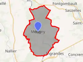 | |
 Mérigny 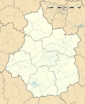 Mérigny | |
| Coordinates: 46°37′55″N 0°55′36″E | |
| Country | France |
| Region | Centre-Val de Loire |
| Department | Indre |
| Arrondissement | Le Blanc |
| Canton | Le Blanc |
| Intercommunality | Brenne Val de Creuse |
| Government | |
| • Mayor (2020–2026) | Michel Liaudois[1] |
| Area 1 | 31.77 km2 (12.27 sq mi) |
| Population | 540 |
| • Density | 17/km2 (44/sq mi) |
| Time zone | UTC+01:00 (CET) |
| • Summer (DST) | UTC+02:00 (CEST) |
| INSEE/Postal code | 36119 /36220 |
| Elevation | 67–136 m (220–446 ft) (avg. 76 m or 249 ft) |
| 1 French Land Register data, which excludes lakes, ponds, glaciers > 1 km2 (0.386 sq mi or 247 acres) and river estuaries. | |
Geography
The commune is located in the parc naturel régional de la Brenne.
The Anglin flows northwest through the middle of the commune, then forms its northwestern border.
Population
|
|
References
- "Répertoire national des élus: les maires". data.gouv.fr, Plateforme ouverte des données publiques françaises (in French). 2 December 2020.
- "Populations légales 2019". The National Institute of Statistics and Economic Studies. 29 December 2021.
| Wikimedia Commons has media related to Mérigny. |
This article is issued from Wikipedia. The text is licensed under Creative Commons - Attribution - Sharealike. Additional terms may apply for the media files.