Méréaucourt
Méréaucourt (French pronunciation: [meʁeokuʁ]) is a commune in the Somme department in Hauts-de-France in northern France.
Méréaucourt | |
|---|---|
 A farmhouse in Méréaucourt | |
Location of Méréaucourt 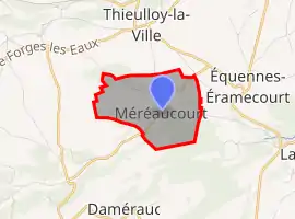 | |
 Méréaucourt  Méréaucourt | |
| Coordinates: 49°43′48″N 1°56′06″E | |
| Country | France |
| Region | Hauts-de-France |
| Department | Somme |
| Arrondissement | Amiens |
| Canton | Poix-de-Picardie |
| Intercommunality | Somme Sud-Ouest |
| Government | |
| • Mayor (2020–2026) | Marc Blarel[1] |
| Area 1 | 3.04 km2 (1.17 sq mi) |
| Population | 9 |
| • Density | 3.0/km2 (7.7/sq mi) |
| Time zone | UTC+01:00 (CET) |
| • Summer (DST) | UTC+02:00 (CEST) |
| INSEE/Postal code | 80528 /80290 |
| Elevation | 120–187 m (394–614 ft) (avg. 97 m or 318 ft) |
| 1 French Land Register data, which excludes lakes, ponds, glaciers > 1 km2 (0.386 sq mi or 247 acres) and river estuaries. | |
Geography
The commune is situated on the D264 road, some 23 miles (37 km) southwest of Amiens. This village is one of the least populous communes in the Hauts-de-France region (8 people in 2018).
History
A priory was built here in the 12th century, belonging to the abbey of Saint-Valery-sur-Somme. It comprised a church, cemetery and farm.
Population
| Year | Pop. | ±% |
|---|---|---|
| 2005 | 15 | — |
| 2006 | 15 | +0.0% |
| 2007 | 14 | −6.7% |
| 2008 | 12 | −14.3% |
| 2009 | 9 | −25.0% |
| 2010 | 7 | −22.2% |
| 2011 | 6 | −14.3% |
| 2012 | 6 | +0.0% |
| 2013 | 6 | +0.0% |
| 2014 | 6 | +0.0% |
| 2015 | 6 | +0.0% |
| 2016 | 6 | +0.0% |
See also
References
- "Répertoire national des élus: les maires". data.gouv.fr, Plateforme ouverte des données publiques françaises (in French). 2 December 2020.
- "Populations légales 2019". The National Institute of Statistics and Economic Studies. 29 December 2021.
| Wikimedia Commons has media related to Méréaucourt. |
This article is issued from Wikipedia. The text is licensed under Creative Commons - Attribution - Sharealike. Additional terms may apply for the media files.