Lowrey, Oklahoma
Lowrey is an unincorporated community and census-designated place (CDP) in Cherokee County, Oklahoma, United States. It was first listed as a CDP prior to the 2020 census.[2]
Lowrey, Oklahoma | |
|---|---|
 Lowrey  Lowrey | |
| Coordinates: 36°5′58″N 94°55′20″W | |
| Country | United States |
| State | Oklahoma |
| County | Cherokee |
| Area | |
| • Total | 15.8 sq mi (41.0 km2) |
| • Land | 15.8 sq mi (40.9 km2) |
| • Water | 0.04 sq mi (0.1 km2) |
| Elevation | 1,082 ft (330 m) |
| Time zone | UTC-6 (Central (CST)) |
| • Summer (DST) | UTC-5 (CDT) |
| ZIP Code | 74464 (Tahlequah) |
| Area code(s) | 918/539 |
| FIPS code | 40-44275 |
| GNIS feature ID | 2805338[2] |
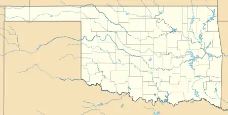
The CDP is in northern Cherokee County, bordered to the north by Rocky Ford, to the northwest by Teresita, to the southwest by Johnson Prairie, and to the south by Moodys. It is 15 miles (24 km) north of Tahlequah, the county seat.
References
- "2020 U.S. Gazetteer Files – Oklahoma". United States Census Bureau. Retrieved August 12, 2021.
- "Lowrey Census Designated Place". Geographic Names Information System. United States Geological Survey.
Municipalities and communities of Cherokee County, Oklahoma, United States | ||
|---|---|---|
| City | 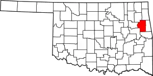 Cherokee County map | |
| Towns | ||
| CDPs | ||
| Other community | ||
| Indian reservation | ||
| Footnotes | ‡This populated place also has portions in an adjacent county or counties | |
| ||
This article is issued from Wikipedia. The text is licensed under Creative Commons - Attribution - Sharealike. Additional terms may apply for the media files.