Los Angeles City Council District 9
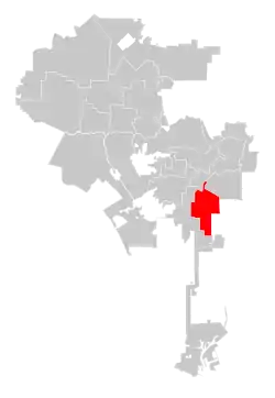
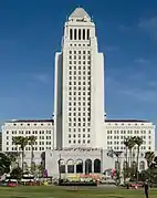
Los Angeles City Council District 9 is one of the 15 districts of the Los Angeles City Council. The Ninth District encompasses much of South Los Angeles and the western section of Downtown Los Angeles which includes L.A. Live, Crypto.com Arena, and the Los Angeles Convention Center. The current council member is Curren Price.
Los Angeles City Council District 9 | |
|---|---|
 | |
| Country | United States |
| State | California |
| County | Los Angeles |
| City | Los Angeles |
| Government | |
| • Type | City district |
| • Body | Los Angeles City Council |
| • Councilmember | Curren Price (Democratic) |
| Website | www |
Geography
Modern
The 9th formerly covered the entire core of Downtown Los Angeles, before redistricting divided it between the 9th and the 14th District. Most of Downtown is now in the nearby 14th City Council district, represented by Jose Huizar. The 9th district's boundary continues several miles to the south and ends just north of Watts.
Historic
A new city charter effective in 1925 replaced the former "at large" voting system for a nine-member council with a district system with a 15-member council. Each district was to be approximately equal in population, based upon the voting in the previous gubernatorial election; thus redistricting was done every four years. (At present, redistricting is done every ten years, based upon the preceding U.S. census results.)[1] The numbering system established in 1925 for City Council districts began with No. 1 in the north of the city, the San Fernando Valley, and ended with No. 15 in the south, the Harbor area.
The district has occupied the same general area since it was formed in 1925. With the city's changes in population, though, its western boundary has moved farther west to include much of Downtown.
The rough boundaries or descriptions have been as follows:
1925: North, Alhambra Avenue; south, Vernon city line; east, Indiana Street; west, Alameda Avenue; with the Los Angeles River bisecting it.[2][3]
1926: Hollenbeck or Boyle Heights.[4]
'1928: Same as 1925, but the western boundary is moved west to Hill Street.[5]
1932–33: North, Alhambra Avenue; south, 25th Street; east, Indiana Avenue; west, Figueroa Street.[6][7]
1964: All of the downtown area.[8]
1990: Downtown, Little Tokyo, Chinatown and "about 70 blocks south of downtown."[9]
1991: From Chinatown on the north to 84th Street on the south.[10]
Officeholders
| Portrait | Name | Term of office | Political party | |
|---|---|---|---|---|
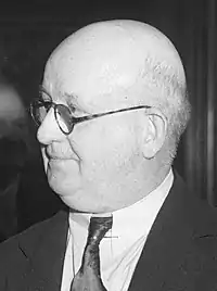
| Winfred J. Sanborn | 1925–1931 | Republican | ||
 |
1931–1935 | Republican | ||
.jpg.webp) |
Parley Parker Christensen | 1935–1937 | Independent | |
| Howard E. Dorsey | 1937 | Democratic | ||
| Winfred J. Sanborn | 1937–1939 | Republican | ||
|
Parley Parker Christensen | 1939–1949 | Independent (until 1937) | |
| Democratic | ||||
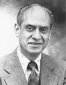 |
Edward R. Roybal | 1949–1962 | Democratic | |
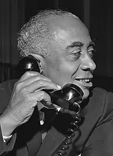 |
Gilbert W. Lindsay | 1962–1990 | Democratic | |
 |
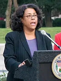
Rita Walters | 1991–2001 | Democratic | |
 |
Jan Perry | 2001–2013 | Democratic | |
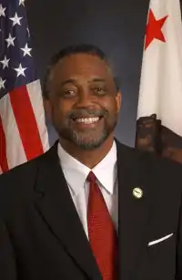 |
Curren Price | 2013–present | Democratic | |
References
- Tina Daunt and Seema Mehta, "Council Districts Drawn to Benefit Valley, Latinos," Los Angeles Times, June 12, 2002
- "First Map Showing City Council's Districts," Los Angeles Times, January 16, 1925, page 1 The map shows all 15 council districts. The official boundaries of all 15 as limned by the city clerk are at "Councilmanic Districts Are Traced by Clerk Dominguez," Los Angeles Times, February 12, 1925, page A-2
- "Here Are the Hundred and Twelve Aspirants for the City's Fifteen Councilmanic Seats," Los Angeles Times, May 3, 1925, page 7
- "To the Citizens of Los Angeles," Los Angeles Times, February 14, 1926, page B-5
- "Council Areas' Lines Changed," Los Angeles Times, December 29, 1928, page A-1
- "District Lines Get Approval," Los Angeles Times, December 24, 1932, page 2
- "City Reapportionment Measure Gets Approval," Los Angeles Times, January 19, 1933 With map of all districts.
- Jack McCurdy, "New Council Districting Voted 14-0," Los Angeles Times, July 16, 1964, page A-1
- Bill Boyarsky, "The Fight to Save the 9th District," Los Angeles Times, December 28, 1990, page 2
- A.S. Doc Young, "Los Angeles Mourns 'Emperor of Great Ninth,' " Los Angeles Sentinel, January 3-10, 1991, page 1
External links
Members of the Los Angeles City Council | |||||||||||
|---|---|---|---|---|---|---|---|---|---|---|---|
President: Nury Martinez | |||||||||||
 | |||||||||||
_edit1.jpg.webp) | City Council |  | |||||
|---|---|---|---|---|---|---|---|
| Departments |
| ||||||
| Elections |
| ||||||
| Officials |
| ||||||
| School Districts |
| ||||||
| By topic | | |
|---|---|---|
| Government | ||