Local government areas of Nigeria
Nigeria has 774 local government areas (LGAs), with each being administered by a local government council[1] consisting of a Chairman, who is the chief executive, and other elected members, who are referred to as Councillors. Each LGA is further subdivided into a minimum of 10 and a maximum of 20 Wards. A Ward is administered by a Councillor, who reports directly to the LGA Chairman. The Councillors fall under the legislative arm of the local government, the third tier of government in Nigeria, below the state governments and the federal government.
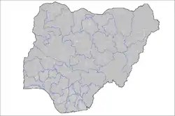
Map of LGAs, as of 2007.
Functions
The functions of local governments are detailed in the Nigerian Constitution and include the following:[2]
- Economic recommendations to the State
- Collection of taxes and fees
- Establishment and maintenance of cemeteries, burial grounds and homes for the destitute or infirm
- Licensing of bicycles, trucks (other than mechanically propelled trucks), canoes, wheel barrows and carts
- Establishment, maintenance and regulation of markets, motor parks and public conveniences
- Construction and maintenance of roads, streets, drains and other public highways, parks, and open spaces
- Naming of roads and streets and numbering of houses
- Provision and maintenance of public transportation and refuse disposal
- Registration of births, deaths and marriages
- Assessment of privately owned houses or tenements for the purpose of levying such rates as may be prescribed by the House of Assembly of a State
- Control and regulation of outdoor advertising, movement and keeping of pets of all descriptions, shops and kiosks, restaurants and other places for sale of food to the public, and laundries
List of LGAs
Cross River State
Cross River State is divided into the following LGAs.[3]
Kano State
- Ajingi
- Albasu
- Bagwai
- Bebeji
- Bichi
- Bunkure
- Dala
- Dambatta
- Dawakin Kudu
- Dawakin Tofa
- Doguwa
- Fagge
- Gabasawa
- Garko
- Garun Mallam
- Gaya
- Gezawa
- Gwale
- Gwarzo
- Kabo
- Kano Municipal
- Karaye
- Kibiya
- Kiru
- Kumbotso
- Kunchi
- Kura
- Madobi
- Makoda
- Minjibir
- Nasarawa
- Rano
- Rimin Gado
- Rogo
- Shanono
- Sumaila
- Takai
- Tarauni
- Tofa
- Tsanyawa
- Tudun Wada
- Ungogo
- Warawa
- Wudil
Oyo State
- Afijio
- Akinyele
- Atiba
- Atisbo
- Egbeda
- Ibadan North
- Ibadan North-East
- Ibadan North-West
- Ibadan South-East
- Ibadan South-West
- Ibarapa Central
- Ibarapa East
- Ibarapa North
- Ido
- Irepo
- Iseyin
- Itesiwaju
- Iwajowa
- Kajola
- Lagelu
- Ogbomosho North
- Ogbomosho South
- Ogo Oluwa
- Olorunsogo
- Oluyole
- Ona Ara
- Orelope
- Ori Ire
- Oyo East
- Oyo West
- Saki East
- Saki West
- Surulere
See also
References
- Country Profile 2019 [The Local Government System in Nigeria] (PDF). p. 161. Retrieved February 26, 2021.
- Awotokun, Kunle (March 2005). "Local Government Administration Under 1999 Constitution in Nigeria". Journal of Social Sciences. 10 (2): 129–134. doi:10.1080/09718923.2005.11892469. ISSN 0971-8923. S2CID 154871740.
- "List of Local Government Areas in Cross River State". Archived from the original on 29 May 2015. Retrieved 23 April 2015.
- Local Government Areas In Nigeria By State: A comprehensive list of all Local Government Areas (LGAs) in Nigeria and their respective states.
External links
- Postcodes.NG - comprehensive directory of LGAs, districts, and villages in Nigeria
- Postcodes.NG - Map of LGAs with boundaries
- Nigeria Congress
- On Line Nigeria
- Sustainable Urban Development and Good Governance in Nigeria
- Thomas Brinkhoff: NIGERIA: Administrative Division (interactive map), in www.citypopulation.de
This article is issued from Wikipedia. The text is licensed under Creative Commons - Attribution - Sharealike. Additional terms may apply for the media files.