List of municipalities in Louisiana
Louisiana is a state located in the Southern United States. According to the 2010 United States Census, Louisiana is the 25th most populous state with 4,533,479 inhabitants and the 33rd largest by land area spanning 43,203.90 square miles (111,897.6 km2) of land.[1] Louisiana is divided into 64 parishes, which are equivalent to counties, and contains 308 incorporated municipalities consisting of four consolidated city-parishes, and 304 cities, towns, and villages.[2] Louisiana's municipalities cover only 7.9% of the state's land mass but are home to 45.3% of its population.[1]
According to the 2015 Louisiana Laws Revised Statutes, residents of any unincorporated area may propose to incorporate as a municipality if the area meets prescribed minimum population thresholds.[3] Municipal corporations are divided based on population into three classes: cities, towns, and villages. Those having five thousand inhabitants or more are classified as cities; those having less than five thousand but more than one thousand inhabitants are classified as towns; and those having one thousand or fewer inhabitants are classified as villages.[4] The governor may change the classification of the municipality if the board of aldermen requests a change and a census shows that the population has increased or decreased making it eligible for a different classification.[5] Municipalities are granted powers to perform functions required by local governments including the levy and collection of taxes and to assume indebtedness.[6]
The largest municipality by population in Louisiana in 2020 is New Orleans with 383,997 residents, and the smallest is Mound with 12 residents.[1] The largest municipality by land area is New Orleans, which spans 169.42 sq mi (438.8 km2), while Napoleonville is the smallest at 0.17 sq mi (0.44 km2).[1] The first municipality to incorporate was Natchitoches in 1712 and the newest is Central in 2005.[7]
List of municipalities
- Largest municipalities in Louisiana by population
 Skyline of New Orleans, the largest municipality in Louisiana
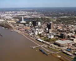 Baton Rouge, capital and second largest municipality in Louisiana
 Skyline of Shreveport, Louisiana's third largest municipality
 Lafayette, Louisiana's fourth largest municipality
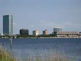 Lake Charles, fifth largest municipality in Louisiana
| Name | Type[1] | Parish[1] | Population (2020)[8] |
Population (2010)[1] |
Change | Land area (2010)[1] |
Population density | Year of incorporation[7] | |
|---|---|---|---|---|---|---|---|---|---|
| sq mi | km2 | ||||||||
| Abbeville | City | Vermilion | 11,186 | 12,257 | −8.7% | 6.04 | 15.6 | 0.0/sq mi (0.0/km2) | 1850 |
| Abita Springs | Town | St. Tammany | 2,631 | 2,365 | +11.2% | 4.48 | 11.6 | 0.0/sq mi (0.0/km2) | 1903 |
| Addis | Town | West Baton Rouge | 0 | 3,593 | −100.0% | 4.20 | 10.9 | 0.0/sq mi (0.0/km2) | 1915 |
| Albany | Village | Livingston | 0 | 1,088 | −100.0% | 1.12 | 2.9 | 0.0/sq mi (0.0/km2) | 1953 |
| Alexandria | City | Rapides | 46,180 | 47,723 | −3.2% | 28.41 | 73.6 | 0.0/sq mi (0.0/km2) | 1818 |
| Amite City | Town | Tangipahoa | 0 | 4,141 | −100.0% | 3.87 | 10.0 | 0.0/sq mi (0.0/km2) | 1861 |
| Anacoco | Village | Vernon | 0 | 869 | −100.0% | 3.08 | 8.0 | 0.0/sq mi (0.0/km2) | 1979 |
| Angie | Village | Washington | 0 | 251 | −100.0% | 1.53 | 4.0 | 0.0/sq mi (0.0/km2) | 1908 |
| Arcadia | Town | Bienville | 0 | 2,919 | −100.0% | 3.05 | 7.9 | 0.0/sq mi (0.0/km2) | 1855 |
| Arnaudville | Town | St. Landry, St. Martin | 0 | 1,057 | −100.0% | 0.69 | 1.8 | 0.0/sq mi (0.0/km2) | 1870 |
| Ashland | Village | Natchitoches | 0 | 269 | −100.0% | 26.91 | 69.7 | 0.0/sq mi (0.0/km2) | 1963 |
| Athens | Village | Claiborne | 0 | 249 | −100.0% | 2.24 | 5.8 | 0.0/sq mi (0.0/km2) | 1902 |
| Atlanta | Village | Winn | 0 | 163 | −100.0% | 1.08 | 2.8 | 0.0/sq mi (0.0/km2) | 1907 |
| Baker | City | East Baton Rouge | 0 | 13,895 | −100.0% | 8.30 | 21.5 | 0.0/sq mi (0.0/km2) | 1944 |
| Baldwin | Town | St. Mary | 0 | 2,436 | −100.0% | 3.22 | 8.3 | 0.0/sq mi (0.0/km2) | 1913 |
| Ball | Town | Rapides | 0 | 4,000 | −100.0% | 8.08 | 20.9 | 0.0/sq mi (0.0/km2) | 1972 |
| Basile | Town | Acadia, Evangeline | 0 | 1,821 | −100.0% | 1.16 | 3.0 | 0.0/sq mi (0.0/km2) | 1911 |
| Baskin | Village | Franklin | 0 | 254 | −100.0% | 1.33 | 3.4 | 0.0/sq mi (0.0/km2) | 1917 |
| Bastrop | City | Morehouse | 0 | 11,365 | −100.0% | 8.90 | 23.1 | 0.0/sq mi (0.0/km2) | 1852 |
| Baton Rouge | Consolidated Government | East Baton Rouge | 227,470 | 229,493 | −0.88% | 76.95 | 199.3 | 2,956.1/sq mi (1,141.3/km2) | 1817 |
| Belcher | Village | Caddo | 0 | 263 | −100.0% | 1.56 | 4.0 | 0.0/sq mi (0.0/km2) | 1966 |
| Benton | Town | Bossier | 0 | 1,948 | −100.0% | 1.95 | 5.1 | 0.0/sq mi (0.0/km2) | 1876 |
| Bernice | Town | Union | 0 | 1,689 | −100.0% | 3.23 | 8.4 | 0.0/sq mi (0.0/km2) | 1899 |
| Berwick | Town | St. Mary | 0 | 4,946 | −100.0% | 5.90 | 15.3 | 0.0/sq mi (0.0/km2) | 1907 |
| Bienville | Village | Bienville | 0 | 218 | −100.0% | 11.04 | 28.6 | 0.0/sq mi (0.0/km2) | 1904 |
| Blanchard | Town | Caddo | 0 | 2,899 | −100.0% | 3.99 | 10.3 | 0.0/sq mi (0.0/km2) | 1961 |
| Bogalusa | City | Washington | 0 | 12,232 | −100.0% | 9.50 | 24.6 | 0.0/sq mi (0.0/km2) | 1914 |
| Bonita | Village | Morehouse | 0 | 284 | −100.0% | 1.35 | 3.5 | 0.0/sq mi (0.0/km2) | 1903 |
| Bossier City | City | Bossier | 62,701 | 61,315 | +2.3% | 42.34 | 109.7 | 0.0/sq mi (0.0/km2) | 1951 |
| Boyce | Town | Rapides | 0 | 1,004 | −100.0% | 0.46 | 1.2 | 0.0/sq mi (0.0/km2) | 1887 |
| Breaux Bridge | City | St. Martin | 0 | 8,139 | −100.0% | 7.72 | 20.0 | 0.0/sq mi (0.0/km2) | 1859 |
| Broussard | City | Lafayette, St. Martin | 0 | 8,197 | −100.0% | 16.40 | 42.5 | 0.0/sq mi (0.0/km2) | 1905 |
| Brusly | Town | West Baton Rouge | 0 | 2,589 | −100.0% | 2.21 | 5.7 | 0.0/sq mi (0.0/km2) | 1901 |
| Bryceland | Village | Bienville | 0 | 108 | −100.0% | 2.33 | 6.0 | 0.0/sq mi (0.0/km2) | 1911 |
| Bunkie | City | Avoyelles | 0 | 4,171 | −100.0% | 2.68 | 6.9 | 0.0/sq mi (0.0/km2) | 1885 |
| Calvin | Village | Winn | 0 | 238 | −100.0% | 2.29 | 5.9 | 0.0/sq mi (0.0/km2) | 1951 |
| Campti | Town | Natchitoches | 0 | 1,056 | −100.0% | 1.04 | 2.7 | 0.0/sq mi (0.0/km2) | 1857 |
| Cankton | Village | St. Landry | 0 | 484 | −100.0% | 2.04 | 5.3 | 0.0/sq mi (0.0/km2) | 1960 |
| Carencro | City | Lafayette | 0 | 7,526 | −100.0% | 7.61 | 19.7 | 0.0/sq mi (0.0/km2) | 1905 |
| Castor | Village | Bienville | 0 | 258 | −100.0% | 1.19 | 3.1 | 0.0/sq mi (0.0/km2) | 1920 |
| Central | City | East Baton Rouge | 29,565 | 26,864 | +10.1% | 62.24 | 161.2 | 0.0/sq mi (0.0/km2) | 2005 |
| Chataignier | Village | Evangeline | 0 | 364 | −100.0% | 0.63 | 1.6 | 0.0/sq mi (0.0/km2) | 1972 |
| Chatham | Town | Jackson | 0 | 557 | −100.0% | 0.99 | 2.6 | 0.0/sq mi (0.0/km2) | 1909 |
| Cheneyville | Town | Rapides | 0 | 625 | −100.0% | 1.02 | 2.6 | 0.0/sq mi (0.0/km2) | 1836 |
| Choudrant | Village | Lincoln | 0 | 845 | −100.0% | 3.85 | 10.0 | 0.0/sq mi (0.0/km2) | 1915 |
| Church Point | Town | Acadia | 0 | 4,560 | −100.0% | 2.89 | 7.5 | 0.0/sq mi (0.0/km2) | 1898 |
| Clarence | Village | Natchitoches | 0 | 499 | −100.0% | 1.57 | 4.1 | 0.0/sq mi (0.0/km2) | 1951 |
| Clarks | Village | Caldwell | 0 | 1,017 | −100.0% | 0.96 | 2.5 | 0.0/sq mi (0.0/km2) | 1953 |
| Clayton | Town | Concordia | 0 | 711 | −100.0% | 1.58 | 4.1 | 0.0/sq mi (0.0/km2) | 1946 |
| Clinton | Town | East Feliciana | 0 | 1,653 | −100.0% | 2.74 | 7.1 | 0.0/sq mi (0.0/km2) | 1852 |
| Colfax | Town | Grant | 0 | 1,558 | −100.0% | 1.49 | 3.9 | 0.0/sq mi (0.0/km2) | 1878 |
| Collinston | Village | Morehouse | 0 | 287 | −100.0% | 1.13 | 2.9 | 0.0/sq mi (0.0/km2) | 1904 |
| Columbia | Town | Caldwell | 0 | 390 | −100.0% | 0.76 | 2.0 | 0.0/sq mi (0.0/km2) | 1847 |
| Converse | Village | Sabine | 0 | 440 | −100.0% | 2.18 | 5.6 | 0.0/sq mi (0.0/km2) | 1921 |
| Cottonport | Town | Avoyelles | 0 | 2,006 | −100.0% | 2.01 | 5.2 | 0.0/sq mi (0.0/km2) | 1888 |
| Cotton Valley | Town | Webster | 0 | 1,009 | −100.0% | 2.63 | 6.8 | 0.0/sq mi (0.0/km2) | 1912 |
| Coushatta | Town | Red River | 0 | 1,964 | −100.0% | 3.34 | 8.7 | 0.0/sq mi (0.0/km2) | 1872 |
| Covington | City | St. Tammany | 0 | 8,765 | −100.0% | 7.98 | 20.7 | 0.0/sq mi (0.0/km2) | 1816 |
| Creola | Village | Grant | 0 | 213 | −100.0% | 0.41 | 1.1 | 0.0/sq mi (0.0/km2) | 2000 |
| Crowley | City | Acadia | 0 | 13,265 | −100.0% | 5.75 | 14.9 | 0.0/sq mi (0.0/km2) | 1887 |
| Cullen | Town | Webster | 0 | 1,163 | −100.0% | 1.15 | 3.0 | 0.0/sq mi (0.0/km2) | 1955 |
| Delcambre | Town | Iberia, Vermilion | 0 | 1,866 | −100.0% | 1.16 | 3.0 | 0.0/sq mi (0.0/km2) | 1907 |
| Delhi | Town | Richland | 0 | 2,919 | −100.0% | 2.88 | 7.5 | 0.0/sq mi (0.0/km2) | 1900 |
| Delta | Village | Madison | 0 | 284 | −100.0% | 3.90 | 10.1 | 0.0/sq mi (0.0/km2) | 1969 |
| Denham Springs | City | Livingston | 0 | 10,215 | −100.0% | 7.29 | 18.9 | 0.0/sq mi (0.0/km2) | 1903 |
| DeQuincy | City | Calcasieu | 0 | 3,235 | −100.0% | 3.18 | 8.2 | 0.0/sq mi (0.0/km2) | 1947 |
| DeRidder | City | Beauregard, Vernon | 0 | 10,578 | −100.0% | 9.14 | 23.7 | 0.0/sq mi (0.0/km2) | 1903 |
| Dixie Inn | Village | Webster | 0 | 273 | −100.0% | 0.47 | 1.2 | 0.0/sq mi (0.0/km2) | 1976 |
| Dodson | Village | Winn | 0 | 337 | −100.0% | 2.25 | 5.8 | 0.0/sq mi (0.0/km2) | 1901 |
| Donaldsonville | City | Ascension | 0 | 7,436 | −100.0% | 3.79 | 9.8 | 0.0/sq mi (0.0/km2) | 1813 |
| Downsville | Village | Lincoln, Union | 0 | 141 | −100.0% | 0.74 | 1.9 | 0.0/sq mi (0.0/km2) | 1972 |
| Doyline | Village | Webster | 0 | 818 | −100.0% | 3.33 | 8.6 | 0.0/sq mi (0.0/km2) | 1948 |
| Dry Prong | Village | Grant | 0 | 436 | −100.0% | 1.32 | 3.4 | 0.0/sq mi (0.0/km2) | 1947 |
| Dubach | Town | Lincoln | 0 | 961 | −100.0% | 1.82 | 4.7 | 0.0/sq mi (0.0/km2) | 1901 |
| Dubberly | Village | Webster | 0 | 273 | −100.0% | 3.94 | 10.2 | 0.0/sq mi (0.0/km2) | 1959 |
| Duson | Town | Acadia, Lafayette | 0 | 1,716 | −100.0% | 2.76 | 7.1 | 0.0/sq mi (0.0/km2) | 1909 |
| East Hodge | Village | Jackson | 0 | 289 | −100.0% | 0.23 | 0.60 | 0.0/sq mi (0.0/km2) | 1968 |
| Edgefield | Village | Red River | 0 | 218 | −100.0% | 0.25 | 0.65 | 0.0/sq mi (0.0/km2) | 1966 |
| Elizabeth | Town | Allen | 0 | 532 | −100.0% | 1.64 | 4.2 | 0.0/sq mi (0.0/km2) | 1964 |
| Elton | Town | Jefferson Davis | 0 | 1,128 | −100.0% | 1.64 | 4.2 | 0.0/sq mi (0.0/km2) | 1911 |
| Epps | Village | West Carroll | 0 | 854 | −100.0% | 0.97 | 2.5 | 0.0/sq mi (0.0/km2) | 1939 |
| Erath | Town | Vermilion | 0 | 2,114 | −100.0% | 1.76 | 4.6 | 0.0/sq mi (0.0/km2) | 1898 |
| Eros | Town | Jackson | 0 | 155 | −100.0% | 1.00 | 2.6 | 0.0/sq mi (0.0/km2) | 1905 |
| Estherwood | Village | Acadia | 0 | 889 | −100.0% | 1.86 | 4.8 | 0.0/sq mi (0.0/km2) | 1901 |
| Eunice | City | Acadia, St. Landry | 0 | 10,398 | −100.0% | 5.13 | 13.3 | 0.0/sq mi (0.0/km2) | 1894 |
| Evergreen | Town | Avoyelles | 0 | 310 | −100.0% | 1.02 | 2.6 | 0.0/sq mi (0.0/km2) | 1871 |
| Farmerville | Town | Union | 0 | 3,860 | −100.0% | 5.78 | 15.0 | 0.0/sq mi (0.0/km2) | 1842 |
| Fenton | Village | Jefferson Davis | 0 | 379 | −100.0% | 0.41 | 1.1 | 0.0/sq mi (0.0/km2) | 1951 |
| Ferriday | Town | Concordia | 0 | 3,511 | −100.0% | 1.63 | 4.2 | 0.0/sq mi (0.0/km2) | 1906 |
| Fisher | Village | Sabine | 0 | 230 | −100.0% | 0.61 | 1.6 | 0.0/sq mi (0.0/km2) | 1971 |
| Florien | Village | Sabine | 0 | 633 | −100.0% | 2.23 | 5.8 | 0.0/sq mi (0.0/km2) | 1959 |
| Folsom | Village | St. Tammany | 0 | 716 | −100.0% | 1.64 | 4.2 | 0.0/sq mi (0.0/km2) | 1915 |
| Fordoche | Town | Pointe Coupee | 0 | 928 | −100.0% | 2.43 | 6.3 | 0.0/sq mi (0.0/km2) | 1961 |
| Forest | Village | West Carroll | 0 | 355 | −100.0% | 1.67 | 4.3 | 0.0/sq mi (0.0/km2) | 1967 |
| Forest Hill | Village | Rapides | 0 | 818 | −100.0% | 3.26 | 8.4 | 0.0/sq mi (0.0/km2) | 1921 |
| Franklin | City | St. Mary | 0 | 7,660 | −100.0% | 9.92 | 25.7 | 0.0/sq mi (0.0/km2) | 1820 |
| Franklinton | Town | Washington | 0 | 3,857 | −100.0% | 4.37 | 11.3 | 0.0/sq mi (0.0/km2) | 1861 |
| French Settlement | Village | Livingston | 0 | 1,116 | −100.0% | 2.73 | 7.1 | 0.0/sq mi (0.0/km2) | 1965 |
| Georgetown | Town | Grant | 0 | 327 | −100.0% | 1.30 | 3.4 | 0.0/sq mi (0.0/km2) | 1949 |
| Gibsland | Town | Bienville | 0 | 979 | −100.0% | 2.63 | 6.8 | 0.0/sq mi (0.0/km2) | 1903 |
| Gilbert | Village | Franklin | 0 | 521 | −100.0% | 0.94 | 2.4 | 0.0/sq mi (0.0/km2) | 1912 |
| Gilliam | Village | Caddo | 0 | 164 | −100.0% | 2.00 | 5.2 | 0.0/sq mi (0.0/km2) | 1968 |
| Glenmora | Town | Rapides | 0 | 1,342 | −100.0% | 1.73 | 4.5 | 0.0/sq mi (0.0/km2) | 1914 |
| Golden Meadow | Town | Lafourche | 0 | 2,101 | −100.0% | 2.45 | 6.3 | 0.0/sq mi (0.0/km2) | 1950 |
| Goldonna | Village | Natchitoches | 0 | 430 | −100.0% | 11.00 | 28.5 | 0.0/sq mi (0.0/km2) | 1911 |
| Gonzales | City | Ascension | 0 | 9,781 | −100.0% | 8.38 | 21.7 | 0.0/sq mi (0.0/km2) | 1922 |
| Grambling | City | Lincoln | 0 | 4,949 | −100.0% | 5.91 | 15.3 | 0.0/sq mi (0.0/km2) | 1953 |
| Gramercy | Town | St. James | 0 | 3,613 | −100.0% | 2.03 | 5.3 | 0.0/sq mi (0.0/km2) | 1947 |
| Grand Cane | Village | De Soto | 0 | 242 | −100.0% | 1.13 | 2.9 | 0.0/sq mi (0.0/km2) | 1899 |
| Grand Coteau | Town | St. Landry | 0 | 947 | −100.0% | 2.42 | 6.3 | 0.0/sq mi (0.0/km2) | 1855 |
| Grand Isle | Town | Jefferson | 0 | 1,296 | −100.0% | 6.40 | 16.6 | 0.0/sq mi (0.0/km2) | 1959 |
| Grayson | Village | Caldwell | 0 | 532 | −100.0% | 1.27 | 3.3 | 0.0/sq mi (0.0/km2) | 1916 |
| Greensburg | Town | St. Helena | 0 | 718 | −100.0% | 2.52 | 6.5 | 0.0/sq mi (0.0/km2) | 1869 |
| Greenwood | Town | Caddo | 0 | 3,219 | −100.0% | 8.98 | 23.3 | 0.0/sq mi (0.0/km2) | 1970 |
| Gretna | City | Jefferson | 0 | 17,736 | −100.0% | 4.04 | 10.5 | 0.0/sq mi (0.0/km2) | 1913 |
| Grosse Tete | Village | Iberville | 0 | 647 | −100.0% | 1.17 | 3.0 | 0.0/sq mi (0.0/km2) | 1952 |
| Gueydan | Town | Vermilion | 0 | 1,398 | −100.0% | 0.91 | 2.4 | 0.0/sq mi (0.0/km2) | 1899 |
| Hall Summit | Village | Red River | 0 | 300 | −100.0% | 1.67 | 4.3 | 0.0/sq mi (0.0/km2) | 1961 |
| Hammond | City | Tangipahoa | 19,584 | 20,019 | −2.2% | 14.01 | 36.3 | 0.0/sq mi (0.0/km2) | 1889 |
| Harahan | City | Jefferson | 0 | 9,277 | −100.0% | 2.01 | 5.2 | 0.0/sq mi (0.0/km2) | 1920 |
| Harrisonburg | Village | Catahoula | 0 | 348 | −100.0% | 0.97 | 2.5 | 0.0/sq mi (0.0/km2) | 1836 |
| Haughton | Town | Bossier | 0 | 3,454 | −100.0% | 5.27 | 13.6 | 0.0/sq mi (0.0/km2) | 1921 |
| Haynesville | Town | Claiborne | 0 | 2,327 | −100.0% | 4.83 | 12.5 | 0.0/sq mi (0.0/km2) | 1901 |
| Heflin | Village | Webster | 0 | 244 | −100.0% | 1.91 | 4.9 | 0.0/sq mi (0.0/km2) | 1952 |
| Henderson | Town | St. Martin | 0 | 1,674 | −100.0% | 1.85 | 4.8 | 0.0/sq mi (0.0/km2) | 1971 |
| Hessmer | Village | Avoyelles | 0 | 802 | −100.0% | 0.83 | 2.1 | 0.0/sq mi (0.0/km2) | 1955 |
| Hodge | Village | Jackson | 0 | 470 | −100.0% | 0.97 | 2.5 | 0.0/sq mi (0.0/km2) | 1928 |
| Homer | Town | Claiborne | 0 | 3,237 | −100.0% | 4.65 | 12.0 | 0.0/sq mi (0.0/km2) | 1850 |
| Hornbeck | Town | Vernon | 0 | 480 | −100.0% | 1.15 | 3.0 | 0.0/sq mi (0.0/km2) | 1902 |
| Hosston | Village | Caddo | 0 | 318 | −100.0% | 2.67 | 6.9 | 0.0/sq mi (0.0/km2) | 1967 |
| Houma | Consolidated Government | Terrebonne | 33,406 | 33,727 | −1.0% | 14.42 | 37.3 | 0.0/sq mi (0.0/km2) | 1834 |
| Ida | Village | Caddo | 0 | 221 | −100.0% | 1.40 | 3.6 | 0.0/sq mi (0.0/km2) | 1967 |
| Independence | Town | Tangipahoa | 0 | 1,665 | −100.0% | 2.27 | 5.9 | 0.0/sq mi (0.0/km2) | 1903 |
| Iota | Town | Acadia | 0 | 1,500 | −100.0% | 1.27 | 3.3 | 0.0/sq mi (0.0/km2) | 1902 |
| Iowa | Town | Calcasieu | 0 | 2,996 | −100.0% | 3.15 | 8.2 | 0.0/sq mi (0.0/km2) | 1952 |
| Jackson | Town | East Feliciana | 0 | 3,842 | −100.0% | 4.46 | 11.6 | 0.0/sq mi (0.0/km2) | 1832 |
| Jamestown | Town | Bienville | 0 | 139 | −100.0% | 1.75 | 4.5 | 0.0/sq mi (0.0/km2) | 1967 |
| Jeanerette | City | Iberia | 0 | 5,530 | −100.0% | 2.29 | 5.9 | 0.0/sq mi (0.0/km2) | 1878 |
| Jean Lafitte | Town | Jefferson | 0 | 1,903 | −100.0% | 5.86 | 15.2 | 0.0/sq mi (0.0/km2) | 1974 |
| Jena | Town | La Salle | 0 | 3,398 | −100.0% | 5.50 | 14.2 | 0.0/sq mi (0.0/km2) | 1909 |
| Jennings | City | Jefferson Davis | 0 | 10,383 | −100.0% | 10.40 | 26.9 | 0.0/sq mi (0.0/km2) | 1888 |
| Jonesboro | Town | Jackson | 0 | 4,704 | −100.0% | 4.84 | 12.5 | 0.0/sq mi (0.0/km2) | 1901 |
| Jonesville | Town | Catahoula | 0 | 2,265 | −100.0% | 1.92 | 5.0 | 0.0/sq mi (0.0/km2) | 1890 |
| Junction City | Village | Claiborne, Union | 0 | 582 | −100.0% | 1.22 | 3.2 | 0.0/sq mi (0.0/km2) | 1907 |
| Kaplan | City | Vermilion | 0 | 4,600 | −100.0% | 2.32 | 6.0 | 0.0/sq mi (0.0/km2) | 1903 |
| Keachi | Town | De Soto | 0 | 295 | −100.0% | 5.03 | 13.0 | 0.0/sq mi (0.0/km2) | 1858 |
| Kenner | City | Jefferson | 66,448 | 66,702 | −0.4% | 14.87 | 38.5 | 0.0/sq mi (0.0/km2) | 1867 |
| Kentwood | Town | Tangipahoa | 0 | 2,198 | −100.0% | 7.07 | 18.3 | 0.0/sq mi (0.0/km2) | 1893 |
| Kilbourne | Village | West Carroll | 0 | 416 | −100.0% | 1.39 | 3.6 | 0.0/sq mi (0.0/km2) | 1954 |
| Killian | Town | Livingston | 0 | 1,206 | −100.0% | 10.88 | 28.2 | 0.0/sq mi (0.0/km2) | 1968 |
| Kinder | Town | Allen | 0 | 2,477 | −100.0% | 5.53 | 14.3 | 0.0/sq mi (0.0/km2) | 1903 |
| Krotz Springs | Town | St. Landry | 0 | 1,198 | −100.0% | 1.73 | 4.5 | 0.0/sq mi (0.0/km2) | 1917 |
| Lafayette | Consolidated Government | Lafayette | 121,374 | 120,623 | +0.6% | 49.23 | 127.5 | 2,465.4/sq mi (951.9/km2) | 1836 |
| Lake Arthur | Town | Jefferson Davis | 0 | 2,738 | −100.0% | 1.85 | 4.8 | 0.0/sq mi (0.0/km2) | 1904 |
| Lake Charles | City | Calcasieu | 84,872 | 71,993 | +17.9% | 42.06 | 108.9 | 2,017.9/sq mi (779.1/km2) | 1867 |
| Lake Providence | Town | East Carroll | 0 | 3,991 | −100.0% | 3.59 | 9.3 | 0.0/sq mi (0.0/km2) | 1848 |
| Lecompte | Town | Rapides | 0 | 1,227 | −100.0% | 1.06 | 2.7 | 0.0/sq mi (0.0/km2) | 1904 |
| Leesville | City | Vernon | 0 | 6,612 | −100.0% | 5.60 | 14.5 | 0.0/sq mi (0.0/km2) | 1900 |
| Leonville | Town | St. Landry | 0 | 1,084 | −100.0% | 2.73 | 7.1 | 0.0/sq mi (0.0/km2) | 1911 |
| Lillie | Village | Union | 0 | 118 | −100.0% | 1.93 | 5.0 | 0.0/sq mi (0.0/km2) | 1966 |
| Lisbon | Village | Claiborne | 0 | 185 | −100.0% | 13.12 | 34.0 | 0.0/sq mi (0.0/km2) | 1958 |
| Livingston | Town | Livingston | 0 | 1,769 | −100.0% | 3.22 | 8.3 | 0.0/sq mi (0.0/km2) | 1955 |
| Livonia | Town | Pointe Coupee | 0 | 1,442 | −100.0% | 1.89 | 4.9 | 0.0/sq mi (0.0/km2) | 1959 |
| Lockport | Town | Lafourche | 0 | 2,578 | −100.0% | 0.64 | 1.7 | 0.0/sq mi (0.0/km2) | 1899 |
| Logansport | Town | De Soto | 0 | 1,555 | −100.0% | 3.26 | 8.4 | 0.0/sq mi (0.0/km2) | 1925 |
| Longstreet | Village | De Soto | 0 | 157 | −100.0% | 2.05 | 5.3 | 0.0/sq mi (0.0/km2) | 1919 |
| Loreauville | Village | Iberia | 0 | 887 | −100.0% | 0.48 | 1.2 | 0.0/sq mi (0.0/km2) | 1909 |
| Lucky | Village | Bienville | 0 | 272 | −100.0% | 8.17 | 21.2 | 0.0/sq mi (0.0/km2) | 1974 |
| Lutcher | Town | St. James | 0 | 3,559 | −100.0% | 3.36 | 8.7 | 0.0/sq mi (0.0/km2) | 1912 |
| McNary | Village | Rapides | 0 | 211 | −100.0% | 1.84 | 4.8 | 0.0/sq mi (0.0/km2) | 1913 |
| Madisonville | Town | St. Tammany | 0 | 748 | −100.0% | 2.49 | 6.4 | 0.0/sq mi (0.0/km2) | 1817 |
| Mamou | Town | Evangeline | 0 | 3,242 | −100.0% | 1.40 | 3.6 | 0.0/sq mi (0.0/km2) | 1911 |
| Mandeville | City | St. Tammany | 0 | 11,560 | −100.0% | 6.71 | 17.4 | 0.0/sq mi (0.0/km2) | 1840 |
| Mangham | Town | Richland | 0 | 672 | −100.0% | 1.02 | 2.6 | 0.0/sq mi (0.0/km2) | 1907 |
| Mansfield | City | De Soto | 0 | 5,001 | −100.0% | 3.65 | 9.5 | 0.0/sq mi (0.0/km2) | 1847 |
| Mansura | Town | Avoyelles | 0 | 1,419 | −100.0% | 2.70 | 7.0 | 0.0/sq mi (0.0/km2) | 1860 |
| Many | Town | Sabine | 0 | 2,853 | −100.0% | 3.46 | 9.0 | 0.0/sq mi (0.0/km2) | 1843 |
| Maringouin | Town | Iberville | 0 | 1,098 | −100.0% | 0.74 | 1.9 | 0.0/sq mi (0.0/km2) | 1907 |
| Marion | Town | Union | 0 | 765 | −100.0% | 3.21 | 8.3 | 0.0/sq mi (0.0/km2) | 1909 |
| Marksville | City | Avoyelles | 0 | 5,702 | −100.0% | 4.82 | 12.5 | 0.0/sq mi (0.0/km2) | 1843 |
| Martin | Village | Red River | 0 | 594 | −100.0% | 11.55 | 29.9 | 0.0/sq mi (0.0/km2) | 1971 |
| Maurice | Village | Vermilion | 0 | 964 | −100.0% | 2.12 | 5.5 | 0.0/sq mi (0.0/km2) | 1911 |
| Melville | Town | St. Landry | 0 | 1,041 | −100.0% | 1.26 | 3.3 | 0.0/sq mi (0.0/km2) | 1899 |
| Mermentau | Village | Acadia | 0 | 661 | −100.0% | 2.13 | 5.5 | 0.0/sq mi (0.0/km2) | 1899 |
| Mer Rouge | Village | Morehouse | 0 | 628 | −100.0% | 1.17 | 3.0 | 0.0/sq mi (0.0/km2) | 1898 |
| Merryville | Town | Beauregard | 0 | 1,103 | −100.0% | 9.79 | 25.4 | 0.0/sq mi (0.0/km2) | 1912 |
| Minden | City | Webster | 11,928 | 13,082 | −8.8% | 14.97 | 38.8 | 0.0/sq mi (0.0/km2) | 1854 |
| Monroe | City | Ouachita | 47,702 | 48,815 | −2.3% | 29.21 | 75.7 | 0.0/sq mi (0.0/km2) | 1820 |
| Montgomery | Town | Grant | 0 | 730 | −100.0% | 2.07 | 5.4 | 0.0/sq mi (0.0/km2) | 1859 |
| Montpelier | Village | St. Helena | 0 | 266 | −100.0% | 1.87 | 4.8 | 0.0/sq mi (0.0/km2) | 1957 |
| Mooringsport | Town | Caddo | 0 | 793 | −100.0% | 1.16 | 3.0 | 0.0/sq mi (0.0/km2) | 1910 |
| Moreauville | Village | Avoyelles | 0 | 929 | −100.0% | 3.03 | 7.8 | 0.0/sq mi (0.0/km2) | 1904 |
| Morgan City | City | St. Martin, St. Mary | 0 | 12,404 | −100.0% | 5.98 | 15.5 | 0.0/sq mi (0.0/km2) | 1860 |
| Morganza | Village | Pointe Coupee | 0 | 610 | −100.0% | 1.18 | 3.1 | 0.0/sq mi (0.0/km2) | 1908 |
| Morse | Village | Acadia | 0 | 812 | −100.0% | 1.40 | 3.6 | 0.0/sq mi (0.0/km2) | 1906 |
| Mound | Village | Madison | 12 | 19 | −36.8% | 0.52 | 1.3 | 23.1/sq mi (8.9/km2) | 1916 |
| Mount Lebanon | Town | Bienville | 0 | 83 | −100.0% | 4.03 | 10.4 | 0.0/sq mi (0.0/km2) | 1853 |
| Napoleonville | Village | Assumption | 0 | 660 | −100.0% | 0.17 | 0.44 | 0.0/sq mi (0.0/km2) | 1878 |
| Natchez | Village | Natchitoches | 0 | 597 | −100.0% | 1.03 | 2.7 | 0.0/sq mi (0.0/km2) | 1973 |
| Natchitoches | City | Natchitoches | 0 | 18,323 | −100.0% | 22.63 | 58.6 | 0.0/sq mi (0.0/km2) | 1714 |
| Newellton | Town | Tensas | 0 | 1,187 | −100.0% | 0.76 | 2.0 | 0.0/sq mi (0.0/km2) | 1900 |
| New Iberia | City | Iberia | 28,555 | 30,617 | −6.7% | 11.14 | 28.9 | 0.0/sq mi (0.0/km2) | 1839 |
| New Llano | Town | Vernon | 0 | 2,504 | −100.0% | 0.97 | 2.5 | 0.0/sq mi (0.0/km2) | 1942 |
| New Orleans | Consolidated Government | Orleans | 383,997 | 343,829 | +11.7% | 169.42 | 438.8 | 2,266.5/sq mi (875.1/km2) | 1805 |
| New Roads | City | Pointe Coupee | 0 | 4,831 | −100.0% | 4.58 | 11.9 | 0.0/sq mi (0.0/km2) | 1894 |
| Noble | Village | Sabine | 0 | 252 | −100.0% | 1.03 | 2.7 | 0.0/sq mi (0.0/km2) | 1901 |
| North Hodge | Village | Jackson | 0 | 388 | −100.0% | 0.68 | 1.8 | 0.0/sq mi (0.0/km2) | 1953 |
| Norwood | Village | East Feliciana | 0 | 322 | −100.0% | 4.08 | 10.6 | 0.0/sq mi (0.0/km2) | 1948 |
| Oakdale | City | Allen | 0 | 7,780 | −100.0% | 5.19 | 13.4 | 0.0/sq mi (0.0/km2) | 1913 |
| Oak Grove | Town | West Carroll | 0 | 1,727 | −100.0% | 1.72 | 4.5 | 0.0/sq mi (0.0/km2) | 1909 |
| Oak Ridge | Village | Morehouse | 0 | 144 | −100.0% | 0.99 | 2.6 | 0.0/sq mi (0.0/km2) | 1882 |
| Oberlin | Town | Allen | 0 | 1,770 | −100.0% | 4.38 | 11.3 | 0.0/sq mi (0.0/km2) | 1900 |
| Oil City | Town | Caddo | 0 | 1,008 | −100.0% | 1.78 | 4.6 | 0.0/sq mi (0.0/km2) | 1940 |
| Olla | Town | La Salle | 0 | 1,385 | −100.0% | 3.93 | 10.2 | 0.0/sq mi (0.0/km2) | 1899 |
| Opelousas | City | St. Landry | 15,786 | 16,634 | −5.1% | 7.91 | 20.5 | 0.0/sq mi (0.0/km2) | 1906 |
| Palmetto | Village | St. Landry | 0 | 164 | −100.0% | 0.89 | 2.3 | 0.0/sq mi (0.0/km2) | 1912 |
| Parks | Village | St. Martin | 0 | 653 | −100.0% | 0.83 | 2.1 | 0.0/sq mi (0.0/km2) | 1898 |
| Patterson | City | St. Mary | 0 | 6,112 | −100.0% | 2.52 | 6.5 | 0.0/sq mi (0.0/km2) | 1906 |
| Pearl River | Town | St. Tammany | 0 | 2,506 | −100.0% | 3.49 | 9.0 | 0.0/sq mi (0.0/km2) | 1906 |
| Pine Prairie | Village | Evangeline | 0 | 1,610 | −100.0% | 1.61 | 4.2 | 0.0/sq mi (0.0/km2) | 1959 |
| Pineville | City | Rapides | 0 | 14,555 | −100.0% | 12.63 | 32.7 | 0.0/sq mi (0.0/km2) | 1878 |
| Pioneer | Village | West Carroll | 0 | 156 | −100.0% | 1.09 | 2.8 | 0.0/sq mi (0.0/km2) | 1911 |
| Plain Dealing | Town | Bossier | 0 | 1,015 | −100.0% | 1.58 | 4.1 | 0.0/sq mi (0.0/km2) | 1890 |
| Plaquemine | City | Iberville | 0 | 7,119 | −100.0% | 2.92 | 7.6 | 0.0/sq mi (0.0/km2) | 1838 |
| Plaucheville | Village | Avoyelles | 0 | 248 | −100.0% | 1.51 | 3.9 | 0.0/sq mi (0.0/km2) | 1903 |
| Pleasant Hill | Village | Sabine | 0 | 723 | −100.0% | 1.61 | 4.2 | 0.0/sq mi (0.0/km2) | 1874 |
| Pollock | Town | Grant | 0 | 469 | −100.0% | 1.29 | 3.3 | 0.0/sq mi (0.0/km2) | 1911 |
| Ponchatoula | City | Tangipahoa | 0 | 6,559 | −100.0% | 4.75 | 12.3 | 0.0/sq mi (0.0/km2) | 1861 |
| Port Allen | City | West Baton Rouge | 0 | 5,180 | −100.0% | 2.83 | 7.3 | 0.0/sq mi (0.0/km2) | 1916 |
| Port Barre | Town | St. Landry | 0 | 2,055 | −100.0% | 1.07 | 2.8 | 0.0/sq mi (0.0/km2) | 1911 |
| Port Vincent | Village | Livingston | 0 | 741 | −100.0% | 1.65 | 4.3 | 0.0/sq mi (0.0/km2) | 1952 |
| Powhatan | Village | Natchitoches | 0 | 135 | −100.0% | 0.54 | 1.4 | 0.0/sq mi (0.0/km2) | 1963 |
| Provencal | Village | Natchitoches | 0 | 611 | −100.0% | 2.46 | 6.4 | 0.0/sq mi (0.0/km2) | 1956 |
| Quitman | Village | Jackson | 0 | 181 | −100.0% | 0.93 | 2.4 | 0.0/sq mi (0.0/km2) | 1903 |
| Rayne | City | Acadia | 0 | 7,953 | −100.0% | 3.81 | 9.9 | 0.0/sq mi (0.0/km2) | 1882 |
| Rayville | Town | Richland | 0 | 3,695 | −100.0% | 2.31 | 6.0 | 0.0/sq mi (0.0/km2) | 1889 |
| Reeves | Village | Allen | 0 | 232 | −100.0% | 2.42 | 6.3 | 0.0/sq mi (0.0/km2) | 1911 |
| Richmond | Village | Madison | 0 | 577 | −100.0% | 1.66 | 4.3 | 0.0/sq mi (0.0/km2) | 1973 |
| Richwood | Town | Ouachita | 0 | 3,392 | −100.0% | 2.55 | 6.6 | 0.0/sq mi (0.0/km2) | 1974 |
| Ridgecrest | Town | Concordia | 0 | 694 | −100.0% | 0.43 | 1.1 | 0.0/sq mi (0.0/km2) | 1961 |
| Ringgold | Town | Bienville | 0 | 1,495 | −100.0% | 2.32 | 6.0 | 0.0/sq mi (0.0/km2) | 1855 |
| Robeline | Village | Natchitoches | 0 | 174 | −100.0% | 1.19 | 3.1 | 0.0/sq mi (0.0/km2) | 1914 |
| Rodessa | Village | Caddo | 0 | 270 | −100.0% | 1.23 | 3.2 | 0.0/sq mi (0.0/km2) | 1967 |
| Rosedale | Village | Iberville | 0 | 793 | −100.0% | 7.78 | 20.2 | 0.0/sq mi (0.0/km2) | 1955 |
| Roseland | Town | Tangipahoa | 0 | 1,123 | −100.0% | 2.08 | 5.4 | 0.0/sq mi (0.0/km2) | 1922 |
| Rosepine | Town | Vernon | 0 | 1,692 | −100.0% | 2.39 | 6.2 | 0.0/sq mi (0.0/km2) | 1902 |
| Ruston | City | Lincoln | 22,166 | 21,859 | +1.4% | 20.85 | 54.0 | 0.0/sq mi (0.0/km2) | 1884 |
| St. Francisville | Town | West Feliciana | 0 | 1,765 | −100.0% | 1.81 | 4.7 | 0.0/sq mi (0.0/km2) | 1813 |
| St. Gabriel | City | Iberville | 0 | 6,677 | −100.0% | 29.66 | 76.8 | 0.0/sq mi (0.0/km2) | 1994 |
| St. Joseph | Town | Tensas | 0 | 1,176 | −100.0% | 0.89 | 2.3 | 0.0/sq mi (0.0/km2) | 1901 |
| St. Martinville | City | St. Martin | 0 | 6,114 | −100.0% | 3.09 | 8.0 | 0.0/sq mi (0.0/km2) | 1817 |
| Saline | Village | Bienville | 0 | 277 | −100.0% | 1.19 | 3.1 | 0.0/sq mi (0.0/km2) | 1905 |
| Sarepta | Town | Webster | 0 | 891 | −100.0% | 1.60 | 4.1 | 0.0/sq mi (0.0/km2) | 1955 |
| Scott | City | Lafayette | 0 | 8,614 | −100.0% | 11.12 | 28.8 | 0.0/sq mi (0.0/km2) | 1907 |
| Shongaloo | Village | Webster | 0 | 182 | −100.0% | 7.88 | 20.4 | 0.0/sq mi (0.0/km2) | 1967 |
| Shreveport | City | Bossier, Caddo | 187,593 | 199,311 | −5.9% | 105.38 | 272.9 | 1,780.2/sq mi (687.3/km2) | 1839 |
| Sibley | Town | Webster | 0 | 1,218 | −100.0% | 3.86 | 10.0 | 0.0/sq mi (0.0/km2) | 1905 |
| Sicily Island | Village | Catahoula | 0 | 526 | −100.0% | 0.57 | 1.5 | 0.0/sq mi (0.0/km2) | 1947 |
| Sikes | Village | Winn | 0 | 119 | −100.0% | 1.56 | 4.0 | 0.0/sq mi (0.0/km2) | 1946 |
| Simmesport | Town | Avoyelles | 0 | 2,161 | −100.0% | 2.18 | 5.6 | 0.0/sq mi (0.0/km2) | 1925 |
| Simpson | Village | Vernon | 0 | 638 | −100.0% | 6.16 | 16.0 | 0.0/sq mi (0.0/km2) | 1967 |
| Simsboro | Village | Lincoln | 0 | 841 | −100.0% | 3.48 | 9.0 | 0.0/sq mi (0.0/km2) | 1906 |
| Slaughter | Town | East Feliciana | 0 | 997 | −100.0% | 5.48 | 14.2 | 0.0/sq mi (0.0/km2) | 1889 |
| Slidell | City | St. Tammany | 28,781 | 27,068 | +6.3% | 14.84 | 38.4 | 0.0/sq mi (0.0/km2) | 1888 |
| Sorrento | Town | Ascension | 0 | 1,401 | −100.0% | 3.42 | 8.9 | 0.0/sq mi (0.0/km2) | 1956 |
| South Mansfield | Village | De Soto | 0 | 346 | −100.0% | 0.68 | 1.8 | 0.0/sq mi (0.0/km2) | 1911 |
| Spearsville | Village | Union | 0 | 137 | −100.0% | 2.06 | 5.3 | 0.0/sq mi (0.0/km2) | 1958 |
| Springfield | Town | Livingston | 0 | 487 | −100.0% | 1.40 | 3.6 | 0.0/sq mi (0.0/km2) | 1838 |
| Springhill | City | Webster | 0 | 5,269 | −100.0% | 6.21 | 16.1 | 0.0/sq mi (0.0/km2) | 1902 |
| Stanley | Village | De Soto | 0 | 107 | −100.0% | 2.17 | 5.6 | 0.0/sq mi (0.0/km2) | 1953 |
| Sterlington | Town | Ouachita | 0 | 1,594 | −100.0% | 2.85 | 7.4 | 0.0/sq mi (0.0/km2) | 1961 |
| Stonewall | Town | De Soto | 0 | 1,814 | −100.0% | 7.49 | 19.4 | 0.0/sq mi (0.0/km2) | 1972 |
| Sulphur | City | Calcasieu | 0 | 20,410 | −100.0% | 9.99 | 25.9 | 0.0/sq mi (0.0/km2) | 1914 |
| Sun | Village | St. Tammany | 0 | 470 | −100.0% | 4.25 | 11.0 | 0.0/sq mi (0.0/km2) | 1958 |
| Sunset | Town | St. Landry | 0 | 2,897 | −100.0% | 3.11 | 8.1 | 0.0/sq mi (0.0/km2) | 1904 |
| Tallulah | City | Madison | 0 | 7,335 | −100.0% | 2.78 | 7.2 | 0.0/sq mi (0.0/km2) | 1902 |
| Tangipahoa | Village | Tangipahoa | 0 | 748 | −100.0% | 1.00 | 2.6 | 0.0/sq mi (0.0/km2) | 1959 |
| Thibodaux | City | Lafourche | 0 | 14,566 | −100.0% | 6.03 | 15.6 | 0.0/sq mi (0.0/km2) | 1838 |
| Tickfaw | Village | Tangipahoa | 0 | 694 | −100.0% | 1.59 | 4.1 | 0.0/sq mi (0.0/km2) | 1957 |
| Tullos | Town | La Salle, Winn | 0 | 385 | −100.0% | 1.58 | 4.1 | 0.0/sq mi (0.0/km2) | 1926 |
| Turkey Creek | Village | Evangeline | 0 | 441 | −100.0% | 2.48 | 6.4 | 0.0/sq mi (0.0/km2) | 1956 |
| Urania | Town | La Salle | 0 | 1,313 | −100.0% | 1.37 | 3.5 | 0.0/sq mi (0.0/km2) | 1969 |
| Varnado | Village | Washington | 0 | 1,461 | −100.0% | 0.85 | 2.2 | 0.0/sq mi (0.0/km2) | 1914 |
| Vidalia | Town | Concordia | 0 | 4,299 | −100.0% | 2.59 | 6.7 | 0.0/sq mi (0.0/km2) | 1870 |
| Vienna | Town | Lincoln | 0 | 386 | −100.0% | 3.47 | 9.0 | 0.0/sq mi (0.0/km2) | 1873 |
| Ville Platte | City | Evangeline | 0 | 7,430 | −100.0% | 4.02 | 10.4 | 0.0/sq mi (0.0/km2) | 1858 |
| Vinton | Town | Calcasieu | 0 | 3,212 | −100.0% | 5.00 | 12.9 | 0.0/sq mi (0.0/km2) | 1910 |
| Vivian | Town | Caddo | 0 | 3,671 | −100.0% | 5.50 | 14.2 | 0.0/sq mi (0.0/km2) | 1898 |
| Walker | Town | Livingston | 0 | 6,138 | −100.0% | 6.23 | 16.1 | 0.0/sq mi (0.0/km2) | 1909 |
| Washington | Town | St. Landry | 0 | 964 | −100.0% | 0.83 | 2.1 | 0.0/sq mi (0.0/km2) | 1835 |
| Waterproof | Town | Tensas | 0 | 688 | −100.0% | 0.70 | 1.8 | 0.0/sq mi (0.0/km2) | 1872 |
| Welsh | Town | Jefferson Davis | 0 | 3,226 | −100.0% | 6.32 | 16.4 | 0.0/sq mi (0.0/km2) | 1888 |
| Westlake | City | Calcasieu | 0 | 4,568 | −100.0% | 3.65 | 9.5 | 0.0/sq mi (0.0/km2) | 1899 |
| West Monroe | City | Ouachita | 0 | 13,065 | −100.0% | 7.94 | 20.6 | 0.0/sq mi (0.0/km2) | 1945 |
| Westwego | City | Jefferson | 0 | 8,534 | −100.0% | 3.11 | 8.1 | 0.0/sq mi (0.0/km2) | 1919 |
| White Castle | Town | Iberville | 0 | 1,883 | −100.0% | 0.73 | 1.9 | 0.0/sq mi (0.0/km2) | 1884 |
| Wilson | Village | East Feliciana | 0 | 595 | −100.0% | 2.71 | 7.0 | 0.0/sq mi (0.0/km2) | 1899 |
| Winnfield | City | Winn | 0 | 4,840 | −100.0% | 3.64 | 9.4 | 0.0/sq mi (0.0/km2) | 1900 |
| Winnsboro | City | Franklin | 0 | 4,910 | −100.0% | 4.08 | 10.6 | 0.0/sq mi (0.0/km2) | 1902 |
| Wisner | Town | Franklin | 0 | 964 | −100.0% | 0.80 | 2.1 | 0.0/sq mi (0.0/km2) | 1938 |
| Woodworth | Town | Rapides | 0 | 1,096 | −100.0% | 8.57 | 22.2 | 0.0/sq mi (0.0/km2) | 1942 |
| Youngsville | City | Lafayette | 0 | 8,105 | −100.0% | 10.95 | 28.4 | 0.0/sq mi (0.0/km2) | 1908 |
| Zachary | City | East Baton Rouge | 19,316 | 14,960 | +29.1% | 23.93 | 62.0 | 0.0/sq mi (0.0/km2) | 1882 |
| Zwolle | Town | Sabine | 0 | 1,759 | −100.0% | 3.25 | 8.4 | 0.0/sq mi (0.0/km2) | 1898 |
| Total | — | — | 0 | 2,517,844 | −100.0% | 3,402.15 | 8,811.5 | 0.0/sq mi (0.0/km2) | — |
See also
Notes
- Baton Rouge consolidated with East Baton Rouge Parish in 1947, which combined the City of Baton Rouge government with the unincorporated areas of the parish. However, the Census only counts the population within Baton Rouge's city limits. This does not include the unincorporated areas. Baton Rouge would be the largest municipality in the state with a population of 384,452 if the 2010 Census included the consolidated areas in Baton Rouge's population.
- Houma city is the parish seat of Terrebonne Parish, but is not a governmental unit having consolidated its functions with the parish. Since Houma city retains its city status under state law, the Census Bureau includes it as an incorporated place. Houma would be the largest municipality by land area with an area of 1,231.81 sq mi (and a population of 111,860) if the Census included the consolidated area within Houma's borders.[2]
- Lafayette was originally known as Vermilionville, which was incorporated in 1826. Its name was changed to Lafayette in 1884. Lafayette city government has been consolidated with Lafayette Parish. Public works and other services, such as land use and plat review, are operated by Lafayette Consolidated Government to serve the City of Lafayette and unincorporated areas of Lafayette Parish. However, the Census only counts the population within city limits. This does not include the unincorporated areas. The population including the consolidated areas is 187,713 and the land area is 222.08 sq mi.[9]
References
- "GCT-PH1 – Population, Housing Units, Area, and Density: 2010 – State — Place and (in selected states) County Subdivision". 2010 United States Census. United States Census Bureau. Archived from the original on February 13, 2020. Retrieved August 8, 2016.
- "Louisiana: 2010 Population and Housing Unit Counts 2010 Census of Population and Housing" (PDF). 2010 United States Census. United States Census Bureau. September 2012. p. III-2. Retrieved August 8, 2016.
- Louisiana State Legislature. "2015 Louisiana Laws Revised Statutes TITLE 33 - Municipalities and Parishes RS 33:1 - Petition for incorporation; contents; circulation; required signatures". Louisiana State Legislature. Retrieved August 28, 2016.
- Louisiana State Legislature. "2015 Louisiana Laws Revised Statutes TITLE 33 - Municipalities and Parishes RS 33:341 - Division into cities, towns, and villages". Louisiana State Legislature. Retrieved August 28, 2016.
- Louisiana State Legislature. "2015 Louisiana Laws Revised Statutes TITLE 33 - Municipalities and Parishes RS 33:342 - Change in classification of municipality; governor's proclamation; census not conclusive; judicial notice". Louisiana State Legislature. Retrieved August 28, 2016.
- Louisiana State Legislature. "2015 Louisiana Laws Revised Statutes TITLE 33 - Municipalities and Parishes RS 33:361 - Municipal powers". Louisiana State Legislature. Retrieved August 28, 2016.
- "Municipal Directory". Louisiana Municipal Association. Retrieved January 25, 2017.
- "Explore Census Data".
- Brand, Anna; Villavaso, Stephen (Spring 2011). "Revisiting Palermo: The Twentieth Anniversary of Louisiana's Landmark Land Use Rights and Zoning Decision and its Legacy for Planning in Louisiana". Loyola Law Review. 57 (1): 113–133.