List of artificial objects on Mars
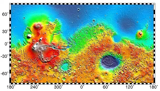
The following table is a partial list of artificial objects on the surface of Mars, consisting of spacecraft which were launched from Earth. Although most are defunct after having served their purpose, the Curiosity rover, InSight lander, Perseverance rover, Ingenuity helicopter, and Zhurong rover are all active. China's Tianwen-1 spacecraft is the most recent artificial object to land safely on Mars, with Mars 3 and Tianwen-1 remote camera the heaviest and lightest Martian spacecraft respectively.
The table does not include smaller objects, such as springs, fragments, parachutes and heat shields. As of February 2021, there are 14 missions with objects on the surface of Mars. Some of these missions contain multiple spacecraft.
List of landers and vehicles
In this listing, it is implied that each mission left debris according to its design. For example, the Schiaparelli EDM lander likely exploded on impact, creating an unknown number of fragments at one location. At another location, there may be a lower heat shield, and at another location, a parachute and upper heat shield. Another example is the counterweights ejected by MSL during its descent. In some cases, the nature and location of this additional debris has been determined and, in other cases, even the location of the main spacecraft has remained unknown. The identification of Beagle 2 after 11 years is one of the greatest breakthroughs yet, since prior to that, it could not be confirmed what had happened.[2] Spacecraft that have not been precisely located include Mars 2, Mars 3, Mars 6, Mars Polar Lander, and the two Deep Space 2 probes.
| No data collection | |
| Transmitted data | |
| Operational |
| Year | Agency | Mission | Object(s) | Image | Mass (kg) | Status | Location |
|---|---|---|---|---|---|---|---|
| 1971 | USSR | Mars 2 | Mars 2 lander and PrOP-M rover | 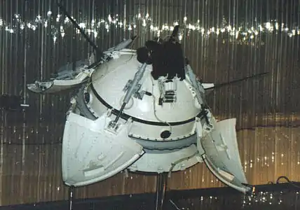 |
1210 | Failure during descent; crashed on surface | Estimated at 45°S 313°W[3] |
| 1971 | USSR | Mars 3 | Mars 3 lander and PrOP-M rover | |
1210 | Transmission failure 110 seconds after soft landing | Estimated at Sirenum Terra |
| 1973 | USSR | Mars 6 | Mars 6 lander |  |
635 | Returned corrupted data for 224 seconds during its descent but contact lost before reaching surface[5] | Estimated at Margaritifer Terra |
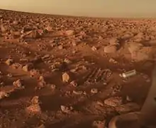
| 1976 | NASA | Viking 1 | Viking 1 lander | 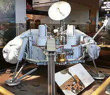 |
657 | Operated 2245 sols. Last contact Nov 11, 1982 | Chryse Planitia |
| 1976 | NASA | Viking 2 | Viking 2 lander | |
657 | Operated 1281 sols. Last contact Apr 11, 1980 | Utopia Planitia |
| 1997 | NASA | Mars Pathfinder | Pathfinder (lander) |  |
360 | Operated 83 sols. Last contact Sep 27, 1997[8] | Ares Vallis |
| Sojourner (rover) | 11.5 | ||||||
| 1999 | NASA | Mars Surveyor '98 | Mars Polar Lander and
Deep Space 2 (probes) |
 |
500 | Unknown failure during descent; crashed on surface | Estimated at Ultimi Scopuli |
| 2003 | ESA
(UK) |
Mars Express | Beagle 2 (lander) | 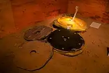 |
33.2 | Landed safely; solar panels failed to deploy | Isidis Planitia |
| 2004 | NASA | Mars Exploration Rover | Spirit (rover) | 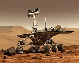 |
185 | Operated 2210 sols. Last contact Mar 22, 2010 | Gusev crater |
| Opportunity (rover) | |
185 | Operated 5111 sols. Last contact June 10, 2018 | Meridiani Planum | |||
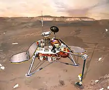
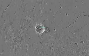
| 2008 | NASA | Phoenix Mars Lander | Phoenix (lander) | 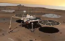 |
350 | Operated 155 sols. Last contact Nov 2, 2008 | Green Valley in Vastitas Borealis |
| 2012 | NASA | Mars Science Laboratory | Curiosity (rover) | 900 | In operation, 3459 sols | Aeolis Palus in Gale Crater | |
| 2016 | ESA | ExoMars 2016 | Schiaparelli EDM (lander) |  |
577 | Crashed on impact; transmitted descent telemetry | Meridiani Planum |
| 2018 | NASA | InSight | InSight (lander) | 358 | In operation, 1218 sols | Elysium Planitia | |
| 2021 | NASA | Mars 2020 | Perseverance (rover) | 1024 | In operation, 424 sols | Jezero crater | |
| Ingenuity (helicopter) | .png.webp) |
1.8 | In operation, 424 sols | Wright Brothers Field | |||
| 2021 | CNSA | Tianwen-1 | Tianwen-1 (lander) | 1285 | Reached end of designed lifespan after landing on 14 May, 2021. | Utopia Planitia | |
| Zhurong (rover) | 240 | In operation, 342 sols | |||||
| Tianwen-1 Remote camera | <1 | Reached end of designed lifespan after mission completion on 1 June, 2021. |
Combined, the total weight would be 9470 kg.
Other objects
- Orbiters whose orbit could eventually decay and impact the surface, include: Viking 1 and Viking 2 orbiters, Mars Reconnaissance Orbiter, 2001 Mars Odyssey, Mars Express, Mars Global Surveyor, Phobos 2, Mars 2, Mars 3, and Mars 5 orbiters, and Mariner 9. (See also List of Mars orbiters)
- The fate of Mars Climate Orbiter (1999) is unknown, but it is thought to have burnt up in the atmosphere before impacting.
- Mariner 9, which entered Mars orbit in 1971, is expected to remain in orbit until approximately 2022, when the spacecraft is projected to enter the Martian atmosphere and either burn up or crash into the planet's surface.[11]
Gallery
From surface
 MER-A Spirit rover lander
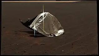 MER-B Opportunity's heat shield
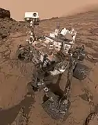 MSL Curiosity self-portrait, 2016
From orbit
 Viking 1 lander in 2006 (HiRise)
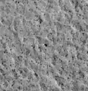 Viking 2 lander in 2006 (HiRise)
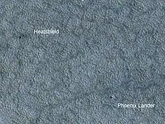 Phoenix lander and heat-shield in 2009 (HiRise)
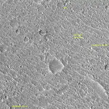
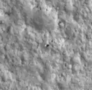
 MER-B Opportunity lander in Eagle crater (2006)
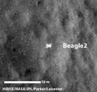 Beagle 2, after 11 years found and showing that it made it to the surface but did not expand fully to transmit
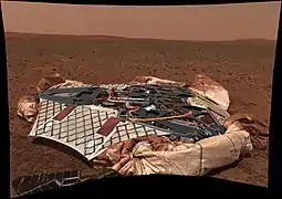
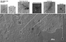 Curiosity landing remnants
 Schiaparelli remnants (2016)
Landing site namings and memorials
Several landing sites have been named, either the spacecraft itself or the landing site:
- Pennants of Soviet Union on Mars 2 and Mars 3 landers (1971).[12]
- Thomas Mutch Memorial Station, the Viking 1 lander (1976).[13]
- Gerald Soffen Memorial Station, the Viking 2 lander (1976).[14]
- Carl Sagan Memorial Station, Mars Pathfinder (Sojourner) base (1997).[15]
- Challenger Memorial Station, MER-B (Opportunity) landing site area (2004).[16]
- Columbia Memorial Station, MER-A (Spirit) landing site area (2004).[17]
- Green Valley, the Phoenix lander (2008).
- Bradbury Landing, Curiosity rover landing site (August 6, 2012).[18] (Note: Due to the nature of the landing system, there is no actual space hardware at the touchdown location of Bradbury Landing, see Curiosity (rover))
- InSight Landing, the InSight lander (2018)
- Octavia E. Butler Landing, Perseverance rover and Ingenuity helicopter landing site (February 18, 2021)
- Wright Brothers Field, the initial take-off and landing site for the Ingenuity helicopter, used for five flights (April, May, 2021)
See also
References
- Mars - Viking 2 Lander
- Beagle 2 spacecraft found intact on surface of Mars after 11 years
- "NASA NSSDC Master Catalog - Mars 2". Retrieved 2010-12-24.
- "NASA NSSDC Master Catalog - Mars 3". Retrieved 2010-12-24.
- "NASA NSSDC Master Catalog - Mars 6". Retrieved 2010-12-24.
- "NASA NSSDC Master Catalog - Viking 1 lander". Retrieved 2010-12-24.
- "NASA NSSDC Master Catalog - Viking 2 lander". Retrieved 2010-12-24.
- "Mars Pathfinder". Retrieved 2011-12-07.
- "NASA NSSDC Master Catalog - Mars Pathfinder". Retrieved 2010-12-24.
- "NASA NSSDC Master Catalog - Mars Pathfinder Rover". Retrieved 2010-12-24.
- NASA - This Month in NASA History: Mariner 9, November 29, 2011 – Vol. 4, Issue 9
- Soviet Craft - Mars (1960-1974) Archived 2013-07-08 at the Wayback Machine
- NSSDC - Viking 1 lander
- NSSDC - Viking 2 lander
- NSSDC - Mars Pathfinder
- NASA - Space Shuttle Challenger Crew Memorialized on Mars
- NASA - Space Shuttle Columbia Crew Memorialized on Mars
- "Curiosity Landing Site Named for Ray Bradbury". NASA. August 22, 2012. Retrieved August 24, 2012.
| Geography | |||||||||||
|---|---|---|---|---|---|---|---|---|---|---|---|
| Astronomy |
| ||||||||||
| Exploration |
| ||||||||||
| Related | |||||||||||
| |||||||||||