Liberty, Tioga County, Pennsylvania
Liberty is a small borough in Tioga County, Pennsylvania, in the United States. The population was 249 at the 2010 census.[3]
Liberty, Pennsylvania | |
|---|---|
 Downtown Liberty, Pennsylvania, during the annual Blockhouse Festival | |
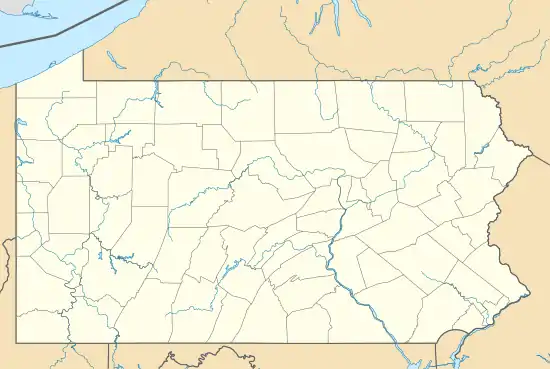
 Location of Liberty in Tioga County, Pennsylvania. | |
 Liberty Location within the state of Pennsylvania  Liberty Liberty (the United States) | |
| Coordinates: 41°33′30″N 77°06′17″W | |
| Country | United States |
| State | Pennsylvania |
| County | Tioga |
| Settled | 1792 |
| Incorporated (borough) | 1893 |
| Area | |
| • Total | 0.48 sq mi (1.23 km2) |
| • Land | 0.48 sq mi (1.23 km2) |
| • Water | 0.00 sq mi (0.00 km2) |
| Elevation | 1,598 ft (487 m) |
| Population (2010) | |
| • Total | 249 |
| • Estimate (2019)[2] | 234 |
| • Density | 491.60/sq mi (189.65/km2) |
| Time zone | Eastern (EST) |
| • Summer (DST) | EDT |
| ZIP code | 16930 |
| Area code(s) | 570 |
| FIPS code | 42-43128 |
| GNIS feature ID | 1215624 |
Geography
Liberty is located at 41°33′30″N 77°6′14″W (41.558446, -77.103839).[4]
According to the United States Census Bureau, the borough has a total area of 0.5 square miles (1.3 km2), all of it land.
Demographics
| Historical population | |||
|---|---|---|---|
| Census | Pop. | %± | |
| 1900 | 263 | — | |
| 1910 | 253 | −3.8% | |
| 1920 | 194 | −23.3% | |
| 1930 | 221 | 13.9% | |
| 1940 | 280 | 26.7% | |
| 1950 | 271 | −3.2% | |
| 1960 | 269 | −0.7% | |
| 1970 | 235 | −12.6% | |
| 1980 | 220 | −6.4% | |
| 1990 | 199 | −9.5% | |
| 2000 | 230 | 15.6% | |
| 2010 | 249 | 8.3% | |
| 2019 (est.) | 234 | [2] | −6.0% |
| Sources:[5][6][7] | |||
As of the census[6] of 2010, there were 249 people, 93 households, and 85 families residing in the borough.[3] The population density was 446.5 people per square mile (170.8/km2). There were 95 housing units at an average density of 184.4/sq mi (70.5/km2). The racial makeup of the borough was 99.13% White, and 0.87% from two or more races. Hispanic or Latino of any race were 0.87% of the population.
There were 88 households, out of which 42.0% had children under the age of 18 living with them, 56.8% were married couples living together, 10.2% had a female householder with no husband present, and 30.7% were non-families. 27.3% of all households were made up of individuals, and 9.1% had someone living alone who was 65 years of age or older. The average household size was 2.61 and the average family size was 3.13.
In the borough the population was spread out, with 31.3% under the age of 18, 9.6% from 18 to 24, 28.7% from 25 to 44, 18.7% from 45 to 64, and 11.7% who were 65 years of age or older. The median age was 32 years. For every 100 females there were 101.8 males. For every 100 females age 18 and over, there were 97.5 males.
The median income for a household in the borough was $39,219, and the median income for a family was $38,542. Males had a median income of $27,813 versus $19,688 for females. The per capita income for the borough was $17,690. About 4.9% of families and 9.8% of the population were below the poverty line, including 13.6% of those under the age of eighteen and none of those 65 or over.
Notable people
- Jimmy Sebring, first baseball player to hit a World Series home run, was born in Liberty.
References
- "2019 U.S. Gazetteer Files". United States Census Bureau. Retrieved July 28, 2020.
- "Population and Housing Unit Estimates". United States Census Bureau. May 24, 2020. Retrieved May 27, 2020.
- https://www.census.gov/popfinder/?fl=4211743128
- "US Gazetteer files: 2010, 2000, and 1990". United States Census Bureau. 2011-02-12. Retrieved 2011-04-23.
- "Census of Population and Housing". U.S. Census Bureau. Retrieved 11 December 2013.
- "U.S. Census website". United States Census Bureau. Retrieved 2008-01-31.
- "Incorporated Places and Minor Civil Divisions Datasets: Subcounty Resident Population Estimates: April 1, 2010 to July 1, 2012". Population Estimates. U.S. Census Bureau. Archived from the original on 11 June 2013. Retrieved 11 December 2013.
External links
Municipalities and communities of Tioga County, Pennsylvania, United States | ||
|---|---|---|
| Boroughs | 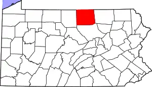 | |
| Townships | ||
| CDPs | ||
| Unincorporated communities | ||
| ||