Le Landreau
Le Landreau (French pronunciation: [lə lɑ̃dʁo] (![]() listen); Breton: Lannerell) is a commune in the Loire-Atlantique department in western France.
listen); Breton: Lannerell) is a commune in the Loire-Atlantique department in western France.
Le Landreau | |
|---|---|
Commune | |
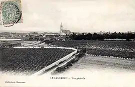 Le Landreau in 1910 | |
.svg.png.webp) Coat of arms | |
Location of Le Landreau 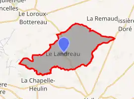 | |
 Le Landreau 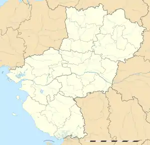 Le Landreau | |
| Coordinates: 47°12′20″N 1°18′15″W | |
| Country | France |
| Region | Pays de la Loire |
| Department | Loire-Atlantique |
| Arrondissement | Nantes |
| Canton | Vallet |
| Intercommunality | Sèvre et Loire |
| Government | |
| • Mayor (2020–2026) | Christophe Richard |
| Area 1 | 23.98 km2 (9.26 sq mi) |
| Population | 3,083 |
| • Density | 130/km2 (330/sq mi) |
| Time zone | UTC+01:00 (CET) |
| • Summer (DST) | UTC+02:00 (CEST) |
| INSEE/Postal code | 44079 /44430 |
| Elevation | 3–96 m (9.8–315.0 ft) |
| 1 French Land Register data, which excludes lakes, ponds, glaciers > 1 km2 (0.386 sq mi or 247 acres) and river estuaries. | |
Population
|
|
References
- "Populations légales 2019". The National Institute of Statistics and Economic Studies. 29 December 2021.
See also
| Wikimedia Commons has media related to Le Landreau. |
This article is issued from Wikipedia. The text is licensed under Creative Commons - Attribution - Sharealike. Additional terms may apply for the media files.