Le Domaine-du-Roy Regional County Municipality
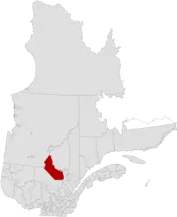
Le Domaine-du-Roy (The King's Domain) is a regional county municipality in the Saguenay-Lac-Saint-Jean region of Quebec, Canada. Its seat is in Roberval, and it is named for the King of France, who owned the land at the time of the colonization of Quebec.
Le Domaine-du-Roy | |
|---|---|
 | |
| Coordinates: 48°29′N 72°21′W[1] | |
| Country | |
| Province | |
| Region | Saguenay–Lac-Saint-Jean |
| Effective | January 1, 1983 |
| County seat | Roberval |
| Government | |
| • Type | Prefecture |
| • Prefect | Yanick Baillargeon |
| Area | |
| • Total | 18,713.70 km2 (7,225.40 sq mi) |
| • Land | 17,803.47 km2 (6,873.96 sq mi) |
| Population (2016)[3] | |
| • Total | 31,285 |
| • Density | 1.8/km2 (5/sq mi) |
| • Change (20111–16) | |
| • Dwellings | 16,549 |
| Time zone | UTC−5 (EST) |
| • Summer (DST) | UTC−4 (EDT) |
| Area code(s) | 418 and 581 |
| Website | www |
Subdivisions
There are 10 subdivisions within the RCM:[2]
|
|
|
|
|
(not associated with RCM)
|
Demographics
Population
Canada census – Le Domaine-du-Roy Regional County Municipality community profile
| 2016 | 2011 | |
|---|---|---|
| Population | 31,285 (-1.8% from 2011) | 31,870 (-0.3% from 2006) |
| Land area | 17,803.47 km2 (6,873.96 sq mi) | 17,799.45 km2 (6,872.41 sq mi) |
| Population density | 1.8/km2 (4.7/sq mi) | 1.8/km2 (4.7/sq mi) |
| Median age | 48.2 (M: 47.3, F: 49.1) | 46.4 (M: 45.9, F: 46.9) |
| Total private dwellings | 16,549 | 17,494 |
| Median household income | $54,587 | $46,848 |
|
| ||||||||||||||||||||||||
| [8][3] | |||||||||||||||||||||||||
Language
| Canada Census Mother Tongue - Le Domaine-du-Roy Regional County Municipality, Quebec[8][3] | ||||||||||||||||||
|---|---|---|---|---|---|---|---|---|---|---|---|---|---|---|---|---|---|---|
| Census | Total | French |
English |
French & English |
Other | |||||||||||||
| Year | Responses | Count | Trend | Pop % | Count | Trend | Pop % | Count | Trend | Pop % | Count | Trend | Pop % | |||||
2016 |
30,715 |
30,090 | 97.97% | 100 | 0.33% | 55 | 0.16% | 470 | 1.05% | |||||||||
2011 |
31,345 |
30,865 | 98.47% | 100 | 0.32% | 50 | 0.16% | 330 | 1.05% | |||||||||
2006 |
31,415 |
30,715 | 97.77% | 110 | 0.35% | 65 | 0.21% | 525 | 1.67% | |||||||||
2001 |
32,155 |
31,515 | 98.01% | 125 | 0.39% | 15 | 0.05% | 500 | 1.55% | |||||||||
1996 |
33,160 |
32,590 | n/a | 98.28% | 95 | n/a | 0.29% | 80 | n/a | 0.24% | 395 | n/a | 1.19% | |||||
Transportation
References
- Reference number 141081 of the Commission de toponymie du Québec (in French)
- Geographic code 910 in the official Répertoire des municipalités (in French)
- "Census Profile, 2016 Census: Le Domaine-du-Roy, Municipalité régionale de comté [Census division], Quebec". Statistics Canada. Retrieved December 15, 2019.
- "2016 Community Profiles". 2016 Canadian Census. Statistics Canada. August 12, 2021. Retrieved 2019-12-15.
- "2011 Community Profiles". 2011 Canadian Census. Statistics Canada. March 21, 2019. Retrieved 2014-02-23.
- "2006 Community Profiles". 2006 Canadian Census. Statistics Canada. August 20, 2019.
- "2001 Community Profiles". 2001 Canadian Census. Statistics Canada. July 18, 2021.
- Statistics Canada: 1996, 2001, 2006, 2011 census
- Official Transport Quebec Road Map
Adjacent Counties & Equivalent Territories | ||||||||||||||||
|---|---|---|---|---|---|---|---|---|---|---|---|---|---|---|---|---|
| ||||||||||||||||
This article is issued from Wikipedia. The text is licensed under Creative Commons - Attribution - Sharealike. Additional terms may apply for the media files.