Le Castellard-Mélan
Le Castellard-Mélan (before 2010: Le Castellard-Melan)[3] is a commune situated in the Alpes-de-Haute-Provence department in southeastern France.
Le Castellard-Mélan | |
|---|---|
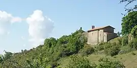 The chapel of Our Lady, with the ruins of the castle in the background | |
 Coat of arms | |
Location of Le Castellard-Mélan 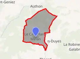 | |
 Le Castellard-Mélan 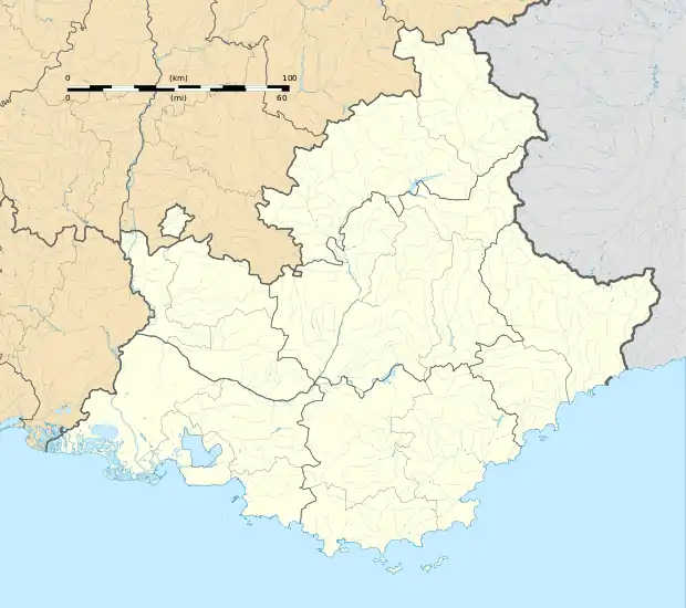 Le Castellard-Mélan | |
| Coordinates: 44°11′18″N 6°07′32″E | |
| Country | France |
| Region | Provence-Alpes-Côte d'Azur |
| Department | Alpes-de-Haute-Provence |
| Arrondissement | Digne-les-Bains |
| Canton | Digne-les-Bains-1 |
| Intercommunality | CA Provence-Alpes |
| Government | |
| • Mayor (2020–2026) | Chantal Bardin[1] |
| Area 1 | 25.74 km2 (9.94 sq mi) |
| Population | 63 |
| • Density | 2.4/km2 (6.3/sq mi) |
| Time zone | UTC+01:00 (CET) |
| • Summer (DST) | UTC+02:00 (CEST) |
| INSEE/Postal code | 04040 /04380 |
| Elevation | 776–1,840 m (2,546–6,037 ft) (avg. 1,050 m or 3,440 ft) |
| 1 French Land Register data, which excludes lakes, ponds, glaciers > 1 km2 (0.386 sq mi or 247 acres) and river estuaries. | |
Population
|
|
References
- "Répertoire national des élus: les maires". data.gouv.fr, Plateforme ouverte des données publiques françaises (in French). 2 December 2020.
- "Populations légales 2019". The National Institute of Statistics and Economic Studies. 29 December 2021.
- INSEE
| Wikimedia Commons has media related to Le Castellard-Mélan. |
This article is issued from Wikipedia. The text is licensed under Creative Commons - Attribution - Sharealike. Additional terms may apply for the media files.