Lambrey
Lambrey is a commune in the Haute-Saône department in the region of Bourgogne-Franche-Comté in eastern France. Its geographical coordinates are 47° 46' 0" North, 5° 56' 0".
Lambrey | |
|---|---|
Location of Lambrey 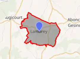 | |
 Lambrey 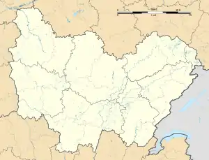 Lambrey | |
| Coordinates: 47°45′52″N 5°55′42″E | |
| Country | France |
| Region | Bourgogne-Franche-Comté |
| Department | Haute-Saône |
| Arrondissement | Vesoul |
| Canton | Jussey |
| Area 1 | 6.08 km2 (2.35 sq mi) |
| Population | 77 |
| • Density | 13/km2 (33/sq mi) |
| Time zone | UTC+01:00 (CET) |
| • Summer (DST) | UTC+02:00 (CEST) |
| INSEE/Postal code | 70293 /70500 |
| Elevation | 228–295 m (748–968 ft) |
| 1 French Land Register data, which excludes lakes, ponds, glaciers > 1 km2 (0.386 sq mi or 247 acres) and river estuaries. | |
References
- "Populations légales 2019". The National Institute of Statistics and Economic Studies. 29 December 2021.
| Wikimedia Commons has media related to Lambrey. |
This article is issued from Wikipedia. The text is licensed under Creative Commons - Attribution - Sharealike. Additional terms may apply for the media files.