La Livinière
La Livinière (French pronunciation: [la livinjɛʁ]; Occitan: La Livinièra) is a commune in the Hérault département in the Occitanie region in southern France.
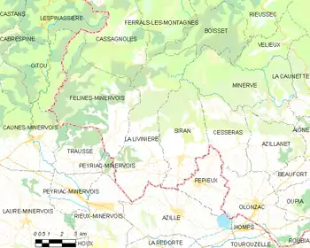
Map
La Livinière | |
|---|---|
 La Laviniere seen from a vineyard | |
.svg.png.webp) Coat of arms | |
Location of La Livinière 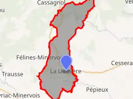 | |
 La Livinière 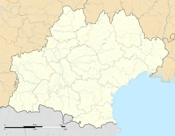 La Livinière | |
| Coordinates: 43°19′00″N 2°38′14″E | |
| Country | France |
| Region | Occitania |
| Department | Hérault |
| Arrondissement | Béziers |
| Canton | Saint-Pons-de-Thomières |
| Government | |
| • Mayor (2020–2026) | Pierre-André Pedesseau[1] |
| Area 1 | 31.56 km2 (12.19 sq mi) |
| Population | 521 |
| • Density | 17/km2 (43/sq mi) |
| Time zone | UTC+01:00 (CET) |
| • Summer (DST) | UTC+02:00 (CEST) |
| INSEE/Postal code | 34141 /34210 |
| Elevation | 90–598 m (295–1,962 ft) (avg. 153 m or 502 ft) |
| 1 French Land Register data, which excludes lakes, ponds, glaciers > 1 km2 (0.386 sq mi or 247 acres) and river estuaries. | |
Population
| Year | Pop. | ±% |
|---|---|---|
| 1962 | 655 | — |
| 1968 | 682 | +4.1% |
| 1975 | 567 | −16.9% |
| 1982 | 512 | −9.7% |
| 1990 | 506 | −1.2% |
| 1999 | 588 | +16.2% |
| 2008 | 549 | −6.6% |
See also
References
- "Répertoire national des élus: les maires". data.gouv.fr, Plateforme ouverte des données publiques françaises (in French). 2 December 2020.
- "Populations légales 2019". The National Institute of Statistics and Economic Studies. 29 December 2021.
| Wikimedia Commons has media related to La Livinière. |
This article is issued from Wikipedia. The text is licensed under Creative Commons - Attribution - Sharealike. Additional terms may apply for the media files.