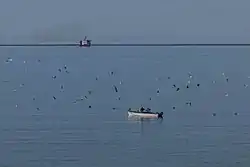
L'Anse-au-Loup
L'Anse-au-Loup is a town in the Canadian province of Newfoundland and Labrador. The town had a population of 558 in the Canada 2016 Census, slightly up from 550 in 2011.[1] In the Canada 2006 Census, there were 593 inhabitants. Common Surnames are Barney, Belben, Cabot, Earle, Linstead, Normore, O'Brien, Ryland.
L'Anse-au-Loup
Wolf Cove | |
|---|---|
Town | |
 | |
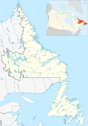 L'Anse-au-Loup Location of L'Anse-au-Loup in Newfoundland & Labrador  L'Anse-au-Loup L'Anse-au-Loup (Canada) | |
| Coordinates: 51°31′33″N 56°50′01″W | |
| Country | Canada |
| Province | Newfoundland and Labrador |
| Area | |
| • Land | 3.48 km2 (1.34 sq mi) |
| Population (2016)[1] | |
| • Total | 558 |
| • Density | 160.5/km2 (416/sq mi) |
| Time zone | UTC-3:30 (Newfoundland Time) |
| • Summer (DST) | UTC-2:30 (Newfoundland Daylight) |
| Area code(s) | 709 |
| Highways | |
The town is located along Route 510 in Labrador, between Forteau and L'Anse-au-Diable. The town was incorporated in 1975. The first mayor was Reginald O'Brien Sr.
Demographics
In the 2021 Census of Population conducted by Statistics Canada, L'Anse-au-Clair had a population of 219 living in 98 of its 111 total private dwellings, a change of 1.4% from its 2016 population of 216. With a land area of 60.65 km2 (23.42 sq mi), it had a population density of 3.6/km2 (9.4/sq mi) in 2021.[2]
See also
- List of cities and towns in Newfoundland and Labrador
- Wolf Cove, Newfoundland and Labrador
References
- "L'Anse au Loup, T [Census subdivision], Newfoundland and Labrador and Canada [Country] (table) Census Profile". 2016 Census. Statistics Canada. Retrieved 27 February 2018.
- "Population and dwelling counts: Canada, provinces and territories, census divisions and census subdivisions (municipalities), Newfoundland and Labrador". Statistics Canada. February 9, 2022. Retrieved March 15, 2022.