Mount Frere
Mount Frere, officially KwaBhaca,[2] is a town located in the Eastern Cape province, previously known as the Transkei region, of South Africa. Its name in Xhosa is KwaBhaca, or "village of the Bhaca chiefdom", which was established here with the approval of the Paramount, King Hintsa.
Mount Frere
KwaBhaca | |
|---|---|
Main street of Mount Frere | |
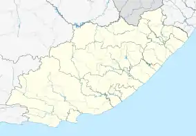 Mount Frere  Mount Frere | |
| Coordinates: 30°55′S 28°59′E | |
| Country | South Africa |
| Province | Eastern Cape |
| District | Alfred Nzo |
| Municipality | Umzimvubu |
| Established | 1876 |
| • Councillor | (ANC) |
| Area | |
| • Total | 3.53 km2 (1.36 sq mi) |
| Population (2011)[1] | |
| • Total | 5,252 |
| • Density | 1,500/km2 (3,900/sq mi) |
| Racial makeup (2011) | |
| • Black African | 96.1% |
| • Coloured | 1.2% |
| • Indian/Asian | 0.8% |
| • White | 0.8% |
| • Other | 1.1% |
| First languages (2011) | |
| • Xhosa | 86.6% |
| • English | 6.0% |
| • Other | 5.7% |
| Time zone | UTC+2 (SAST) |
| Postal code (street) | 5090 |
| PO box | 5090 |
| Area code | 039 255 |
Mount Frere was founded in the 17th century and named after Sir Henry Bartle Edward Frere. In February 2016, Mount Frere was renamed KwaBhaca.[2]
References
- "Main Place Mount Frere". Census 2011.
- "Government Gazette No. 39669" (PDF). South African Government. 2016-02-09. p. 9. Retrieved 8 August 2019.
External links
Municipalities and communities of Alfred Nzo District Municipality, Eastern Cape | ||
|---|---|---|
District seat: Mount Ayliff | ||
| Matatiele | .svg.png.webp) Alfred Nzo District within South Africa | |
| Umzimvubu | ||
| Mbizana | ||
| Ntabankulu | ||
This article is issued from Wikipedia. The text is licensed under Creative Commons - Attribution - Sharealike. Additional terms may apply for the media files.