Killona, Louisiana
Killona is a census-designated place (CDP) in St. Charles Parish, Louisiana, United States. The population was 724 in 2020.[2]
Killona | |
|---|---|
 Killona Location of Killona in Louisiana | |
| Coordinates: 29°59′58″N 90°29′13″W | |
| Country | United States |
| State | Louisiana |
| Parish | St. Charles |
| Area | |
| • Total | 0.88 sq mi (2.28 km2) |
| • Land | 0.80 sq mi (2.06 km2) |
| • Water | 0.08 sq mi (0.21 km2) |
| Elevation | 30 ft (9 m) |
| Population (2020) | |
| • Total | 724 |
| • Density | 908.41/sq mi (350.61/km2) |
| Time zone | UTC-6 (CST) |
| • Summer (DST) | UTC-5 (CDT) |
| Area code(s) | 985 |
| FIPS code | 22-39720 |
Geography
Killona is located at 29°59′58″N 90°29′13″W (29.999471, -90.487081).[3]
According to the United States Census Bureau, the CDP has a total area of 9.3 square miles (24 km2), of which 8.5 square miles (22 km2) is land and 0.9 square miles (2.3 km2) (9.13%) is water.
Education
St. Charles Parish Public School System operates public schools:
Place of interest
Killona is home to the following:
- Waterford 3—Operated by Entergy Nuclear, Waterford Nuclear Generating Station (aka Waterford 3), produces roughly 10% of power for the state of Louisiana.[6]
References
- "2020 U.S. Gazetteer Files". United States Census Bureau. Retrieved March 20, 2022.
- "2020 Race and Population Totals". United States Census Bureau. Retrieved 2021-10-25.
{{cite web}}: CS1 maint: url-status (link) - "US Gazetteer files: 2010, 2000, and 1990". United States Census Bureau. 2011-02-12. Retrieved 2011-04-23.
- "Census of Population and Housing". Census.gov. Retrieved June 4, 2016.
- "Hahnville High School" (Archive). AdvancED. p. 4/9. Retrieved on December 3, 2016. "Hahnville High School services all students on the west bank of the Mississippi River in St. Charles Parish, including the communities of Ama, Boutte, Hahnville, Luling, Paradis, Des Allemands and Killona."
- "Entergy Nuclear - Waterford 3". Entergy Nuclear. Retrieved 2015-10-27.
Municipalities and communities of St. Charles Parish, Louisiana, United States | ||
|---|---|---|
| CDPs | 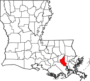 | |
| Other communities | ||
| Footnotes | ‡This populated place also has portions in an adjacent parish or parishes | |
| ||
This article is issued from Wikipedia. The text is licensed under Creative Commons - Attribution - Sharealike. Additional terms may apply for the media files.