Khirbet el-'Ormeh
Khirbet el-'Ormeh (Arabic: جبل العرمة, romanized: Jebel el-Urmah), also known as Horvat Ormah (Hebrew: חורבת עורמה), is an archeological site located in the West Bank. It is located near around ten kilometers southeast of Nablus.[1] The site includes the remains of a fortress from dating from the Hellenistic and Roman periods, with features typical of monumental Hasmonean and Herodian architecture style.[2]
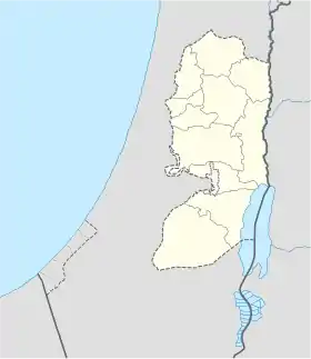 Shown within the West Bank | |
| Location | West Bank |
|---|---|
| Coordinates | 32.14759°N 35.32136°E |
| Type | fortification |
| Height | 843 m |
| History | |
| Periods | Hellenistic to late Roman period |
| Associated with | Hasmoneans |
| Site notes | |
| Condition | Razed |
| Public access | Yes |
Location
Khirbet el-'Ormeh is situated atop a hill, on an altitude of 843 meters above sea level. It is located about 1.5 km northwest of the Palestinian town of Aqraba, and southeast of the Israeli settlement of Itamar.
In the 1995 Oslo Accords, the site was classified as Area B (Palestinian civil control and joint Israeli-Palestinian security control).
Biblical identification
Khirbet el-'Ormeh is commonly identified with Arumah, a place mentioned in the Book of Judges as where Abimelech, son of Gideon resided for some time.[3][1][4]
Archeology
Early visits
The area was surveyed in 1874-75 by Conder and Kitchener of the Palestine Exploration Fund, as part of The Survey of Western Palestine. The two cited C.W.M Van De Velde, a Dutch cartographer who had previously surveyed the site and identified it with Biblical Arumah. The site appears on his maps of Palestine and Jerusalem.
French explorer Victor Guerin also identified Khirbet el-'Ormeh with Arumah. It appears on his 1881 map of the Holy Land.
Archeological surveys and findings
Khirbet el-'Ormeh has not yet been excavated but has been surveyed by various teams. It was first surveyed in the 1960s by the archeological expedition of Dro-McCormick on behalf of the American Schools of Oriental Research, and again in 1968 as part of the Archaeological Survey of Israel. [2] Other surveys followed.
According to archeologists, Khirbet el-'Ormeh was the site of a fortress with many water facilities.[2] A glacis was discovered on the east side of the wall line, at a level lower than the top of the mound, surrounding the mound on all sides.[2] At its bottom was a hewn shaft, which also served as a quarry for building stones. At its southern end is a fortified structure with two phases: the upper phase is built of ashlars with chisels, and the lower is built of coarse construction. Three open cisterns on the southwestern slope of the northern dome and a water aqueduct, similar to the Hasmonean and Herodian systems in Alexandrium and Hyrcania. Potsherds from the Early Roman period were found there, among other findings. Ceramics dating from the Late Hellenistic and Late Roman periods, and a fragment of terra sigillata pottery was also discovered at the site.[2]
In October 1984, nine Demetrius II coins dating from 146 to 138 BCE were found on the western and northern slopes of Khirbet el-'Ormeh.[2]
Analysis
Given its similarity to Hasmonean desert forts, it is likely that it was built by the Hasmoneans to guard the nearby town of Aqraba, and was later controlled by Herod.[2] Josephus (Wars 3.3.5) mentions Aqraba (Acrabatta) as being one of the administrative cities (toparchy) in Roman Judea.[5] Following the First-Jewish Roman War, the area's importance declined, and the fort gradually fell into disuse.[2]
Vandalism
In December 2021, Israeli media reported that the site was partially razed by the Palestinian Authority, which flattened much of the ancient remains in order to build a large mosque ("mosque of the martyrs") and a solar power system.[6]
See also
References
- Ross, James F. (1963). "BIBLE AND ARCHAEOLOGY". Journal of the American Academy of Religion. XXXI (2): 244. doi:10.1093/jaarel/XXXI.2.242. ISSN 0002-7189. Archived from the original on 2022-04-28. Retrieved 2022-04-28.
On the maps Arumah is apparently located at Khirbet el-'Ormeh, some ten kilometers southeast of Nablus
- אשל, חנן; ארליך, זאב ח'; ESHEL, HANAN; ERLICH, ZEEV H. (1988). "THE FORTRESS OF AQRABA IN KH. URMEH / מבצרה של עקרבה בחורבת עורמה". Cathedra: For the History of Eretz Israel and Its Yishuv / קתדרה: לתולדות ארץ ישראל ויישובה (47): 17–24. ISSN 0334-4657. Archived from the original on 2022-04-28. Retrieved 2022-04-28.
- Judges 9:41
- Daniel I. Block (13 October 2009). Joshua, Judges, Ruth, 1 & 2 Samuel. Zondervan. p. 173. ISBN 978-0-310-25574-1.
- Conder & Kitchener (1882). p. 386
- קמר, אסף (2021-12-05). "החשמונאים מתהפכים בקברם: "מסגד השאהידים" נבנה על המבצר העתיק" [The Hasmoneans turn over in their graves: the "Martyrs' Mosque" was built on the ancient fortress]. Ynet (in Hebrew). Archived from the original on 2022-02-26. Retrieved 2022-04-28.