Kamoenai, Hokkaido
Kamoenai (神恵内村, Kamoenai-mura) is a village located in Shiribeshi Subprefecture, Hokkaido, Japan. It is the second smallest municipality in Hokkaido by population, after Otoineppu.
Kamoenai
神恵内村 | |
|---|---|
Village | |
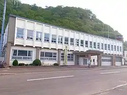 Kamoenai village office | |
 Flag  Emblem | |
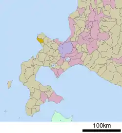 Location of Kamoenai in Hokkaido (Shiribeshi Subprefecture) | |
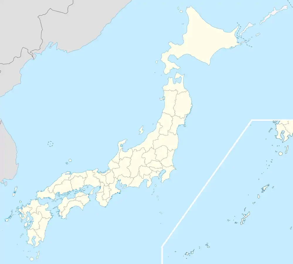 Kamoenai Location in Japan | |
| Coordinates: 43°9′N 140°26′E | |
| Country | Japan |
| Region | Hokkaido |
| Prefecture | Hokkaido (Shiribeshi Subprefecture) |
| District | Furuu |
| Government | |
| • Mayor | Masayuki Takahashi |
| Area | |
| • Total | 147.71 km2 (57.03 sq mi) |
| Population (September 30, 2016) | |
| • Total | 904 |
| • Density | 6.1/km2 (16/sq mi) |
| Time zone | UTC+09:00 (JST) |
| City hall address | 81-4 Kamoenaimura, Kamoenai, Furuu-gun, Hokkaido 045-0301 |
| Climate | Dfb |
| Website | www |
| Symbols | |
| Fish | Chum salmon |
| Tree | Abies sachalinensis |
As of September 2016, the village has an estimated population of 904. The total area is 147.71 km².
Geography
Kamoenai is located on the western of the Shakotan Peninsula.
Climate
| Climate data for Kamoenai (1991−2020 normals, extremes 1977−present) | |||||||||||||
|---|---|---|---|---|---|---|---|---|---|---|---|---|---|
| Month | Jan | Feb | Mar | Apr | May | Jun | Jul | Aug | Sep | Oct | Nov | Dec | Year |
| Record high °C (°F) | 8.9 (48.0) |
12.2 (54.0) |
15.2 (59.4) |
22.7 (72.9) |
30.0 (86.0) |
29.1 (84.4) |
33.5 (92.3) |
32.9 (91.2) |
32.2 (90.0) |
24.8 (76.6) |
19.6 (67.3) |
15.0 (59.0) |
33.5 (92.3) |
| Average high °C (°F) | 0.0 (32.0) |
0.5 (32.9) |
4.2 (39.6) |
10.0 (50.0) |
15.6 (60.1) |
19.6 (67.3) |
23.6 (74.5) |
25.4 (77.7) |
22.5 (72.5) |
16.1 (61.0) |
8.8 (47.8) |
2.3 (36.1) |
12.4 (54.3) |
| Daily mean °C (°F) | −2.3 (27.9) |
−1.9 (28.6) |
1.4 (34.5) |
6.7 (44.1) |
11.7 (53.1) |
15.7 (60.3) |
19.8 (67.6) |
21.4 (70.5) |
18.3 (64.9) |
12.5 (54.5) |
5.9 (42.6) |
−0.2 (31.6) |
9.1 (48.4) |
| Average low °C (°F) | −4.7 (23.5) |
−4.4 (24.1) |
−1.3 (29.7) |
3.6 (38.5) |
8.3 (46.9) |
12.4 (54.3) |
16.9 (62.4) |
18.3 (64.9) |
14.7 (58.5) |
9.1 (48.4) |
2.9 (37.2) |
−2.8 (27.0) |
6.1 (42.9) |
| Record low °C (°F) | −13.0 (8.6) |
−13.8 (7.2) |
−9.6 (14.7) |
−3.1 (26.4) |
1.1 (34.0) |
5.0 (41.0) |
9.8 (49.6) |
12.0 (53.6) |
6.4 (43.5) |
0.2 (32.4) |
−8.3 (17.1) |
−12.2 (10.0) |
−13.8 (7.2) |
| Average precipitation mm (inches) | 94.8 (3.73) |
72.1 (2.84) |
59.8 (2.35) |
65.1 (2.56) |
88.0 (3.46) |
69.4 (2.73) |
140.3 (5.52) |
142.8 (5.62) |
153.8 (6.06) |
133.4 (5.25) |
122.1 (4.81) |
117.4 (4.62) |
1,257.6 (49.51) |
| Average precipitation days (≥ 1.0 mm) | 18.3 | 15.3 | 12.6 | 10.5 | 10.5 | 9.4 | 10.0 | 10.0 | 11.9 | 14.1 | 16.0 | 19.0 | 157.6 |
| Mean monthly sunshine hours | 42.4 | 58.8 | 123.5 | 173.7 | 198.1 | 171.5 | 157.6 | 166.5 | 169.6 | 129.0 | 65.8 | 35.5 | 1,487.5 |
| Source: Japan Meteorological Agency[1][2] | |||||||||||||
History
Kamoenai was developed by fisheries. Kamoenai Village was merged with Akaishi Village and Sannai Village and became a Second Class Village in 1906.
Education
- Kamoenai Elementary School
- Kamoenai Junior High School
References
- 観測史上1~10位の値(年間を通じての値). JMA. Retrieved March 18, 2022.
- 気象庁 / 平年値(年・月ごとの値). JMA. Retrieved March 18, 2022.
External links
 Media related to Kamoenai, Hokkaidō at Wikimedia Commons
- Official Website (in Japanese)
| ||||||||||||
| ||||||||||||
| ||||||||||||
| ||||||||||||
| ||||||||||||
| ||||||||||||
| ||||||||||||
| ||||||||||||
| ||||||||||||
| ||||||||||||
| ||||||||||||
| ||||||||||||
| ||||||||||||
| ||||||||||||
This article is issued from Wikipedia. The text is licensed under Creative Commons - Attribution - Sharealike. Additional terms may apply for the media files.