Hualong Hui Autonomous County
Hualong Hui Autonomous County (simplified Chinese: 化隆回族自治县; traditional Chinese: 化隆回族自治縣; pinyin: Huàlóng Huízú Zìzhìxiàn; Xiao'erjing: خُوَلْو خُوِذُو ذِجِشِیًا) is a county in the east of Qinghai Province, China. It is under the administration of Haidong City. Its area is 2,790 square kilometers and has a population of 203,317 in 2010.[1]
Hualong
化隆县 · خُوَلْو | |
|---|---|
| 化隆回族自治县 · خُوَلْو خُوِذُو ذِجِشِیًا Hualong Hui Autonomous County | |
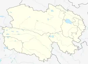 Hualong Location of the seat in Qinghai | |
| Coordinates: 36°05′N 102°12′E | |
| Country | People's Republic of China |
| Province | Qinghai |
| Prefecture-level city | Haidong |
| Area | |
| • Total | 2,790 km2 (1,080 sq mi) |
| Population (2010) | |
| • Total | 203,317 |
| • Density | 73/km2 (190/sq mi) |
| Time zone | UTC+8 (China Standard) |
| Website | www |
Administrative divisions
Towns
Townships
- Chuma Township (ཆུ་དམར་, 初麻乡), Ertang Township (二塘乡), Xiejiatan Township (谢家滩乡), Dehenglong Township (སྟག་ལུང་, 德恒隆乡), Shalianbao Township (沙连堡乡), Ashennu Township (ཨ་སྔོན་, 阿什奴乡), Dashicang Township (སྟག་ཚང་, 石大仓乡)
Ethnic Townships
- Shongshen Tibetan Ethnic Township (གཤོང་ཤན་, 雄先藏族乡), Tsaphug Tibetan Ethnic Township (ཚ་ཕུག་, 查甫藏族乡), Thagya Tibetan Ethnic Township (ཐ་རྒྱ་, 塔加藏族乡), Serzhong Tibetan Ethnic Township (གསེར་གཞོང་, 金源藏族乡)
References
- "Huàlóng Huízú Zìzhìxiàn (Autonomous County, China) - Population Statistics, Charts, Map and Location". www.citypopulation.de. Retrieved 2021-07-17.
External links
This article is issued from Wikipedia. The text is licensed under Creative Commons - Attribution - Sharealike. Additional terms may apply for the media files.