Honey Acres Airport
Honey Acres Airport is located one mile (1.6 km) west of Clinton, Michigan on W. Michigan Ave. and spans the border between Lenawee and Washtenaw counties. It is owned and operated by Raymond L. Kussmaul who also owns the Kussmaul Honey Farm, hence the name of the airport.[2][3] It has an FAA identifier of 7N4. It is at an elevation of 820 feet (250 m). It has one runway, 18/36, with a grass surface and a length of 3,800 feet (1,200 m). The airport opened in July 1990. Five aircraft are based at the airport which averages 67 aircraft operations per month. The airport encompasses an area of 60 acres (240,000 m2).[4][5][6]
Honey Acres Airport | |||||||||||
|---|---|---|---|---|---|---|---|---|---|---|---|
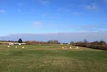 Runway viewed from Michigan Ave. | |||||||||||
| Summary | |||||||||||
| Airport type | Public | ||||||||||
| Owner | Raymond L. Kussmaul | ||||||||||
| Operator | Raymond L. Kussmaul | ||||||||||
| Serves | Clinton, Michigan | ||||||||||
| Elevation AMSL | 820 ft / 250 m | ||||||||||
| Coordinates | 42°04′40.15″N 83°59′9.8″W | ||||||||||
| Runways | |||||||||||
| |||||||||||
Source: FAA Airports GIS[1] | |||||||||||
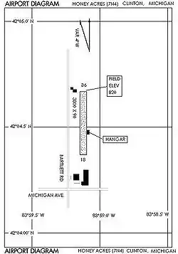
Airport diagram
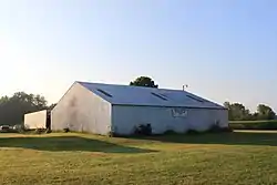
Hangar
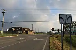
Intersection of Michigan Ave. & Bartlett Rd./Matthews Hwy at southern end of airport
References
- "Resource Moved". Archived from the original on 2011-07-21.
- "Archived copy". Archived from the original on 2006-05-18. Retrieved 2010-07-19.
{{cite web}}: CS1 maint: archived copy as title (link) - "Bees-On-The-Net | All you ever wanted to know about bees and beekeeping but were afraid to ask".
- https://airports-gis.faa.gov/airportsgis/airportLookup/airportDisplay.jsp?category=nasr&airportId=7N4 FAA Airports GIS
- "AirNav: 7N4 - Honey Acres Airport".
- "Honey Acres Airport (7N4) in Clinton, Michigan - Elevation, Runways, Altitude".
This article is issued from Wikipedia. The text is licensed under Creative Commons - Attribution - Sharealike. Additional terms may apply for the media files.