Helfaut
Helfaut (French pronunciation: [ɛlfo]; West Flemish: Helveld) is a commune in the Pas-de-Calais department in the Hauts-de-France region of France.
Helfaut
Helveld | |
|---|---|
_mairie_et_%C3%A9coles.JPG.webp) The town hall and schools of Helfaut | |
 Coat of arms | |
Location of Helfaut 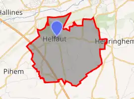 | |
 Helfaut  Helfaut | |
| Coordinates: 50°41′54″N 2°14′38″E | |
| Country | France |
| Region | Hauts-de-France |
| Department | Pas-de-Calais |
| Arrondissement | Saint-Omer |
| Canton | Longuenesse |
| Intercommunality | Pays de Saint-Omer |
| Government | |
| • Mayor (2020–2026) | Francis Marquant[1] |
| Area 1 | 8.92 km2 (3.44 sq mi) |
| Population | 1,720 |
| • Density | 190/km2 (500/sq mi) |
| Time zone | UTC+01:00 (CET) |
| • Summer (DST) | UTC+02:00 (CEST) |
| INSEE/Postal code | 62423 /62570 |
| Elevation | 23–95 m (75–312 ft) (avg. 92 m or 302 ft) |
| 1 French Land Register data, which excludes lakes, ponds, glaciers > 1 km2 (0.386 sq mi or 247 acres) and river estuaries. | |
Geography
A large village situated 4 miles (6 km) south of Saint-Omer, at the D195 and D198 crossroads. It is located on a geological formation called the "plateau d'Helfaut", which separates the Aa valley to the north from the Lys valley, to the south. The commune is home to a unique geological heritage, resulting in an unusual landscape. The sides of the old quarries alongside the plateau display many geological strata. The quarries of Heuringhem and Blendecques have collapsed as a result of soil creep. The commune gave its name to 'Dilluvium d’Helfaut', a flint and clay formation rare in France and Europe. The commune is home to many rare and protected species in a heathland landscape, which is unusual for northern France and justified the creation of a nature reserve (Les Landes d'Helfaut).
Population
The inhabitants are called Helfalois.
| Year | Pop. | ±% p.a. |
|---|---|---|
| 1968 | 1,139 | — |
| 1975 | 1,248 | +1.31% |
| 1982 | 1,426 | +1.92% |
| 1990 | 1,671 | +2.00% |
| 1999 | 1,693 | +0.15% |
| 2007 | 1,750 | +0.41% |
| 2012 | 1,596 | −1.83% |
| 2017 | 1,697 | +1.23% |
| Source: INSEE[3] | ||
History
The village was subject to much damage during World War II, as it was here that the Germans sited La coupole, an underground bunker, housing a huge concrete dome built by the Nazis between 1943 and 1944. Initially this bunker was to serve as a base to launch V2 rockets, but it never entered service because of the many bombing raids by the Allies. The Dome has been transformed into a museum.[4]
Places of interest
- The church of St. Fuscien and St. Victoric, dating from the thirteenth century.
- The church at Bilques.
- La Coupole : Second World War museum and visitor's centre
- The monument known as the ‘Helfaut column’. See fr:colonne d'Helfaut (in French)
References
- "Répertoire national des élus: les maires". data.gouv.fr, Plateforme ouverte des données publiques françaises (in French). 9 August 2021.
- "Populations légales 2019". The National Institute of Statistics and Economic Studies. 29 December 2021.
- Population en historique depuis 1968, INSEE
- "Base Mémoire : accès cartographique". culture.gouv.fr. Retrieved 25 March 2015.
External links
| Wikimedia Commons has media related to Helfaut. |
- Helfaut on the Insee website (in French)