Prince, Ontario
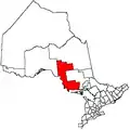
Prince is a township in the Canadian province of Ontario, located within the Algoma District northwest of Sault Ste. Marie. Although the township is not part of the city of Sault Ste. Marie, some municipal services are contracted to the city.
Prince | |
|---|---|
| Township of Prince | |
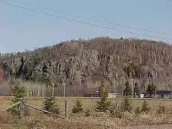
 The end of Highway 550 in Gros Cap. | |
 Prince | |
| Coordinates: 46°32′N 84°30′W | |
| Country | Canada |
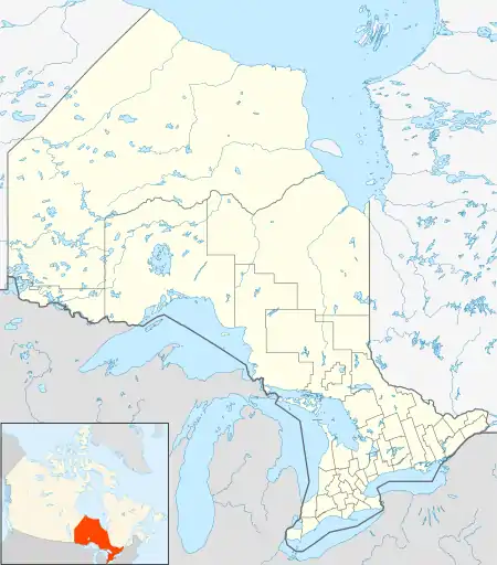
| Province | Ontario |
| District | Algoma |
| Government | |
| • Type | Township |
| • Reeve | Ken Lamming |
| • MP | Terry Sheehan |
| • MPP | Mike Mantha |
| Area | |
| • Land | 85.30 km2 (32.93 sq mi) |
| Population (2016)[1] | |
| • Total | 1,010 |
| • Density | 11.8/km2 (31/sq mi) |
| Time zone | UTC-5 (EST) |
| • Summer (DST) | UTC-4 (EDT) |
| Postal code span | P6A |
| Area code(s) | 705, 249 |
| Website | www.twp.prince.on.ca |
The only named community within the township is Gros Cap. Most mail and telephone service in the township is part of Sault Ste. Marie's sortation area and telephone exchange.
One of the largest wind farms in Canada, the Prince Township Wind Farm, is centred in Prince Township. It provides enough electricity to serve 20,000 homes. The project is run by Brascan Power Wind.
The township was named after John Prince, the first judge in the Algoma District.
Demographics
In the 2021 Census of Population conducted by Statistics Canada, Prince had a population of 975 living in 394 of its 462 total private dwellings, a change of -3.5% from its 2016 population of 1,010. With a land area of 84.98 km2 (32.81 sq mi), it had a population density of 11.5/km2 (29.7/sq mi) in 2021.[2]
| 2016 | 2011 | |
|---|---|---|
| Population | 1,010 (-2.0% from 2011) | 1,031 (6.2% from 2006) |
| Land area | 85.30 km2 (32.93 sq mi) | 85.31 km2 (32.94 sq mi) |
| Population density | 11.8/km2 (31/sq mi) | 12.1/km2 (31/sq mi) |
| Median age | 48.1 (M: 48.6, F: 47.6) | |
| Total private dwellings | 459 | 466 |
| Median household income |
Population trend:[7]
- Population in 2016: 1,010
- Population in 2011: 1,031
- Population in 2006: 971
- Population in 2001: 1,010
- Population in 1996: 971
- Population in 1991: 987
See also
References
- "Prince census profile". 2016 Census of Population. Statistics Canada. Retrieved 2019-06-04.
- "Population and dwelling counts: Canada, provinces and territories, census divisions and census subdivisions (municipalities), Ontario". Statistics Canada. February 9, 2022. Retrieved April 2, 2022.
- "2016 Community Profiles". 2016 Canadian Census. Statistics Canada. August 12, 2021. Retrieved 2019-06-04.
- "2011 Community Profiles". 2011 Canadian Census. Statistics Canada. March 21, 2019. Retrieved 2012-02-17.
- "2006 Community Profiles". 2006 Canadian Census. Statistics Canada. August 20, 2019.
- "2001 Community Profiles". 2001 Canadian Census. Statistics Canada. July 18, 2021.
- Statistics Canada: 1996, 2001, 2006, 2011 census
External links
| Wikimedia Commons has media related to Prince, Ontario. |
Places adjacent to Prince, Ontario | |
|---|---|