Gila Crossing, Arizona
Gila Crossing (O'odham: Kuiwa) is a census-designated place (CDP) in Maricopa County, Arizona, United States, located in the Gila River Indian Community south of Komatke. The population was 621 at the 2010 census.
Gila Crossing, Arizona
O'odham: Kuiwa | |
|---|---|
 | |
 Location of Gila Crossing in Maricopa County, Arizona. | |
 Gila Crossing, Arizona Location in the United States | |
| Coordinates: 33°16′34″N 112°10′1″W | |
| Country | United States |
| State | Arizona |
| County | Maricopa |
| Area | |
| • Total | 0.87 sq mi (2.25 km2) |
| • Land | 0.87 sq mi (2.25 km2) |
| • Water | 0.00 sq mi (0.00 km2) |
| Population (2020) | |
| • Total | 636 |
| • Density | 731.03/sq mi (282.16/km2) |
| Time zone | UTC-7 (MST (no DST)) |
| FIPS code | 04-27260 |
Demographics
| Historical population | |||
|---|---|---|---|
| Census | Pop. | %± | |
| 2020 | 636 | — | |
| U.S. Decennial Census[2] | |||
As of the census[3] of 2010, there were 621 people living in the CDP. The population density was 714.5 people per square mile. The racial makeup of the CDP was 84% Native American, 3% White, 1% Black or African American, 1% from other races, and 11% from two or more races. 15% of the population were Hispanic or Latino of any race.
Transportation
Gila River Transit connects Gila Crossing with Komatke and Maricopa Colony.[4]
References
- "2020 U.S. Gazetteer Files". United States Census Bureau. Retrieved October 29, 2021.
- "Census of Population and Housing". Census.gov. Retrieved June 4, 2016.
- "Archived copy". Archived from the original on 2011-07-21. Retrieved 2011-04-27.
{{cite web}}: CS1 maint: archived copy as title (link) - "West End Shuttle - Gila River Transit".
External links
 Media related to Gila Crossing, Arizona at Wikimedia Commons
Municipalities and communities of Maricopa County, Arizona, United States | ||
|---|---|---|
| Cities | 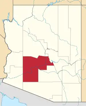 | |
| Towns | ||
| CDPs | ||
| Populated places |
| |
| Indian reservations | ||
| Ghost towns/ former populated places | ||
| Footnotes | ‡This populated place also has portions in an adjacent county or counties | |
| ||
This article is issued from Wikipedia. The text is licensed under Creative Commons - Attribution - Sharealike. Additional terms may apply for the media files.