Florida, Puerto Rico
Florida (Spanish pronunciation: [floˈɾiða]) is a town and municipality of Puerto Rico located in the karst region north of Ciales, south of Barceloneta, east of Arecibo, and west of Manatí. Florida is not like other municipalities of Puerto Rico with multiple subdivisions called barrios. It has one barrio called Florida Adentro and two other subdivisions: Florida Zona Urbana and Pajonal comunidad. It is part of the San Juan-Caguas-Guaynabo Metropolitan Statistical Area.
Florida
Municipio de Florida | |
|---|---|
Town and Municipality | |
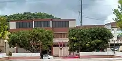 Building in Florida with flags out front | |
.svg.png.webp) Coat of arms | |
| Nicknames: "Pueblo de la Piña Cayenalisa", "La Tierra del Río Encantado", "Tierra de los Mogotes" | |
| Anthem: "Florida jardín hermoso (1961)" | |
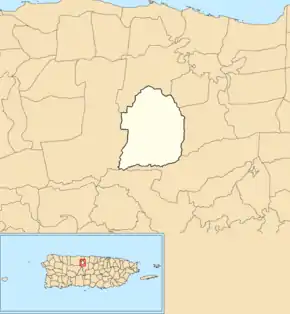
 Map of Puerto Rico highlighting Florida Municipality | |
| Coordinates: 18°21′49″N 66°34′17″W | |
| Commonwealth | |
| Founded | 1971 |
| Barrios | 1 barrio |
| Government | |
| • Mayor | José Gerena Polanco (PNP) |
| • Senatorial dist. | 3 - Arecibo |
| • Representative dist. | 13 |
| Area | |
| • Total | 26 km2 (10 sq mi) |
| Population (2020)[1] | |
| • Total | 11,692 |
| • Density | 450/km2 (1,200/sq mi) |
| Demonym(s) | Florideños |
| Time zone | UTC-4 (AST) |
| ZIP Code | 00650 |
| Area code(s) | 787/939 |
| Major routes | |

History
Florida was founded first as a barrio of Barceloneta in 1881 when a priest, Father Carrión, the mayor of Barceloneta, and other dignitaries arrived at a terrain of almost 4 acres. They decided to establish a new barrio and the owner of the place, Don Manuel Cintrón granted the land while he retained a piece of it. The barrio was first called Florida Adentro.[2]
During the 20th century, several efforts were made to declare Florida as a municipality. First, on 14 April 1949, House Representative Francisco Díaz Marchand presented a project to create a legislative commission that would study the economic and social conditions of the barrio, to determine the suitability of it as an independent municipality. The project was unsuccessful. In 1960, Manuel Frías Morales presented a law that would permit the study to establish the municipality but it didn't succeed either.
Finally, on 14 June 1971, the Senate of Puerto Rico and Governor Don Luis A. Ferré approved the law that officially created the municipality of Florida. It is thus the youngest municipality established in the island.
Geography
Florida is the second smallest municipality of Puerto Rico, with an area of 10 square miles. The municipality is the only in Puerto Rico with its urban area within the northern karst region (sometimes referred as the Northern Karst Hills), thus it is surrounded by low elevation haystack hills known as mogotes. The southern border of the municipality with Ciales remains one of the least developed areas on the island, due to the ruggedness of the karst. The Rio Encantado is a subterranean river that goes through this area. Several caves are in the town like Román Cave, Miró Cave, and Juana Gómez Cave.[3] Balcon Cave (Cueva Balcon) is located in Florida.[4]
Barrios
Like all municipalities of Puerto Rico, Florida is subdivided into administrative units called barrios (which means barrios or boroughs or neighborhoods in English). A newer municipality of Puerto Rico, Florida has one barrio called Florida Adentro and two subbarrios: Florida Zona Urbana and Pajonal and it does not have a barrio-pueblo like most of the other municipalities of Puerto Rico.[5][6][7]
The following areas are neighborhoods in Florida:
- Parcelas Arroyo
- Parcelas Selgas
- Pueblo Viejo
- San Agustín
- Perol
- Tosas
Sectors
Barrios (which are like minor civil divisions)[8] are subdivided into smaller local populated place areas/units called sectores (sectors in English). The types of sectores may vary, from sector to urbanización to reparto to barriada to residencial, among others.[9][10][11][12][13]
Special Communities
Comunidades Especiales de Puerto Rico (Special Communities of Puerto Rico) are marginalized communities whose citizens are experiencing a certain amount of social exclusion. A map shows these communities occur in nearly every municipality of the commonwealth. Of the 742 places that were on the list in 2014, the following barrios, communities, sectors, or neighborhoods were in Florida: Sector El Hoyo in Comunidad San Agustín, Comunidad Arroyo, Sector Polvorín in Comunidad La Ceiba, Comunidad La Fuente, Estancias de Arroyo in La Joya, Sector El Cerro in Pajonal, and Sectors La Charca and Los Quemaos (both) in Parcelas Selgas.[14]
Culture
Festival and events
Florida celebrates its patron saint festival in September. The Fiestas Patronales de Nuestra Señora de las Mercedes is a religious and cultural celebration that generally features parades, games, artisans, amusement rides, regional food, and live entertainment.[3]
Other festivals and events celebrated in Florida include:
- Three Kings Festival – January
- Cayenalisa Pineapple Festival- July
- Cultural Fair of Río Encantado – October
Economy
Florida's economy had mostly relied on agriculture, specifically pineapple, crops and other fruit related products. Today that's history with the high taxes impose on small vendors, there had been a few of manufacturing plants establishing in the area. There are pharmaceuticals in Florida.[15][16]
Demographics
| Historical population | |||
|---|---|---|---|
| Census | Pop. | %± | |
| 1980 | 7,232 | — | |
| 1990 | 8,689 | 20.1% | |
| 2000 | 12,367 | 42.3% | |
| 2010 | 12,680 | 2.5% | |
| 2020 | 11,692 | −7.8% | |
| U.S. Decennial Census[17] 1899 (shown as 1900)[18] 1910-1930[19] 1930-1950[20] 1960-2000[21] 2010[22] 2020[23] | |||
Florida is one of the least populated municipalities of Puerto Rico, perhaps due to its small size. The population, according to the 2000 census, was 12,237 with a population density of 1,236.7 people per square mile (475.6/km2). After its establishment in 1974, the population has steadily increased over the years, with 7,232 people in the 1980 census.
Statistics taken from the 2000 census shows that 86.0% of Florideños are of White origin, 4.9% are black, 0.2% are Amerindian etc.
| Race - Florida, Puerto Rico - 2000 Census[24] | ||
|---|---|---|
| Race | Population | % of Total |
| White | 11,381 | 92.0% |
| Black/African American | 305 | 2.5% |
| American Indian and Alaska Native | 43 | 0.3% |
| Asian | 31 | 0.3% |
| Native Hawaiian/Pacific Islander | 0 | 0.0% |
| Some other race | 409 | 3.3% |
| Two or more races | 198 | 1.6% |
Government
After its initial establishment, Florida belonged to the Barceloneta region.[25] In 1949 and 1960 there were some attempts to separate the barrio from Barceloneta, but these were unsuccessful. However, in 1974, Governor Luis A. Ferré and the Puerto Rican Senate officially declared Florida an independent municipality. Its first mayor was Jorge L. Pérez Piñeiro. The current mayor is José Gerena Polanco, of the New Progressive Party (PNP). He was elected at the 2012 general elections.
The city belongs to the Puerto Rico Senatorial district III, which is represented by two Senators. In 2008, José Emilio González and Angel Martínez were elected as District Senators.[26]
Symbols
The municipio has an official flag and coat of arms.[27]
Flag
It consists of three horizontal stripes, with the following colors and widths: green the superior and white the inferior, with five modules of width each one, the center one red, with a width of one module.[28]
Coat of arms
Field of silver, in an abyss, a gules (red) anchored cross, like the one in the Asturian district of Llanes. The cross is anchored between two branches of bloomed poinsettias (Poinsettia pulcherrima). A green terrace represents the hilly terrain of the town, with a stripe forming waves outlined in silver which represents the underground river of Encantado. At the top, a three tower gold crown distinct in municipalities coat of arms. The shield can be surrounded, to its flanks and bottom by two crossed coffee tree branches with fruits.[28]
Names
Florida derives its name from the abundant flowers and natural resources on its land. It is also known as La Tierra del Río Encantado due to an underground river called Encantado. Another nickname is the Pueblo de la Piña Cayenalisa due to its pineapple crops.
Education
There are several public and private schools, serving students in pre-kindergarten through twelfth grade, distributed throughout the municipality of Florida. Public education is handled by the Puerto Rico Department of Education. These are some of the schools in Florida, as of 2020:[9]
- Adolfo Egüen School
- Juanita Ramírez González School
- Juan Ponce De León II School
- Francisco Frías Morales School
- Ricardo Rodríguez Torres School
- Early Head Start
Transportation
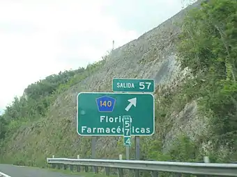
Puerto Rico Highway 22 provides access to PR-140, which leads to Florida from the cities of Mayagüez in the west, or San Juan in the north.
Like most other towns in the island, it has a public transportation system consisting of public cars.
There is only one bridge in Florida.[29]
Mayors of Florida
- 1974–1981 - Jorge Luis Pérez Piñeiro
- 1981–1984 - Heriberto González Vélez
- 1984–1992 - Juan Ramon De León Vélez [Johnny]
- 1992–2004 - Maria Dolores Guzmán Cardona [Maggie]
- 2004–2012 - José Aaron Pargas Ojeda
- 2012 – present - José Gerena Polanco
Notable Florideños
- Charlie Montoyo - Current Manager of the Toronto Blue Jays and former Major League Baseball player
- Alexis Mateo - Drag queen and contestant on Season 3 of RuPaul’s Drag Race.
- Danny A. Viera Carrero- Primer puertorriqueño como jefe de tripulación en el avión del Secretario de Defensa de los Estados Unidos 2008-2011 y Primer Crewchief y jefe de comunicaciones del jefe de Operaciones Navales de los Estados Unidos 2011–2015.
See also
- List of Puerto Ricans
- History of Puerto Rico
- Did you know-Puerto Rico?
References
- Bureau, US Census. "PUERTO RICO: 2020 Census". The United States Census Bureau. Retrieved August 25, 2021.
- Puerto Rico (1977). Acts and Resolutions of Puerto Rico. Equity de Puerto Rico. p. 822.
- "Florida Municipality". enciclopediapr.org. Fundación Puertorriqueña de las Humanidades (FPH). Archived from the original on August 28, 2019. Retrieved March 20, 2019.
- "Cueva Balcones Florida PR para CIAM". YouTube (in Spanish). CENTRO DE INVESTIGACIÓN AMBIENTAL JPL. Archived from the original on December 21, 2021. Retrieved July 19, 2020.
- Gwillim Law (May 20, 2015). Administrative Subdivisions of Countries: A Comprehensive World Reference, 1900 through 1998. McFarland. p. 300. ISBN 978-1-4766-0447-3. Retrieved December 25, 2018.
- Puerto Rico:2010:population and housing unit counts.pdf (PDF). U.S. Dept. of Commerce, Economics and Statistics Administration, U.S. Census Bureau. 2010. Archived (PDF) from the original on February 20, 2017. Retrieved January 11, 2019.
- "Map of Florida at the Wayback Machine" (PDF). Archived from the original (PDF) on March 24, 2018. Retrieved December 29, 2018.
- "US Census Barrio-Pueblo definition". factfinder.com. US Census. Archived from the original on May 13, 2017. Retrieved January 5, 2019.
- "PRECINTO ELECTORAL FLORIDA 024" (PDF). Comisión Estatal de Elecciones (in Spanish). PR Government. October 19, 2018. Retrieved June 21, 2019.
- Mari Mut, José A. (August 28, 2013). "Los pueblos de Puerto Rico y las iglesias de sus plazas" (in Spanish). Retrieved June 19, 2020 – via archive.org.
- "Agencia: Oficina del Coordinador General para el Financiamiento Socioeconómico y la Autogestión (Proposed 2016 Budget)". Puerto Rico Budgets (in Spanish). Retrieved June 28, 2019.
- Rivera Quintero, Marcia (2014), El vuelo de la esperanza : Proyecto de las Comunidades Especiales Puerto Rico, 1997-2004 (Primera edición ed.), San Juan, Puerto Rico Fundación Sila M. Calderón, ISBN 978-0-9820806-1-0
- "Leyes del 2001". Lex Juris Puerto Rico (in Spanish). Retrieved June 24, 2019.
- Rivera Quintero, Marcia (2014), El vuelo de la esperanza:Proyecto de las Comunidades Especiales Puerto Rico, 1997-2004 (Primera edición ed.), San Juan, Puerto Rico Fundación Sila M. Calderón, p. 273, ISBN 978-0-9820806-1-0
- Bomey, Nathan (September 22, 2017). "Hurricane Maria halts crucial drug manufacturing in Puerto Rico, may spur shortages". USA TODAY. Retrieved July 19, 2020.
- "Pharmaceutical industry: Eyes on Puerto Rico". El Nuevo Día. March 10, 2020. Retrieved July 19, 2020.
- "U.S. Decennial Census". United States Census Bureau. Archived from the original on February 13, 2020. Retrieved September 21, 2017.
- "Report of the Census of Porto Rico 1899". War Department Office Director Census of Porto Rico. Archived from the original on July 16, 2017. Retrieved September 21, 2017.
- "Table 3-Population of Municipalities: 1930 1920 and 1910" (PDF). United States Census Bureau. Archived (PDF) from the original on August 17, 2017. Retrieved September 21, 2017.
- "Table 4-Area and Population of Municipalities Urban and Rural: 1930 to 1950" (PDF). United States Census Bureau. Archived (PDF) from the original on August 30, 2015. Retrieved September 21, 2014.
- "Table 2 Population and Housing Units: 1960 to 2000" (PDF). United States Census Bureau. Archived (PDF) from the original on July 24, 2017. Retrieved September 21, 2017.
- Puerto Rico:2010:population and housing unit counts.pdf (PDF). U.S. Dept. of Commerce Economics and Statistics Administration U.S. Census Bureau. 2010. Archived (PDF) from the original on February 20, 2017. Retrieved December 25, 2018.
- Bureau, US Census. "PUERTO RICO: 2020 Census". The United States Census Bureau. Retrieved August 25, 2021.
- "Ethnicity 2000 census" (PDF). Archived (PDF) from the original on February 16, 2008. Retrieved April 2, 2009.
- Puerto Rico (1975). Acts of the Legislature of Puerto Rico. p. 544.
- Elecciones Generales 2008: Escrutinio General Archived 20 November 2011 at the Wayback Machine on CEEPUR
- "Ley Núm. 70 de 2006 -Ley para disponer la oficialidad de la bandera y el escudo de los setenta y ocho (78) municipios". LexJuris de Puerto Rico (in Spanish). Retrieved June 15, 2021.
- "FLORIDA". LexJuris (Leyes y Jurisprudencia) de Puerto Rico (in Spanish). February 19, 2020. Archived from the original on February 19, 2020. Retrieved September 17, 2020.
- "Florida Bridges". National Bridge Inventory Data. US Dept. of Transportation. Archived from the original on February 21, 2019. Retrieved February 20, 2019.
External links
- Municipality of Florida (in Spanish)
- Viability Study of Florida (in Spanish)
- Dr. Valentín's Historical Archives (in Spanish)
- "Florida". Salon Hogar.
- Welcome to Puerto Rico! Florida
Places adjacent to Florida, Puerto Rico | ||||||||||||||||
|---|---|---|---|---|---|---|---|---|---|---|---|---|---|---|---|---|
| ||||||||||||||||