Flers-sur-Noye
Flers-sur-Noye (French pronunciation: [flɛʁ syʁ nwa], literally Flers on Noye) is a commune in the Somme department in Hauts-de-France in northern France.
Flers-sur-Noye | |
|---|---|
_France_(4).JPG.webp) Church of Saint-Pierre | |
Location of Flers-sur-Noye 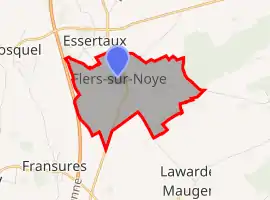 | |
 Flers-sur-Noye  Flers-sur-Noye | |
| Coordinates: 49°43′59″N 2°15′14″E | |
| Country | France |
| Region | Hauts-de-France |
| Department | Somme |
| Arrondissement | Montdidier |
| Canton | Ailly-sur-Noye |
| Intercommunality | CC Avre Luce Noye |
| Government | |
| • Mayor (2020–2026) | Joël Beaumont[1] |
| Area 1 | 4.65 km2 (1.80 sq mi) |
| Population | 508 |
| • Density | 110/km2 (280/sq mi) |
| Time zone | UTC+01:00 (CET) |
| • Summer (DST) | UTC+02:00 (CEST) |
| INSEE/Postal code | 80315 /80160 |
| Elevation | 113–159 m (371–522 ft) (avg. 147 m or 482 ft) |
| 1 French Land Register data, which excludes lakes, ponds, glaciers > 1 km2 (0.386 sq mi or 247 acres) and river estuaries. | |
Geography
The commune is situated on the N1 road, a mile from the junction with the A16 autoroute, on the banks of the river Noye, some 15 miles (24 km) south of Amiens.
Population
| Year | 1962 | 1968 | 1975 | 1982 | 1990 | 1999 | 2006 |
|---|---|---|---|---|---|---|---|
| Population | 210 | 223 | 220 | 247 | 299 | 342 | 372 |
| From the year 1962 on: No double counting—residents of multiple communes (e.g. students and military personnel) are counted only once. | |||||||
See also
References
- "Répertoire national des élus: les maires". data.gouv.fr, Plateforme ouverte des données publiques françaises (in French). 2 December 2020.
- "Populations légales 2019". The National Institute of Statistics and Economic Studies. 29 December 2021.
This article is issued from Wikipedia. The text is licensed under Creative Commons - Attribution - Sharealike. Additional terms may apply for the media files.