Driencourt
Driencourt (French pronunciation: [dʁijɛ̃kuʁ]) is a commune in the Somme department in Hauts-de-France in northern France.
Driencourt | |
|---|---|
.JPG.webp) The town hall and school in Driencourt | |
Location of Driencourt 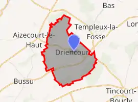 | |
 Driencourt  Driencourt | |
| Coordinates: 49°57′33″N 3°00′38″E | |
| Country | France |
| Region | Hauts-de-France |
| Department | Somme |
| Arrondissement | Péronne |
| Canton | Péronne |
| Intercommunality | Haute Somme |
| Government | |
| • Mayor (2020–2026) | Gaston Widiez[1] |
| Area 1 | 5 km2 (2 sq mi) |
| Population | 87 |
| • Density | 17/km2 (45/sq mi) |
| Time zone | UTC+01:00 (CET) |
| • Summer (DST) | UTC+02:00 (CEST) |
| INSEE/Postal code | 80258 /80240 |
| Elevation | 65–139 m (213–456 ft) (avg. 40 m or 130 ft) |
| 1 French Land Register data, which excludes lakes, ponds, glaciers > 1 km2 (0.386 sq mi or 247 acres) and river estuaries. | |
Geography
Driencourt is situated on the D181 road, some 15 miles (24 km) northwest of Saint-Quentin.
Population
| Year | 1962 | 1968 | 1975 | 1982 | 1990 | 1999 | 2006 |
|---|---|---|---|---|---|---|---|
| Population | 111 | 119 | 97 | 88 | 78 | 85 | 91 |
| From the year 1962 on: No double counting—residents of multiple communes (e.g. students and military personnel) are counted only once. | |||||||
History
As with many towns in this part of France, World War I saw the place reduced to rubble. A Parisian architect, Jacques Debat-Ponsan, was employed to design and reconstruct the town's public buildings.
- Reconstruction of the school and Mayor's office – accomplished in 1927
- Reconstruction of the church achieved in 1920
- Other reconstructions. A certain number of homes, judging by their style, were rebuilt by the same architect.
See also
References
- "Répertoire national des élus: les maires". data.gouv.fr, Plateforme ouverte des données publiques françaises (in French). 2 December 2020.
- "Populations légales 2019". The National Institute of Statistics and Economic Studies. 29 December 2021.
| Wikimedia Commons has media related to Driencourt. |
This article is issued from Wikipedia. The text is licensed under Creative Commons - Attribution - Sharealike. Additional terms may apply for the media files.