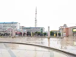
Dorbod Mongol Autonomous County
Dorbod Mongol Autonomous County (simplified Chinese: 杜尔伯特蒙古族自治县; traditional Chinese: 杜爾伯特蒙古族自治縣; pinyin: Dù'ěrbótè měnggǔzú Zìzhìxiàn; Mongolian: ᠳᠥᠷᠪᠡᠳ ᠮᠣᠩᠭᠣᠯ ᠥᠪᠡᠷᠲᠡᠭᠡᠨ ᠵᠠᠰᠠᠬᠤ ᠰᠢᠶᠠᠨ ) is a county in the west of Heilongjiang
Dorbod County | |
|---|---|
| 杜尔伯特蒙古族自治县 · ᠳᠥᠷᠪᠡᠳ ᠮᠣᠩᠭᠣᠯ ᠥᠪᠡᠷᠲᠡᠭᠡᠨ ᠵᠠᠰᠠᠬᠤ ᠰᠢᠶᠠᠨ Dorbod Mongol Autonomous County | |
 | |
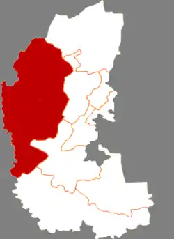 Dorbod in Daqing | |
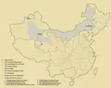
.png.webp) Daqing in Heilongjiang | |
| Coordinates: 46°51′46″N 124°26′33″E | |
| Country | People's Republic of China |
| Province | Heilongjiang |
| Prefecture-level city | Daqing |
| Area | |
| • Total | 6,427 km2 (2,481 sq mi) |
| Population (2010) | |
| • Total | 233,838 |
| • Density | 36/km2 (94/sq mi) |
| Time zone | UTC+8 (China Standard) |
province, China, bordering Jilin province to the southwest. It is under the jurisdiction of the prefecture-level city of Daqing. Formerly known as Dorbod Banner.
Administrative divisions
Dorbod Mongol Autonomous County is divided into 5 towns and 6 townships.[1]
- 5 towns
- Taikang (泰康镇), Hujitumo (胡吉吐莫镇), Yantongtun (烟筒屯镇), Talaha (他拉哈镇), Lianhuanhu (连环湖镇)
- 6 townships
- Yixin (一心乡), Ke'ertai (克尔台乡), Aolinxibo (敖林西伯乡), Bayanchagan (巴彦查干乡), Yaoxin (腰新乡), Jiangwan (江湾乡)
Demographics
The population of the county was 243,829 in 1999.[2]
It is named after the Dörbed Mongols.
References
- "国家统计局" (in Chinese). National Bureau of Statistics of the People's Republic of China. Retrieved 2021-12-07.
- (in English) National Population Statistics Materials by County and City - 1999 Period, in China County & City Population 1999, Harvard China Historical GIS
External links
- (in Chinese) Government site - Google translation
See also
| Regions |
|  | |||||||
|---|---|---|---|---|---|---|---|---|---|
| Prefectures and counties |
| ||||||||
| |||||||||
This article is issued from Wikipedia. The text is licensed under Creative Commons - Attribution - Sharealike. Additional terms may apply for the media files.