Dolní Dvořiště
Dolní Dvořiště (German: Unterhaid) is a municipality and village in Český Krumlov District in the South Bohemian Region of the Czech Republic. It has around 1,400 inhabitants. It lies on the border with Austria.
Dolní Dvořiště | |
|---|---|
 The square with Church of Saint Giles | |
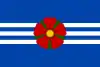 Flag 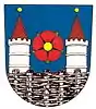 Coat of arms | |
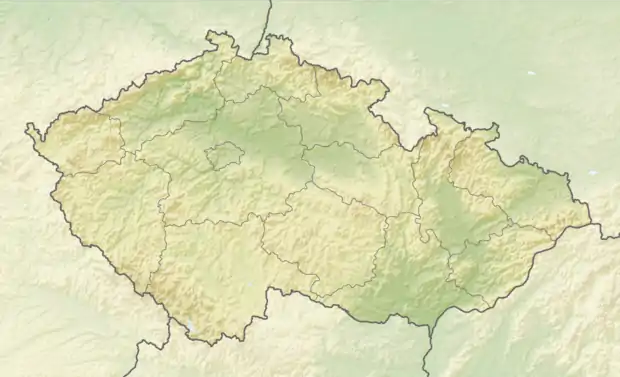 Dolní Dvořiště Location in the Czech Republic | |
| Coordinates: 48°39′23″N 14°27′8″E | |
| Country | |
| Region | South Bohemian |
| District | Český Krumlov |
| First mentioned | 1279 |
| Area | |
| • Total | 89.97 km2 (34.74 sq mi) |
| Elevation | 618 m (2,028 ft) |
| Population (2021-01-01)[1] | |
| • Total | 1,388 |
| • Density | 15/km2 (40/sq mi) |
| Time zone | UTC+1 (CET) |
| • Summer (DST) | UTC+2 (CEST) |
| Postal code | 382 72 |
| Website | www |
Administrative parts
Villages of Budákov, Jenín, Rybník, Rychnov nad Malší, Tichá, Trojany and Všeměřice are administrative parts of Dolní Dvořiště.
History
The first written mention of Dolní Dvořiště is from 1279.[2]
Transport
Dolní Dvořiště is situated at the road I/3, which is one of the most important links between the Czech Republic and Austria. The construction of the D3 motorway is planned, connecting the municipality with Prague and České Budějovice.
Gallery
 Dolní Dvořiště as seen from the west
 Statue of St. John of Nepomuk on the square
 Municipal office on the square
References
- "Population of Municipalities – 1 January 2021". Czech Statistical Office. 2021-04-30.
- "Z historie obce a okolí: Dolní Dvořiště" (in Czech). Obec Dolní Dvořiště. Retrieved 2021-09-03.
This article is issued from Wikipedia. The text is licensed under Creative Commons - Attribution - Sharealike. Additional terms may apply for the media files.