Dogiyai Regency
Dogiyai Regency is one of the regencies (kabupaten) in Papua Province of Indonesia. It covers an area of 7,052.92 km2 (revised from 4,237.4 km2), and had a population of 84,230 at the 2010 Census[2] and 116,206 at the 2020 Census,[3] comprising 60,682 males and 55,524 females. The administrative centre is the town of Kigamani.
Dogiyai Regency
Kabupaten Dogiyai | |
|---|---|
 Coat of arms | |
| Motto(s): Dogiyai Dou Enaa | |
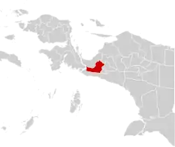 | |
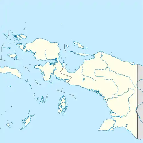 Dogiyai Regency Location in Western New Guinea and Indonesia  Dogiyai Regency Dogiyai Regency (Indonesia) | |
| Coordinates: 4.0319°S 135.4394°E | |
| Country | |
| Province | |
| Capital | Kigamani |
| Government | |
| • Regent | Yakobus Dumupa |
| • Vice Regent | Oskar Makai |
| Area | |
| • Total | 7,052.92 km2 (2,723.15 sq mi) |
| Population (2020 Census)[1] | |
| • Total | 116,206 |
| • Density | 16/km2 (43/sq mi) |
| Time zone | UTC+9 (Indonesia Eastern Time) |
| Area code | (+62) 971 |
| Website | dogiyaikab |
Administrative districts and villages
When formed in 2007, the new Dogiyai Regency comprised three districts (distrik) from within the southern part of the existing Nabire Regency,but these were subsequently reconstructed into the present ten districts. The Sukikai Selatan and Piyaiye Districts were formed from the former Sukikai District. The Mapia Barat, Mapia Tengah and Mapia Districts were formed from the former Mapia District. The Dogiyai, Kamu Selatan, Kamu, Kamu Timur and Kamu Utara Districts were formed from the former Kamu District.
The following is a table of the current districts (kecamatan) - and of the 79 villages by district - within the Dogiyai Regency, based on Statistics Indonesia,[4] with the district areas and their populations at the Censuses of 2010 and 2020. The villages named in bold below are the locations of the district administrative centres.
| yes. | District (distrik) |
Area in km2 |
Pop'n at Census 2021[5] |
Pop'n at Census 2020[6] |
Villages |
|---|---|---|---|---|---|
| 1 | Sukikai Selatan (South Sukikai) |
887.00 | 3,720 | 4,362 | Iyaro, Sukikai, Unito, Wigoumakida. |
| 2 | Piyaiye | 1,349.00 | 10,575 | 8,511 | Apogomakida, Deniyode, Egipa, Ideduwa, Kegata, Teipaugi, Ukagu, Yegiyepa. |
| 3 | Mapia Barat (West Mapia) |
760.00 | 4,557 | 3,553 | Abouyaga, Maikotu, Toubaikebo, Yegoukotu. |
| 4 | Mapia Tengah (Central Mapia) |
2014.50 | 10,124 | 11,012 | Adauwo, Bonakunu, Diyeugi, Gabaukuna, Megaikebo, Modio, Putapa, Timepa, Tuamani / Atou, Ukudawata / Upibega. |
| 5 | Mapia | 1,531.75 | 5,983 | 9,838 | Abaimaida, Abaugi / Obaikagopa, Bomomani, Dawaikunu, Gabaikunu, Gapoya, Magode. |
| 6 | Dogiyai (district) | 115.92 | 11,326 | 14,385 | Abgoigi / Dogimani, Bobobutu, Denemani, Egebutu, Idadagi, Kigamani, Makidimi, Motito, Pona. |
| 7 | Kamu Selatan (South Kamu) |
144.48 | 12,347 | 21,450 | Bogoya Teugi, Botumoma, Digikebo, Makidimi / Yepo, Matadi, Obaibega, Pouwouda, Puweta I, Puweta II, Tuwaida, Ugikagouda, Ugikebo. |
| 8 | Kamu | 77.60 | 11,400 | 16,491 | Bukapa, Ekemanida, Idakotu, Kimupugi, Mauwa, Moanemani / Ikebo, Putapa, Tokapo / Diyiyouwa. |
| 9 | Kamu Timur (East Kamu) |
80.00 | 5,978 | 10,561 | Boduda, Bokaibutu, Bunauwo, Deiyapa, Nuwa, Ugapuga, Yotapuga. |
| 10 | Kamu Utara (North Kamu) |
92.67 | 8,220 | 16,043 | Duntek, Ekimani, Idakebo, Ikrar, Kuyakago, Mogou, Obayo, Pugatadi I, Pugatadi II, Yametadi. |
References
- Badan Pusat Statistik, Jakarta, 2021.
- Biro Pusat Statistik, Jakarta, 2011.
- Badan Pusat Statistik, Jakarta, 2021.
- "Archived copy". Archived from the original on 2014-02-09. Retrieved 2014-02-04.
{{cite web}}: CS1 maint: archived copy as title (link) - Biro Pusat Statistik, Jakarta, 2021.
- Badan Pusat Statistik, Jakarta, 2021.