Depauw, Indiana
Depauw is an unincorporated community in Blue River Township and Spencer Township, Harrison County, Indiana. Marengo Cave in Marengo, IN is only a 7-mile (11 km) drive from Depauw. To the North of Depauw is Fredericksburg, IN, to the east is Ramsey, IN, to the south is Frenchtown, IN, and to the west is Miltown, IN. Depauw is home Gurtz Auto Salvage — the largest junkyard in Harrison County, Indiana. As many as 2,000 cars have been scrapped in Gurtz Auto Salvage in the past. Depauw also has Hillview Farm, Satterfeild's Old Fashioned Grocery, United States Postal Service, and 3D Valley Farm Store. The population of Depauw is unknown because Depauw did not take part in any recent U.S. Census therefore the population has to be estimated. The approximate population of Depauw for 2020 is 120 and it is slowly decreasing.
Depauw, Indiana | |
|---|---|
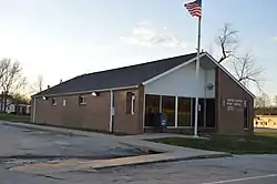 Post Office | |
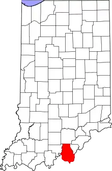 Harrison County's Location In Indiana | |
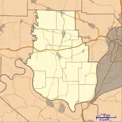 Depauw Depauw's Location In Harrison County | |
| Coordinates: 38°20′06.6″N 86°13′03.10″W | |
| Country | United States |
| State | Indiana |
| County | Harrison |
| Township | Blue River, Spencer |
| Area | |
| • Total | 1.58 sq mi (4.10 km2) |
| Elevation | 653.96 ft (199.33 m) |
| Population | |
| • Estimate (2020) | 120 |
| Time zone | UTC-4:00 (EDT) |
| ZIP code | 47115 |
| FIPS code | 18-17794[1] |
| GNIS feature ID | 433484[2] |
History
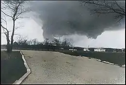
Depauw was platted by Felician Henriott on April 8, 1884.[3] According to one source, the community may be named for Washington C. DePauw.[4] Violent tornadoes were recorded include one on April 3, 1903, two on April 3, 1974, one on April 5, 1985, and one on June 2, 1990. On April 3, 1974, at around 3:20 PM, an F5 tornado hit Depauw, leaving some of the mobile homes and houses completely demolished. This tornado had formed near New Boston, IN. It kept heading east passing just west of Frenchtown, IN and then the tornado hit Depauw. Many of the Depauw locals who didn't have a basement quickly rushed to people's homes that did have one. The tornado went through Depauw and then it headed northeast towards Palmyra, IN after Depauw. The tornado killed 6 people and injured 76 people in the 68 miles (110 km) it was on the ground. The Depauw tornado was 1.6 miles (2.5 km) wide and was the first of many other F5 tornadoes that were to form on that same day in the midwest. The series of tornadoes that occurred on that day was part of what was known as the 1974 Super Outbreak.
References
- "U.S. Census website". United States Census Bureau. Retrieved 2008-01-31.
- "Depauw, Indiana". Geographic Names Information System. United States Geological Survey. Retrieved 2009-10-10.
- Roose, William H. (1911). Indiana's Birthplace: A History of Harrison County, Indiana. Tribune Company, Printers. p. 71.
- Baker, Ronald L. (October 1995). From Needmore to Prosperity: Hoosier Place Names in Folklore and History. Indiana University Press. p. 113. ISBN 978-0-253-32866-3.
...perhaps for industrialist Washington C. DePauw ...
Municipalities and communities of Harrison County, Indiana, United States | ||
|---|---|---|
| Towns | Map of Indiana highlighting Harrison County | |
| Townships | ||
| CDP | ||
| Other unincorporated communities |
| |
| Ghost town | ||
| Footnotes | ‡This populated place also has portions in an adjacent county or counties | |
| ||
5. https://www.weather.gov/lmk/tornado_climatology_harrisonin