Curel, Alpes-de-Haute-Provence
Curel (French pronunciation: [kyʁɛl]; Occitan: Curèu) is a commune in the Alpes-de-Haute-Provence department in southeastern France.
Curel | |
|---|---|
%252C_%C3%A9glise_neuve_Saint-Martin.jpg.webp) The church of Saint-Martin, in Curel | |
 Coat of arms | |
Location of Curel 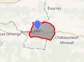 | |
 Curel 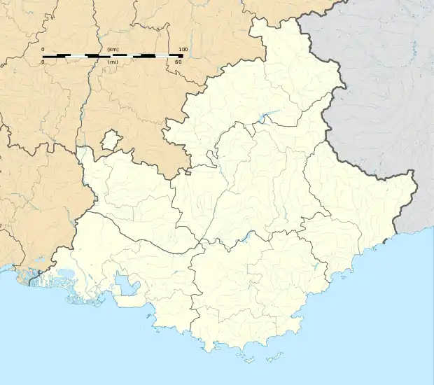 Curel | |
| Coordinates: 44°10′40″N 5°39′45″E | |
| Country | France |
| Region | Provence-Alpes-Côte d'Azur |
| Department | Alpes-de-Haute-Provence |
| Arrondissement | Forcalquier |
| Canton | Sisteron |
| Intercommunality | Jabron Lure Vançon Durance |
| Government | |
| • Mayor (2020–2026) | Thierry Bellemain |
| Area 1 | 10.45 km2 (4.03 sq mi) |
| Population | 52 |
| • Density | 5.0/km2 (13/sq mi) |
| Time zone | UTC+01:00 (CET) |
| • Summer (DST) | UTC+02:00 (CEST) |
| INSEE/Postal code | 04067 /04200 |
| Elevation | 670–1,440 m (2,200–4,720 ft) (avg. 696 m or 2,283 ft) |
| 1 French Land Register data, which excludes lakes, ponds, glaciers > 1 km2 (0.386 sq mi or 247 acres) and river estuaries. | |
Population
|
|
References
- "Populations légales 2019". The National Institute of Statistics and Economic Studies. 29 December 2021.
| Wikimedia Commons has media related to Curel, Alpes-de-Haute-Provence. |
This article is issued from Wikipedia. The text is licensed under Creative Commons - Attribution - Sharealike. Additional terms may apply for the media files.