Cowichan Valley Regional District
The Cowichan Valley Regional District is a regional district in the Canadian province of British Columbia is on the southern part of Vancouver Island,[3] bordered by the Nanaimo and Alberni-Clayoquot Regional Districts to the north and northwest, and by the Capital Regional District to the south and east. As of the 2021 Census, the Regional District had a population of 89,013. The regional district offices are in Duncan.
Cowichan Valley | |
|---|---|
| Cowichan Valley Regional District | |
 | |
|
Logo | |
 Location in British Columbia | |
| Country | Canada |
| Province | British Columbia |
| Administrative office location | Duncan |
| Government | |
| • Type | Regional district |
| • Body | Board of directors |
| • Chair | Ian Morrison (F) |
| • Vice chair | Sierra Acton (B) |
| • Electoral areas |
|
| Area | |
| • Land | 3,474.52 km2 (1,341.52 sq mi) |
| Population (2021)[2] | |
| • Total | 89,013 |
| • Density | 25.6/km2 (66/sq mi) |
| Website | cvrd.bc.ca |
Geography
The Cowichan Valley Regional District covers an area between the Stuart Channel and Saanich Inlet on the east coast of Vancouver Island and the southern part of the West Coast Trail, with Cowichan Lake and Cowichan Valley proper located in its central region. It includes the Gulf Islands of Thetis, Kuper and Valdes. The total land area is 3,473.12 km² (1,340.98 sq mi).
Demographics
As a census division in the 2021 Census of Population conducted by Statistics Canada, the Cowichan Valley Regional District had a population of 89,013 living in 37,290 of its 40,174 total private dwellings, a change of 6.3% from its 2016 population of 83,739. With a land area of 3,472.48 km2 (1,340.73 sq mi), it had a population density of 25.6/km2 (66.4/sq mi) in 2021.[4]
Communities
Incorporated communities
- City of Duncan - Pop 5,047
- Town of Ladysmith - Pop 8,990
- Town of Lake Cowichan - Pop 3,325
- District Municipality of North Cowichan - Pop 31,990
Indigenous Reserves
- Chemainus 13
- Claoose 4
- Cowichan 1
- Cowichan 9
- Cowichan Lake
- Est-Patrolas 4
- Halalt 2
- Kil-pah-las 3
- Kuper Island 7
- Lyacksun 3
- Malachan 11
- Malahat 11
- Oyster Bay 12
- Portier Pass 5
- Shingle Point 4
- Squaw-hay-one 11
- Theik 2
- Tsussie 6
- Wyah 3
E
- Cowichan Station
- Eagle Heights
- Glenora
- Koksilah
- Sahtlam
F
- Honeymoon Bay
- Mesachie Lake
- Skutz Falls
G
H
- Diamond
- North Oyster
- Yellow Point
I
- Meade Creek
- Youbou
References
- "Board of Directors". Retrieved July 9, 2019.
- "Cowichan Valley Regional District". BC Geographical Names.
- "Population and dwelling counts: Canada and census divisions". Statistics Canada. February 9, 2022. Retrieved April 3, 2022.
External links
| Wikimedia Commons has media related to Cowichan Valley Regional District. |
Places adjacent to Cowichan Valley Regional District | ||||||||||||||||
|---|---|---|---|---|---|---|---|---|---|---|---|---|---|---|---|---|
| ||||||||||||||||
Subdivisions of British Columbia | ||
|---|---|---|
| Subdivisions | 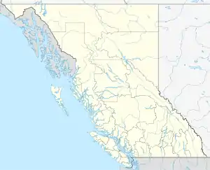 | |
| Communities | ||
| Metro areas and agglomerations | ||
| Regional districts |
| |
| ||