Chevry, Ain
Chevry is a commune in the Ain department in eastern France, located only twenty minutes from the Swiss border near Geneva. Chevry's inhabitants are called Chevrysiens.
Chevry | |
|---|---|
_-_Mairie.JPG.webp) Town hall | |
.svg.png.webp) Coat of arms | |
Location of Chevry 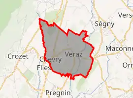 | |
 Chevry 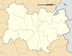 Chevry | |
| Coordinates: 46°16′51″N 6°02′13″E | |
| Country | France |
| Region | Auvergne-Rhône-Alpes |
| Department | Ain |
| Arrondissement | Gex |
| Canton | Thoiry |
| Intercommunality | Pays de Gex Agglo |
| Government | |
| • Mayor (2020–2026) | David Munier[1] |
| Area 1 | 5.84 km2 (2.25 sq mi) |
| Population | 2,149 |
| • Density | 370/km2 (950/sq mi) |
| Time zone | UTC+01:00 (CET) |
| • Summer (DST) | UTC+02:00 (CEST) |
| INSEE/Postal code | 01103 /01170 |
| Elevation | 457–580 m (1,499–1,903 ft) (avg. 490 m or 1,610 ft) |
| 1 French Land Register data, which excludes lakes, ponds, glaciers > 1 km2 (0.386 sq mi or 247 acres) and river estuaries. | |
Chevry is located between Gex and Saint-Genis-Pouilly, on the departmental highway RD984, which is the primary access to the town. The commune also includes the villages of Veraz (to the east) and Naz-Dessous (to the north).
The town has several rivers: the Great Journans, Petit Journans, the Allondon and Janvoin.
In its administrative plans, Chevry is closely related to the town of Gex, the department of Ain and the region of Auvergne-Rhone-Alpes.[3]
Population
| Year | Pop. | ±% |
|---|---|---|
| 2004 | 1,065 | — |
| 2006 | 1,118 | +5.0% |
| 2007 | 1,151 | +3.0% |
| 2008 | 1,184 | +2.9% |
| 2009 | 1,217 | +2.8% |
| 2010 | 1,235 | +1.5% |
| 2011 | 1,269 | +2.8% |
| 2012 | 1,333 | +5.0% |
| 2013 | 1,396 | +4.7% |
| 2014 | 1,459 | +4.5% |
| 2015 | 1,525 | +4.5% |
| 2016 | 1,643 | +7.7% |
See also
References
- "Répertoire national des élus: les maires". data.gouv.fr, Plateforme ouverte des données publiques françaises (in French). 9 August 2021.
- "Populations légales 2019". The National Institute of Statistics and Economic Studies. 29 December 2021.
- region of Auvergne-Rhone-Alpes
| Wikimedia Commons has media related to Chevry, Ain. |
This article is issued from Wikipedia. The text is licensed under Creative Commons - Attribution - Sharealike. Additional terms may apply for the media files.