Chester Center, Connecticut
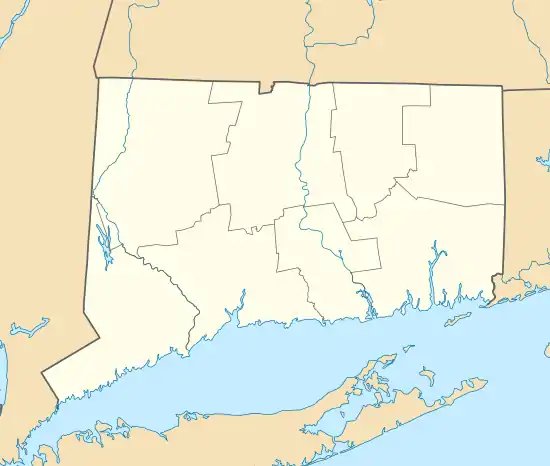
Chester Center is a census-designated place (CDP) comprising the primary village in the town of Chester, Middlesex County, Connecticut, United States. It is in the southeast corner of the town, bordered to the south by the town of Deep River and to the southwest largely by the Connecticut Route 9 freeway. As of the 2010 census, Chester Center had a population of 1,558,[3] out of 3,994 in the entire town of Chester.
Chester Center, Connecticut | |
|---|---|
 Chester Center  Chester Center | |
| Coordinates: 41°24′10″N 72°27′3″W | |
| Country | |
| State | Connecticut |
| County | Middlesex |
| Town | Chester |
| Area | |
| • Total | 7.00 km2 (2.70 sq mi) |
| • Land | 6.93 km2 (2.68 sq mi) |
| • Water | 0.07 km2 (0.03 sq mi) |
| Elevation | 6 m (20 ft) |
| Population | |
| • Total | 1,558 |
| • Density | 224.8/km2 (582/sq mi) |
| Time zone | UTC-5 (Eastern (EST)) |
| • Summer (DST) | UTC-4 (EDT) |
| ZIP Code | 06412 (Chester) |
| Area code(s) | 860/959 |
| FIPS code | 09-14370 |
| GNIS feature ID | 2378346[2] |
References
- "2020 U.S. Gazetteer Files – Connecticut". United States Census Bureau. Retrieved April 14, 2021.
- "Chester Center Census Designated Place". Geographic Names Information System. United States Geological Survey.
- "Total Population: 2010 Census DEC Summary File 1 (P1), Chester Center CDP, Connecticut". data.census.gov. U.S. Census Bureau. Retrieved April 13, 2021.
Municipalities and communities of Middlesex County, Connecticut, United States | ||
|---|---|---|
| City | 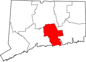 | |
| Towns | ||
| Borough | ||
| CDPs | ||
| Other communities | ||
| ||
This article is issued from Wikipedia. The text is licensed under Creative Commons - Attribution - Sharealike. Additional terms may apply for the media files.