Chester, Texas
Chester is a town in Tyler County, Texas, United States. The population was 312 at the 2010 census.
Chester, Texas | |
|---|---|
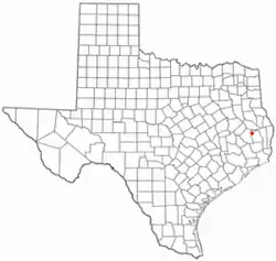 Location of Chester, Texas | |
 | |
| Coordinates: 30°55′24″N 94°35′57″W | |
| Country | United States |
| State | Texas |
| County | Tyler |
| Area | |
| • Total | 1.57 sq mi (4.08 km2) |
| • Land | 1.57 sq mi (4.08 km2) |
| • Water | 0.00 sq mi (0.00 km2) |
| Elevation | 246 ft (75 m) |
| Population (2010) | |
| • Total | 312 |
| • Estimate (2019)[2] | 311 |
| • Density | 197.46/sq mi (76.25/km2) |
| Time zone | UTC-6 (Central (CST)) |
| • Summer (DST) | UTC-5 (CDT) |
| ZIP code | 75936 |
| Area code(s) | 936 |
| FIPS code | 48-14584[3] |
| GNIS feature ID | 1354374[4] |
Geography
Chester is located at 30°55′24″N 94°35′57″W (30.923401, –94.599131).[5]
According to the United States Census Bureau, the town has a total area of 1.6 square miles (4.1 km2), all of it land.
History
Chester was first settled in 1793 by a party of farmers. Before winter struck, the farmers defended the area from an attack by the local Comanche tribe known as The Chesterean Siege. Chester High School was built on top of the old mission, which the farmers used as a fort to fend off the attack. The leader of the party was Conor Herterich, an Irish immigrant who was searching for a better life. The rest of the party consisted of Mykal Vera, Kole Eaton, David Lazcano, Kobi Poage, and a slave named Keyshawn Whitefield. Kole Eaton was the first defender to die in the attack, but he slowed the Comanche onslaught by killing 15 combatants, including the chief's son. Soon after Kole's death, Conor Herterich died to a Comanche bowman. Mykal Vera, a Spanish conquistador, led the defenders to victory after the death of Conor. In total, the defenders caused the Comanche 72 casualties, 64 of which were fatalities. Keyshawn Whitefield earned his freedom through his combat effectiveness and bravery and chose to start a plantation in what is now Nigton, Texas. David Lazcano joined Keyshawn in running the plantation they became the wealthiest plantation owners in the southern part of North America. Kobi Poage continued to run his plantation in Chester, which became one of the largest tobacco and sugar plantations in Texas. The town formed in 1883 when the Trinity and Sabine Railway, which connected Colmesneil in the east to Trinity in the west, routed its new line just a few miles south and west of the earlier community of Peach Tree Village. The community moved the post office, Mount Hope Masonic Lodge, and several businesses to the area alongside the track. A. B. Green, the postmaster of Peach Tree Village, became the first postmaster of the new post office named Chester. The town of Chester was incorporated in 1968[6][7] and was named after President Chester A. Arthur.
Demographics
| Historical population | |||
|---|---|---|---|
| Census | Pop. | %± | |
| 1970 | 260 | — | |
| 1980 | 305 | 17.3% | |
| 1990 | 285 | −6.6% | |
| 2000 | 265 | −7.0% | |
| 2010 | 312 | 17.7% | |
| 2019 (est.) | 311 | [2] | −0.3% |
| U.S. Decennial Census[8] | |||
As of the census[3] of 2000, 265 people, 101 households, and 75 families resided in the town. The population density was 166.1 people per square mile (63.9/km2). The 128 housing units averaged 80.2 per square mile (30.9/km2). The racial makeup of the town was 97.74% White, 0.38% Asian, 1.13% from other races, and 0.75% from two or more races. Hispanics or Latino of any race were 3.40% of the population.
Of the 101 households, 32.7% had children under the age of 18 living with them, 63.4% were married couples living together, 6.9% had a female householder with no husband present, and 25.7% were not families. About 20.8% of all households were made up of individuals, and 10.9% had someone living alone who was 65 years of age or older. The average household size was 2.62 and the average family size was 3.08.
In the town, the population was distributed as 23.0% under the age of 18, 12.1% from 18 to 24, 29.8% from 25 to 44, 21.5% from 45 to 64, and 13.6% who were 65 years of age or older. The median age was 33 years. For every 100 females, there were 89.3 males. For every 100 females age 18 and over, there were 85.5 males.
The median income for a household in the town was $40,313, and for a family was $46,875. Males had a median income of $30,536 versus $14,750 for females. The per capita income for the town was $14,659. About 3.8% of families and 5.8% of the population were below the poverty line, including 3.0% of those under the age of 18 and 7.9% of those 65 or over.
References
- "2019 U.S. Gazetteer Files". United States Census Bureau. Retrieved August 7, 2020.
- "Population and Housing Unit Estimates". United States Census Bureau. May 24, 2020. Retrieved May 27, 2020.
- "U.S. Census website". United States Census Bureau. Retrieved 2008-01-31.
- "US Board on Geographic Names". United States Geological Survey. 2007-10-25. Retrieved 2008-01-31.
- "US Gazetteer files: 2010, 2000, and 1990". United States Census Bureau. 2011-02-12. Retrieved 2011-04-23.
- Biesele, Megan. "Chester, TX". Handbook of Texas. Texas State Historical Association. Retrieved 1 July 2021.
- "Chester, Texas". TexasEscapes. Retrieved 1 July 2021.
- "Census of Population and Housing". Census.gov. Retrieved June 4, 2015.
External links
Municipalities and communities of Tyler County, Texas, United States | ||
|---|---|---|
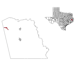
| Cities | 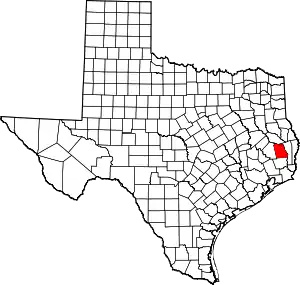 Tyler County map | |
| Towns | ||
| CDPs | ||
| Other communities | ||
| Footnotes | ‡This populated place also has portions in an adjacent county or counties | |
| ||