Charlottsville, Pennsylvania
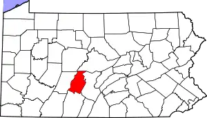
Charlottsville is an unincorporated community and census-designated place (CDP) in Blair County, Pennsylvania, United States. It was first listed as a CDP prior to the 2020 census.[2]
Charlottsville, Pennsylvania | |
|---|---|
 Charlottsville  Charlottsville | |
| Coordinates: 40°38′44″N 78°16′34″W | |
| Country | United States |
| State | Pennsylvania |
| County | Blair |
| Townships | Antis, Snyder |
| Area | |
| • Total | 0.07 sq mi (0.19 km2) |
| • Land | 0.07 sq mi (0.19 km2) |
| • Water | 0.0 sq mi (0.0 km2) |
| Elevation | 960 ft (290 m) |
| Time zone | UTC-5 (Eastern (EST)) |
| • Summer (DST) | UTC-4 (EDT) |
| ZIP Code | 16686 (Tyrone) |
| Area code(s) | 814/582 |
| FIPS code | 42-12768 |
| GNIS feature ID | 2805474[2] |
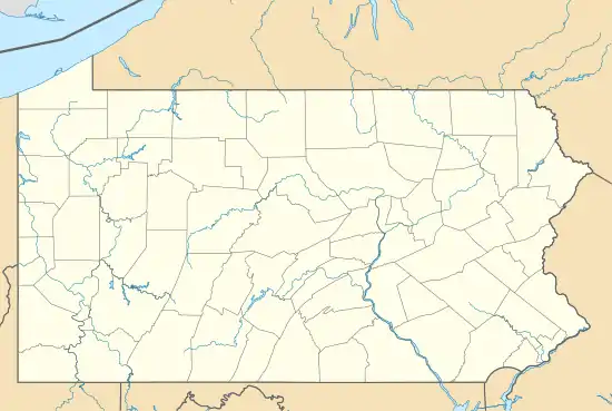
The CDP is in northern Blair County, mostly in the east part of Antis Township but extending northeast into the south part of Snyder Township. North Pleasant Valley Boulevard (old U.S. Route 220) forms the southeast edge of the CDP, and the Pittsburgh Line of the Norfolk Southern Railway forms the northwest edge. Interstate 99 passes southeast of the community, with access from Exit 45 at Pleasant Valley Boulevard. Tyrone is 3 miles (5 km) to the northeast, and Altoona is 11 miles (18 km) to the southwest.
Charlottsville is on the northwest side of the valley of the Little Juniata River, which flows east to join the Juniata River near Petersburg.
References
- "2020 U.S. Gazetteer Files – Pennsylvania". United States Census Bureau. Retrieved August 19, 2021.
- "Charlottsville Census Designated Place". Geographic Names Information System. United States Geological Survey.