Châtillon-la-Palud
Châtillon-la-Palud (French pronunciation: [ʃatijɔ̃ la paly]) is a commune in the Ain department in eastern France.
Châtillon-la-Palud | |
|---|---|
Commune | |
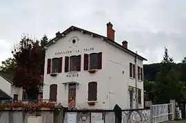 Town hall | |
.svg.png.webp) Coat of arms | |
Location of Châtillon-la-Palud 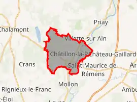 | |
 Châtillon-la-Palud 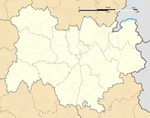 Châtillon-la-Palud | |
| Coordinates: 45°58′37″N 5°14′59″E | |
| Country | France |
| Region | Auvergne-Rhône-Alpes |
| Department | Ain |
| Arrondissement | Bourg-en-Bresse |
| Canton | Ceyzériat |
| Intercommunality | Dombes |
| Government | |
| • Mayor (2020–2026) | Gilles Dubois[1] |
| Area 1 | 14.01 km2 (5.41 sq mi) |
| Population | 1,604 |
| • Density | 110/km2 (300/sq mi) |
| Time zone | UTC+01:00 (CET) |
| • Summer (DST) | UTC+02:00 (CEST) |
| INSEE/Postal code | 01092 /01320 |
| Elevation | 218–326 m (715–1,070 ft) |
| 1 French Land Register data, which excludes lakes, ponds, glaciers > 1 km2 (0.386 sq mi or 247 acres) and river estuaries. | |
Geography
The commune is located in the Dombes. It lies on the right bank of the Ain, which flows south through the commune's eastern part. The Albarine flows into the Ain in the southeastern part of the commune.
Population
| Year | Pop. | ±% |
|---|---|---|
| 2004 | 1,336 | — |
| 2006 | 1,395 | +4.4% |
| 2007 | 1,446 | +3.7% |
| 2008 | 1,496 | +3.5% |
| 2009 | 1,546 | +3.3% |
| 2010 | 1,562 | +1.0% |
| 2011 | 1,583 | +1.3% |
| 2012 | 1,578 | −0.3% |
| 2013 | 1,573 | −0.3% |
| 2014 | 1,568 | −0.3% |
| 2015 | 1,566 | −0.1% |
| 2016 | 1,574 | +0.5% |
See also
References
- "Répertoire national des élus: les maires". data.gouv.fr, Plateforme ouverte des données publiques françaises (in French). 9 August 2021.
- "Populations légales 2019". The National Institute of Statistics and Economic Studies. 29 December 2021.
External links
| Wikimedia Commons has media related to Châtillon-la-Palud. |
This article is issued from Wikipedia. The text is licensed under Creative Commons - Attribution - Sharealike. Additional terms may apply for the media files.