Château-l'Abbaye
Château-l'Abbaye (French pronunciation: [ʃɑto labe.i]) is a commune of the Nord department in northern France.
Château-l'Abbaye | |
|---|---|
_mairie.JPG.webp) The town hall in Château-l'Abbaye | |
_Nord-France.svg.png.webp) Coat of arms | |
Location of Château-l'Abbaye 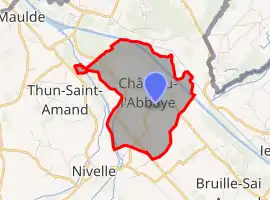 | |
 Château-l'Abbaye  Château-l'Abbaye | |
| Coordinates: 50°29′05″N 3°28′48″E | |
| Country | France |
| Region | Hauts-de-France |
| Department | Nord |
| Arrondissement | Valenciennes |
| Canton | Saint-Amand-les-Eaux |
| Intercommunality | CA Porte du Hainaut |
| Government | |
| • Mayor (2020–2026) | Waldemar Domin[1] |
| Area 1 | 4.41 km2 (1.70 sq mi) |
| Population | 862 |
| • Density | 200/km2 (510/sq mi) |
| Time zone | UTC+01:00 (CET) |
| • Summer (DST) | UTC+02:00 (CEST) |
| INSEE/Postal code | 59144 /59230 |
| Elevation | 13–28 m (43–92 ft) (avg. 30 m or 98 ft) |
| 1 French Land Register data, which excludes lakes, ponds, glaciers > 1 km2 (0.386 sq mi or 247 acres) and river estuaries. | |
Heraldry
Arms of Château-l'Abbaye |
The arms of Château-l'Abbaye are blazoned : Gules, a left hand issuant from dexter, vested Or, maintaining a rose Or, slipped and leaved vert.
|
See also
References
- "Répertoire national des élus: les maires". data.gouv.fr, Plateforme ouverte des données publiques françaises (in French). 2 December 2020.
- "Populations légales 2019". The National Institute of Statistics and Economic Studies. 29 December 2021.
| Wikimedia Commons has media related to Château-l'Abbaye. |
This article is issued from Wikipedia. The text is licensed under Creative Commons - Attribution - Sharealike. Additional terms may apply for the media files.