Carpenter's Station, Louisiana
Carpenter's Station, Louisiana, is an unincorporated historical community centered around a 19th century railroad stop in Richland Parish, Louisiana.[1][2][3]
Carpenter's Station, Louisiana | |
|---|---|
 Carpenter's Station, Louisiana  Carpenter's Station, Louisiana | |
| Coordinates: 32°27′46″N 91°34′05″W | |
| Country | United States |
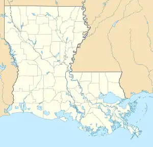
| State | Louisiana |
| Parish | Richland Parish |
| Elevation | 86.392 ft (26.332 m) |
| Time zone | UTC-6 (Central (CST)) |
| • Summer (DST) | UTC-5 (CDT) |
The 1875 Cram's Rail Road & Township Map of Louisiana and the 1879 Rand, McNally & Co.'s Business Atlas Map of Louisiana show the location as "Carpenter's" and "Carpenters" (respectively) between Bee Bayou and Delhi, Louisiana, east of modern-day Rayville in northeastern Richland Parish.[4][5][6] The 1897 Rand, McNally & Co.'s New Business Atlas Map of Louisiana places "Carpenters" between Callaway and Delhi.[7]
The railroad serving the community in 1879 was the Louisiana & Texas R. R.[5] and in 1897 the Shreveport & Pacific R. R.[7]
References
- Samuel H. Lockett and Lauren C. Post (Ed.): Louisiana As It Is: A Geographical and Topographical Description of the State, Louisiana State University Press, Baton Rouge, La., 1969, p. 87, https://books.google.com/books?id=vEQeiw8nT7UC, last accessed February 25, 2018: "a belt of pine wood lands extends almost without interruption from Carpenter's Station southward to Boeuf Prairie in the extreme southern part of Franklin."
- Col. Samuel H. Lockett: Fourth Annual Report of the Topographical Survey of Louisiana, December 31, 1872, Documents of the State of Louisiana, The Democrat, New Orleans, La., 1878, https://books.google.com/books?id=h3El4IlPxYIC, p. 141, last accessed February 25, 2018.
- A. C. Veatch: Geology and Underground Water Resources of Northern Louisiana and Southern Arkansas, Professional Paper No. 46, Department of the Interior, United States Geological Survey, U.S. Government Printing Office, Washington, D.C., 1906, p. 378, https://books.google.com/books?id=bGznAAAAMAAJ, last accessed 22 Nov 2018: "Richland Parish | Location: Carpenter's station; pipestone bench in yard of cabin opposite railroad platform. | Authority: U.S.E. (United States Engineers) | Class: P (Precise) | Elevation: 86.392."
- Cram's Rail Road & Township Map of Louisiana, published by George F. Cram, Proprietor of the Western Map Depot, 66 Lake St., Chicago, Ills., 1875, in the David Rumsey Historical Map Collection, List No. 5370.022, http://www.oldmapsonline.org/map/rumsey/5370.022, last accessed 22 Nov 2018.
- Rand, McNally & Co.'s Louisiana, Rand, McNally & Co., Printers, Engravers and Publishers, Chicago, 1878-9, in the David Rumsey Historical Map Collection, List No. 4520.037, http://www.oldmapsonline.org/map/rumsey/4520.037, last accessed 22 Nov 2018.
- R. B. Marshall, Chief Geographer: Spirit Leveling in Louisiana, 1903 to 1915, Inclusive, United States Geological Survey Bulletin 634, Washington, D.C.: Government Printing Office, 1916, https://pubs.usgs.gov/bul/0634/report.pdf, p. 35, retrieved March 11, 2018: BASKINTON QUADRANGLE. [Latitude 32° 15'-32° 30'; longitude 91° 30'-91° 45'.] From Carpenter west along railroad to Rayville. Carpenter station, in southeast corner of yard of cabin standing opposite railroad platform, 15.4 meters north of center of track and 23.8 meters southeast of southeast corner of cabin: Bolt in stone under ground (U.S.C.E. p. b. m. 14)...86.752 Top of cap on iron post...90.820.
- Rand, McNally & Co.'s New Business Atlas Map of Louisiana, Rand, McNally & Co., Chicago, 1897, in the David Rumsey Historical Map Collection, List No. 3565.098, http://www.oldmapsonline.org/map/rumsey/3565.098, last accessed 22 Nov 2018.
This article is issued from Wikipedia. The text is licensed under Creative Commons - Attribution - Sharealike. Additional terms may apply for the media files.