Carmacks, Yukon
Carmacks is a village in Yukon, Canada, on the Yukon River along the Klondike Highway, and at the west end of the Robert Campbell Highway from Watson Lake. The population is 493 (Canada Census, 2016). It is the home of the Little Salmon/Carmacks First Nation, a Northern Tutchone-speaking people.
Carmacks | |
|---|---|
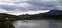 Carmacks is seen from the Yukon River bridge with the river in the foreground. | |
 Carmacks 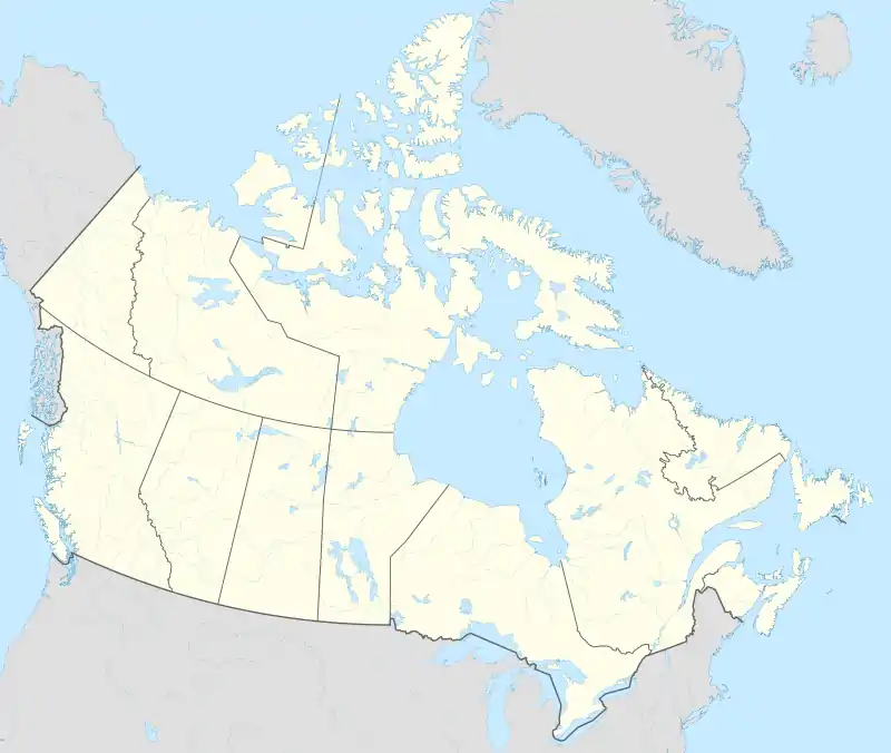 Carmacks | |
| Coordinates: 62°05′20″N 136°17′20″W | |
| Country | Canada |
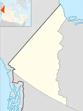
| Territory | Yukon |
| Area | |
| • Land | 36.95 km2 (14.27 sq mi) |
| Population (2016) | |
| • Total | 493 |
| • Density | 13.3/km2 (34/sq mi) |
| • Change 2011-16 | |
| Time zone | UTC−07:00 (MST) |
| Climate | Dsc |
| Website | Official website |
History
The name of the settlement comes from George Carmack who, in 1891, found coal nearby. He created a trading post and began by engaging in commerce with local people, before opening a coal mine in the south bank of the Yukon River. The focus of his entrepreneurial energy switched a few years later when he or his wife, Kate Carmack, discovered gold, at what was to become the Discovery Claim, near Dawson City.
The community consists of the Village of Carmacks and the Little Salmon/Carmacks First Nation and was named after George Washington Carmack, who found coal near Tantalus Butte (locally called Coal Mine Hill) in 1893. Carmack built a trading post and traded with locals near the present site of Carmacks and also started a coal mine on the south bank of the Yukon River. Carmack soon discovered gold in the Dawson region with his wife, Kate Carmack, her brother, Keish (Skookum Jim), and Dawson Charlie (Tagish Charlie) a few years later, starting the Klondike Gold Rush. Carmacks became incorporated as a village on November 1, 1984.
Geography
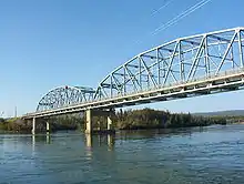
Carmacks is situated at the confluence of the Nordenskiold and Yukon rivers, approximately 180 km (110 mi) north of Whitehorse and 360 km (220 mi) south of Dawson City on the North Klondike Highway. It is the site of one of the four bridges over the Yukon River. The Campbell Highway also intersects the community and carries on to Faro, Ross River and Watson Lake, providing a gateway to the Canol Road and some of Yukon's most spectacular scenery.
Climate
Carmacks has a subarctic climate (Dfc) with short but mild summers and long, severely cold winters.
| Climate data for Carmacks | |||||||||||||
|---|---|---|---|---|---|---|---|---|---|---|---|---|---|
| Month | Jan | Feb | Mar | Apr | May | Jun | Jul | Aug | Sep | Oct | Nov | Dec | Year |
| Record high °C (°F) | 6.0 (42.8) |
12.8 (55.0) |
14.4 (57.9) |
23.3 (73.9) |
35.0 (95.0) |
35.0 (95.0) |
31.7 (89.1) |
32.0 (89.6) |
27.0 (80.6) |
18.3 (64.9) |
12.8 (55.0) |
8.0 (46.4) |
35.0 (95.0) |
| Average high °C (°F) | −23.8 (−10.8) |
−12.1 (10.2) |
— | — | 14.5 (58.1) |
20.3 (68.5) |
21.9 (71.4) |
19.6 (67.3) |
13.3 (55.9) |
3.1 (37.6) |
−10.7 (12.7) |
−20.1 (−4.2) |
— |
| Daily mean °C (°F) | −28.6 (−19.5) |
−18.2 (−0.8) |
— | — | 7.2 (45.0) |
12.9 (55.2) |
14.8 (58.6) |
12.5 (54.5) |
6.9 (44.4) |
−1.6 (29.1) |
−14.7 (5.5) |
−24.7 (−12.5) |
— |
| Average low °C (°F) | −33.6 (−28.5) |
−25.3 (−13.5) |
— | — | −0.2 (31.6) |
5.3 (41.5) |
7.6 (45.7) |
5.3 (41.5) |
0.4 (32.7) |
−6.3 (20.7) |
−19.0 (−2.2) |
−29.6 (−21.3) |
— |
| Record low °C (°F) | −57.8 (−72.0) |
−57.2 (−71.0) |
−50.0 (−58.0) |
−32.0 (−25.6) |
−12.2 (10.0) |
−3.9 (25.0) |
−1.1 (30.0) |
−5.0 (23.0) |
−16.5 (2.3) |
−32.5 (−26.5) |
−46.7 (−52.1) |
−54.4 (−65.9) |
−57.8 (−72.0) |
| Average precipitation mm (inches) | 17.9 (0.70) |
12.3 (0.48) |
7.0 (0.28) |
6.8 (0.27) |
20.1 (0.79) |
34.5 (1.36) |
55.1 (2.17) |
39.4 (1.55) |
30.6 (1.20) |
9.5 (0.37) |
18.3 (0.72) |
15.3 (0.60) |
276.7 (10.89) |
| Source: 1961-1990 Environment Canada[1] | |||||||||||||
Demographics
| Year | Pop. | ±% |
|---|---|---|
| 1986 | 404 | — |
| 1991 | 349 | −13.6% |
| 1996 | 466 | +33.5% |
| 2001 | 431 | −7.5% |
| 2006 | 425 | −1.4% |
| 2011 | 503 | +18.4% |
| 2016 | 493 | −2.0% |
| 2021 | 588 | +19.3% |
| Source: Statistics Canada [2][3][4][5][6][7] | ||
| Year | Pop. | ±% |
|---|---|---|
| 1981 | — | |
| 1986 | 124 | — |
| 1991 | 106 | −14.5% |
| Source: Statistics Canada [8][9] | ||
In the 2021 Census of Population conducted by Statistics Canada, Carmacks had a population of 588 living in 263 of its 302 total private dwellings, a change of 19.3% from its 2016 population of 493. With a land area of 36.87 km2 (14.24 sq mi), it had a population density of 15.9/km2 (41.3/sq mi) in 2021.[7]
Carmacks has a 91.4% First Nations population the majority of which belong to the Little Salmon Carmacks First Nations. The local language of the LSCFN community is Northern Tuchone, which is carried on both by the elders and taught to all students at the local Tantalus Elementary/high School.
Economy
The area around Carmacks has abundant mineral resources, including coal, copper, and gold. Various mining activities are taking place on mineral sites around Carmacks. There is a small zinc-copper mine in production near Carmacks operated by Western Silver and a gold property northwest of Carmacks currently in the exploration stage operated by Northern Freegold Resources based out of Whitehorse.
Attractions
The Carmacks Recreation Centre is at the east end of River Drive between the nursing station and visitor centre, and is a community focal point for youth. There is a youth drop in daily with a computer access, video games, table games and other activities, often funded by Yukon grant programs. The gymnasium is host to adult floor hockey and other sports. The Recreation Centre also holds a three lane curling rink, fully loaded fitness gym and a full kitchen for all occasions.
Carmacks also has an indoor swimming pool that is open to the community from June to September.
Infrastructure
Carmacks is served by Klondike Highway by cars and Carmacks Airport by air.
Sports
Every February, Carmacks hosts a checkpoint for both the long-distance Yukon Quest sled dog race and the Yukon Arctic Ultra foot/ski/bike race.
See also
References
- Environment Canada—Canadian Climate Normals 1961–1990. Retrieved 22 June 2011.
- "96 Census: A National Overview - Population and Dwelling Counts" (PDF). Statistics Canada. April 1997. Retrieved January 30, 2022.
- "Population and Dwelling Counts, for Canada, Provinces and Territories, and Census Subdivisions (Municipalities), 2001 and 1996 Censuses - 100% Data (Yukon Territory)". Statistics Canada. August 15, 2012. Retrieved January 30, 2022.
- "Population and dwelling counts, for Canada, provinces and territories, and census subdivisions (municipalities), 2006 and 2001 censuses - 100% data (Yukon Territory)". Statistics Canada. August 20, 2021. Retrieved January 30, 2022.
- "Population and dwelling counts, for Canada, provinces and territories, and census subdivisions (municipalities), 2011 and 2006 censuses (Yukon)". Statistics Canada. July 25, 2021. Retrieved January 30, 2022.
- "Population and dwelling counts, for Canada, provinces and territories, and census subdivisions (municipalities), 2016 and 2011 censuses – 100% data (Yukon)". Statistics Canada. February 8, 2017. Retrieved January 30, 2022.
- "Population and dwelling counts: Canada, provinces and territories, and census subdivisions (municipalities), Yukon". Statistics Canada. February 9, 2022. Retrieved February 18, 2022.
- "1986 Census: Population - Census Divisions and Census Subdivisions" (PDF). Statistics Canada. September 1987. Retrieved January 30, 2022.
- "91 Census: Census Divisions and Census Subdivisions - Population and Dwelling Counts" (PDF). Statistics Canada. April 1992. Retrieved January 30, 2022.
- Ninth Census of Canada, 1951 (PDF). Vol. SP-7 (Population: Unincorporated villages and hamlets). Dominion Bureau of Statistics. March 31, 1954. Retrieved February 2, 2022.
- "1981 Census of Canada: Census subdivisions in decreasing population order" (PDF). Statistics Canada. May 1992. Retrieved January 30, 2021.
External links
| Wikimedia Commons has media related to Carmacks, Yukon. |
Subdivisions of Yukon | |
|---|---|
| Municipalities | |
| Unorganized areas | |
| Communities (unincorporated) | |
| Ghost towns | |
| Parks | |
| Regions | |
| |