California Historical Landmarks in Napa County
List table of the properties and districts — listed on the California Historical Landmarks — within Napa County, California.
- Note: Click the "Map of all coordinates" link to the right to view a Google map of all properties and districts with latitude and longitude coordinates in the table below.
Listings
| Image | [1] | Landmark name | Location | City or town | Summary |
|---|---|---|---|---|---|
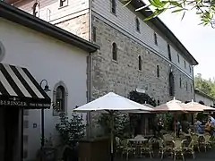 Beringer Brothers Winery |
814 | Beringer Brothers Winery | 2000 Main St. 38°30′38″N 122°28′52″W |
St. Helena | |
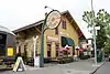 Calistoga Depot |
687 | Calistoga Depot | 1458 Lincoln Ave. 38°34′48″N 122°34′42″W |
Calistoga | |
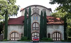 Charles Krug Winery |
563 | Charles Krug Winery | 2800 Main St. 38°31′02″N 122°29′20″W |
St. Helena | |
 Chiles Mill |
547 | Chiles Mill | Chiles and Pope Rd. and Lower Chiles Valley Rd. 38°32′07″N 122°20′14″W |
St. Helena | |
 First Presbyterian Church |
878 | First Presbyterian Church | 1333-3rd St between Randolph and Franklin Sts. 38°17′48″N 122°17′13″W |
Napa | |
.jpg.webp) George Yount's Blockhouse |
564 | George Yount's Blockhouse | Cook Rd. and Yount Mill Rd. 38°25′16″N 122°22′12″W |
Yountville | |
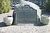 Grave of George Yount |
693 | Grave of George Yount | George C. Yount Pioneer Cemetery, Lincoln and Jackson Sts. 38°24′31″N 122°22′07″W |
Yountville | |
| 683 | Hudson Cabin | Hwy 29 & Lincoln Ave. 38°34′31″N 122°34′50″W |
Calistoga | ||
| 686 | Kelsey House | Hwy 29 & Diamond Mtn. Rd. 38°34′02″N 122°33′55″W |
Calistoga | ||
| 939 | Litto's Hubcap Ranch | 6654 Pope Valley Rd. 34°55′31″N 116°53′12″W |
Pope Valley | Part of the 20th century folk art environments project. | |
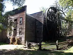 Old Bale Mill |
359 | Old Bale Mill | Bale Grist Mill State Historic Park 38°32′29″N 122°30′30″W |
St. Helena | |
 Robert Louis Stevenson State Park |
710 | Robert Louis Stevenson State Park | Robert Louis Stevenson State Park 38°39′12″N 122°36′12″W |
Yountville | |
 Sam Brannan Cottage |
685 | Sam Brannan Cottage | 1311 Washington St. 38°34′44″N 122°34′50″W |
Calistoga | |
| 684 | Sam Brannan Store | Wapoo Ave and Grant St 38°34′58″N 122°34′38″W |
Calistoga | ||
 Schramsberg Vineyards |
561 | Schramsberg Vineyards | Schramsberg Rd. 38°33′10″N 122°31′53″W |
Calistoga | |
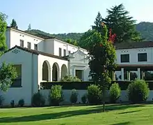 Veterans Home of California Yountville |
828 | Veterans Home of California Yountville | California Dr. & Hwy 29 38°23′39″N 122°21′54″W |
Yountville | |
| 682 | York's Cabin | Hwy 29 & Lincoln Ave. 38°34′30″N 122°34′50″W |
Calistoga |
References
- "California Historical Landmarks By County". Ohp.parks.ca.gov. Retrieved 2019-04-03.
See also
| Wikimedia Commons has media related to California Historical Landmarks in Napa County, California. |
- List of California Historical Landmarks
- National Register of Historic Places listings in Napa County, California
Municipalities and communities of Napa County, California, United States | ||
|---|---|---|
| Cities and towns |  Napa County map | |
| CDPs | ||
| Unincorporated communities | ||
| Ghost towns | ||
| ||
This article is issued from Wikipedia. The text is licensed under Creative Commons - Attribution - Sharealike. Additional terms may apply for the media files.