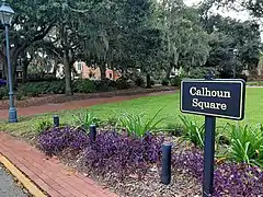
Calhoun Square (Savannah, Georgia)
Calhoun Square is one of the 22 squares of Savannah, Georgia, United States. It is located in the southernmost row of the city's five rows of squares, on Abercorn Street and East Wayne Street, and was laid out in 1851. It is south of Lafayette Square, west of Whitefield Square and east of Monterey Square. The oldest buildings on the square are at 102 East Taylor Street and 118–122 East Taylor Street, both of which date to 1853.[1]
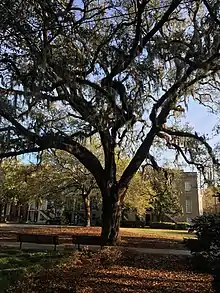 A live oak in the southwestern corner of the square, looking east | |||
| Namesake | John C. Calhoun | ||
|---|---|---|---|
| Maintained by | City of Savannah | ||
| Location | Savannah, Georgia, U.S. | ||
| Coordinates | 32.0707°N 81.0925°W | ||
| North | Abercorn Street | ||
| East | East Wayne Street | ||
| South | Abercorn Street | ||
| West | East Wayne Street | ||
| Construction | |||
| Completion | 1851 | ||
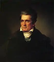
The square is named for South Carolina statesman John C. Calhoun, who served as Secretary of War, Secretary of State, and as vice president under John Quincy Adams and Andrew Jackson.[2]
The square is sometimes called Massie Square, in reference to the former Massie Common School House, built in 1855,[3] in the southeastern residential/tything lot of the square.[4]
On the western side of the square is the Wesley Monumental United Methodist Church, founded in 1868.
It is the only square with all of its original buildings intact.[5]
The square is believed to have been built over a slave burial ground, with around one thousand bodies buried in it. In 1855, the bodies of Emily and Rinah, both slaves, were removed to Laurel Grove Cemetery.[6] In 2004, a skull was found by utility workers outside the Massie Heritage Interpretation Center on the square's southeastern side.[7] Due to this connection, a movement was started in 2021 to rename the square Sankofa Square. The Sankofa bird is a Ghanaian symbol expressing the "importance of knowing one's history."[8] Another renaming, this time for Susie King Taylor, was considered in August 2021.[9]
Dedication
 The square is dedicated to John C. Calhoun, who was vice-president to two presidents
Constituent buildings
Each building below is in one of the eight blocks around the square composed of four residential "tything" blocks and four civic ("trust") blocks, now known as the Oglethorpe Plan. They are listed with construction years where known.
- Northwestern residential/tything block
- Mary Demere House, 128 East Taylor Street (1860)[1] – bay windows added 1894
- Mary Demere (Estate of) House, 126 East Taylor Street (1872)[1]
- Adam Short Property, 118–122 East Taylor Street (1853)[1] – joint-oldest building on the square
- 108–114 East Taylor Street (1873)[1]
- John Kuck House, 106 East Taylor Street (1906)[1]
- Alexander Bennett House, 102 East Taylor Street (1853)[1] – joint-oldest building on the square
- Northwestern trust/civic block
- Sara Clark House, 421 Abercorn Street (1859)[1] – additional level added in 1894
- Southwestern trust/civic block
- Wesley Monumental United Methodist Church, 429 Abercorn Street (1875)[10]
- Southwestern residential/tything block
- Northeastern residential/tything block
- William Rogers House, 202 East Taylor Street (1859)[1]
- George Ash Row House (1), 206–210 East Taylor Street (1855)[1]
- Andrew Hanley House, 214 East Taylor Street (1883)[1]
- George Ash & Francis Grimball Duplex, 216–218 East Taylor Street (1854)[1]
- George Ash Row House (2), 220–224 East Taylor Street (1869)[1]
- Northeastern trust/civic block
- Easton Yonge House, 426 Abercorn Street (1855)[1] – by George Ash; side porch added 1909
- Southeastern trust/civic block
- Southeastern residential/tything block
Gallery
 Calhoun Square
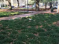 The square's unique clumps of grass, looking southwest towards the United Methodist Church
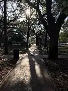 Looking east towards 432 Abercorn Street
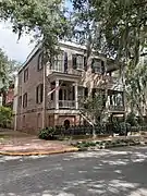 Easton Yonge House, 426 Abercorn Street
 430–432 Abercorn Street
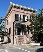 William Rogers House, 202 East Taylor Street
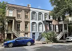 George Ash Row House (1), 206–210 East Taylor Street
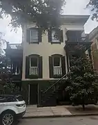 Andrew Hanley House, 214 East Taylor Street
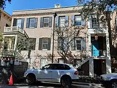 George Ash & Francis Grimball Duplex, 216–218 East Taylor Street
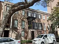 George Ash Row House (2), 220–224 East Taylor Street
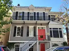 Charles Hutchins House, 113 East Gordon Street
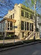 Adolphus Gomm House, 115 East Gordon Street
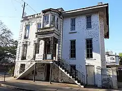 John B. Berry House, 127 East Gordon Street
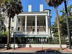 Sara Clark House, 421 Abercorn Street
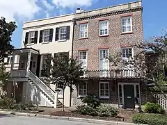 Edward Purse Duplex, 220–222 East Gordon Street
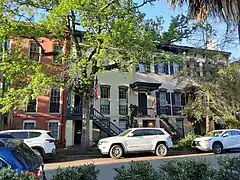 John Guerrard Row House, 215–229 East Gordon Street
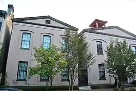 Massie Common School House, 201–213 East Gordon Street
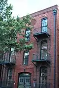 Lengre Building, 233 East Gordon Street
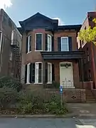 Flora Max House, 235 East Gordon Street
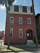 Thomas Davis House, 237 East Gordon Street
 Alexander Bennett House, 102 East Taylor Street
 Another view of 102 East Taylor Street
 John Kuck House, 106 East Taylor Street
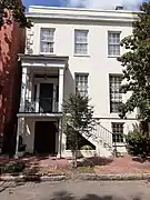 Adam Short Property, 118–120 East Taylor Street
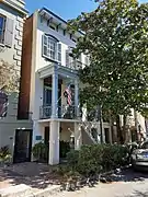 Mary Demere (Estate of) House, 126 East Taylor Street
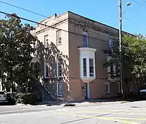 Mary Demere House, 128 East Taylor Street
References
- Historic Building Map: Savannah Historic District – Historic Preservation Department of the Chatham County-Savannah Metropolitan Planning Commission (November 17, 2011), p. 68
- Savannah Scene magazine, May–June 2007, pp 10–11, accessed June 16, 2007.
- Massie Common School House: Savannah’s Cradle of Public Education – Georgia Historical Society
- Chan Sieg (1984). The squares: an introduction to Savannah. Virginia Beach: Donning.
- Our Coast's guide to Savannah's Squares, accessed June 16, 2007. Site features an excellent interactive map of Savannah's squares and numerous photographs.
- "Negro Burials Grounds Located In Two Historic Squares" – Savannah Tribune, October 14, 2020
- "Workers dig up historic skull" - Savannah Now, July 1, 2004
- "Push to erase names of slaveholders from Savannah squares would be first change in a century" – Savannah Morning News, February 1, 2021
- "Group seeking to change name of Calhoun Square proposes honoring Susie King Taylor" – Savannah Morning News, August 15, 2021
- History – Wesley Monumental United Methodist Church official website
- Historic Building Map: Savannah Historic District – Historic Preservation Department of the Chatham County-Savannah Metropolitan Planning Commission (November 17, 2011), p. 69