Calaca, Batangas
Calaca, officially the Municipality of Calaca (Tagalog: Bayan ng Calaca), is a 1st class municipality in the province of Batangas, Philippines. According to the 2020 census, it has a population of 87,361 people. [4]
Calaca | |
|---|---|
| Municipality of Calaca | |
 Street and Municipal Hall in Calaca | |
 Seal | |
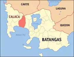 Map of Batangas with Calaca highlighted | |
OpenStreetMap 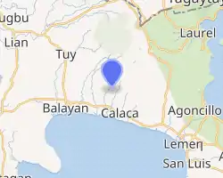 | |
.svg.png.webp) Calaca Location within the Philippines | |
| Coordinates: 13°58′N 120°48′E | |
| Country | Philippines |
| Region | Calabarzon |
| Province | Batangas |
| District | 1st district |
| Founded | May 10, 1835 [1] |
| Cityhood | (pending ratification of RA 11554) |
| Barangays | 40 (see Barangays) |
| Government | |
| • Type | Sangguniang Bayan |
| • Mayor | Sofronio Leonardo C. Ona Jr. |
| • Vice Mayor | Renante L. Macalindong |
| • Representative | Elenita R. Ermita-Buhain |
| • Municipal Council | Members |
| • Electorate | 51,670 voters (2019) |
| Area | |
| • Total | 114.58 km2 (44.24 sq mi) |
| Elevation | 49 m (161 ft) |
| Highest elevation | 253 m (830 ft) |
| Lowest elevation | 0 m (0 ft) |
| Population | |
| • Total | 87,361 |
| • Density | 760/km2 (2,000/sq mi) |
| • Households | 17,707 |
| Economy | |
| • Income class | 1st municipal income class |
| • Poverty incidence | 10.29% (2018)[5] |
| • Revenue | ₱763,597,239.06 (2020) |
| • Assets | ₱2,259,900,761.08 (2020) |
| • Expenditure | ₱726,369,167.15 (2020) |
| • Liabilities | ₱786,418,693.35 (2020) |
| Service provider | |
| • Electricity | Batangas 1 Electric Cooperative (BATELEC 1) |
| Time zone | UTC+8 (PST) |
| ZIP code | 4212 |
| PSGC | |
| IDD : area code | +63 (0)43 |
| Native languages | Tagalog |
| Website | calaca |
Calaca is home to the lively Calacatchara festival (a portmanteau of Calaca and atchara (chutney).
History
Calaca was part of Balayan when it was used to be a barrio. On May 10, 1835, it was officially converted into a town. Don Rufino Punungbayan was the first Gobernadorcillo of the municipality during the year 1835–1836.
Cityhood
House Bill No. 6598 was filed last March 11, 2020 for the conversion of the municipality of Calaca into a component city in the province of Batangas.[6] The House of Representatives passed the bill. The bill was passed by the Senate and was approved by the President Rodrigo Roa Duterte on May 26, 2021[7] through Republic Act No. 11544. Once the law is ratified in a future plebiscite to be conducted by COMELEC, Calaca will be the fifth city in the province of Batangas. COMELEC postpones the plebiscite to ratify the conversion of the municipality of Calaca into a city for the preparation of the 2022 elections.[8]
Geography
According to the Philippine Statistics Authority, the municipality has a land area of 114.58 square kilometres (44.24 sq mi) [9] constituting 3.67% of the 3,119.75-square-kilometre- (1,204.54 sq mi) total area of Batangas.
Barangays
Calaca is politically subdivided into 40 barangays.[10]. As of June 30, 2021, there are five barangays that are considered urban (highlighted in bold).[11]
| PSGC | Barangay | Population | ±% p.a. | |||
|---|---|---|---|---|---|---|
| 2020 [4] | 2010 [12] | |||||
| 041007001 | Bagong Tubig | 2.8% | 2,434 | 2,083 | 1.57% | |
| 041007002 | Baclas | 1.9% | 1,688 | 1,574 | 0.70% | |
| 041007003 | Balimbing | 0.6% | 494 | 456 | 0.81% | |
| 041007004 | Bambang | 1.6% | 1,415 | 1,239 | 1.34% | |
| 041007006 | Barangay 1 (Poblacion) | 2.2% | 1,903 | 1,839 | 0.34% | |
| 041007007 | Barangay 2 (Poblacion) | 0.9% | 827 | 729 | 1.27% | |
| 041007008 | Barangay 3 (Poblacion) | 0.3% | 278 | 279 | −0.04% | |
| 041007009 | Barangay 4 (Poblacion) | 1.2% | 1,031 | 908 | 1.28% | |
| 041007010 | Barangay 5 (Poblacion) | 1.3% | 1,096 | 1,004 | 0.88% | |
| 041007011 | Barangay 6 (Poblacion) | 0.9% | 762 | 742 | 0.27% | |
| 041007012 | Bisaya | 1.2% | 1,016 | 861 | 1.67% | |
| 041007013 | Cahil | 4.3% | 3,742 | 2,929 | 2.48% | |
| 041007014 | Caluangan | 2.1% | 1,863 | 1,699 | 0.93% | |
| 041007015 | Calantas | 3.6% | 3,128 | 2,784 | 1.17% | |
| 041007016 | Camastilisan | 4.7% | 4,147 | 3,425 | 1.93% | |
| 041007017 | Coral ni Lopez (Sugod) | 2.2% | 1,921 | 1,695 | 1.26% | |
| 041007018 | Coral ni Bacal | 1.6% | 1,389 | 1,145 | 1.95% | |
| 041007019 | Dacanlao | 7.1% | 6,177 | 5,243 | 1.66% | |
| 041007020 | Dila | 1.9% | 1,624 | 1,504 | 0.77% | |
| 041007021 | Loma | 1.5% | 1,346 | 1,112 | 1.93% | |
| 041007022 | Lumbang Calzada | 3.2% | 2,820 | 2,329 | 1.93% | |
| 041007023 | Lumbang na Bata | 2.1% | 1,873 | 1,769 | 0.57% | |
| 041007024 | Lumbang na Matanda | 2.9% | 2,549 | 1,944 | 2.75% | |
| 041007025 | Madalunot | 2.2% | 1,927 | 1,675 | 1.41% | |
| 041007027 | Makina | 1.5% | 1,301 | 1,094 | 1.75% | |
| 041007028 | Matipok | 2.1% | 1,830 | 1,515 | 1.91% | |
| 041007030 | Munting Coral | 0.4% | 387 | 328 | 1.67% | |
| 041007031 | Niyugan | 1.6% | 1,404 | 1,185 | 1.71% | |
| 041007032 | Pantay | 6.5% | 5,654 | 4,517 | 2.27% | |
| 041007033 | Puting Bato West | 3.8% | 3,291 | 2,892 | 1.30% | |
| 041007034 | Puting Kahoy | 1.5% | 1,310 | 1,179 | 1.06% | |
| 041007035 | Puting Bato East | 2.5% | 2,145 | 2,001 | 0.70% | |
| 041007036 | Quisumbing | 2.5% | 2,193 | 1,824 | 1.86% | |
| 041007037 | Salong | 5.5% | 4,766 | 4,130 | 1.45% | |
| 041007038 | San Rafael | 1.1% | 965 | 661 | 3.86% | |
| 041007039 | Sinisian | 2.3% | 2,025 | 1,764 | 1.39% | |
| 041007041 | Taklang Anak | 1.4% | 1,190 | 980 | 1.96% | |
| 041007042 | Talisay | 2.3% | 1,985 | 1,935 | 0.26% | |
| 041007043 | Tamayo | 1.8% | 1,590 | 1,435 | 1.03% | |
| 041007044 | Timbain | 2.7% | 2,373 | 2,114 | 1.16% | |
| Total | 87,361 | 70,521 | 2.17% | |||
Climate
| Climate data for Calaca, Batangas | |||||||||||||
|---|---|---|---|---|---|---|---|---|---|---|---|---|---|
| Month | Jan | Feb | Mar | Apr | May | Jun | Jul | Aug | Sep | Oct | Nov | Dec | Year |
| Average high °C (°F) | 29 (84) |
30 (86) |
31 (88) |
33 (91) |
32 (90) |
30 (86) |
29 (84) |
29 (84) |
29 (84) |
29 (84) |
29 (84) |
29 (84) |
30 (86) |
| Average low °C (°F) | 20 (68) |
20 (68) |
21 (70) |
22 (72) |
24 (75) |
24 (75) |
24 (75) |
24 (75) |
24 (75) |
23 (73) |
22 (72) |
21 (70) |
22 (72) |
| Average precipitation mm (inches) | 11 (0.4) |
13 (0.5) |
14 (0.6) |
32 (1.3) |
101 (4.0) |
142 (5.6) |
208 (8.2) |
187 (7.4) |
175 (6.9) |
131 (5.2) |
68 (2.7) |
39 (1.5) |
1,121 (44.3) |
| Average rainy days | 5.2 | 5.0 | 7.4 | 11.5 | 19.8 | 23.5 | 27.0 | 25.9 | 25.2 | 23.2 | 15.5 | 8.3 | 197.5 |
| Source: Meteoblue (Use with caution: this is modeled/calculated data, not measured locally.) [13] | |||||||||||||
Demographics
| Year | Pop. | ±% p.a. |
|---|---|---|
| 1903 | 5,838 | — |
| 1918 | 9,310 | +3.16% |
| 1939 | 10,671 | +0.65% |
| 1948 | 13,551 | +2.69% |
| 1960 | 18,667 | +2.70% |
| 1970 | 27,780 | +4.05% |
| 1975 | 31,705 | +2.69% |
| 1980 | 36,508 | +2.86% |
| 1990 | 45,377 | +2.20% |
| 1995 | 51,459 | +2.38% |
| 2000 | 58,489 | +2.78% |
| 2007 | 64,966 | +1.46% |
| 2010 | 70,521 | +3.03% |
| 2015 | 81,859 | +2.88% |
| 2020 | 87,361 | +1.29% |
| Source: Philippine Statistics Authority [14] [12] [15][16] | ||
In the 2020 census, Calaca had a population of 87,361. [4] The population density was 760 inhabitants per square kilometre (2,000/sq mi).
Economy
| Poverty Incidence of Calaca | |
| Source: Philippine Statistics Authority[17][18][19][20][21][22][23] | |
Gallery
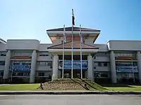 Municipal hall
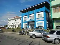 Police station
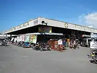 Public market
 Saint Raphael the Archangel Parish Church
References
- "On its 180th Founding Anniversary, Calaca celebrates the 11th CALACAtchara Festival". 29 October 2015.
- Municipality of Calaca | (DILG)
- "2015 Census of Population, Report No. 3 – Population, Land Area, and Population Density" (PDF). Philippine Statistics Authority. Quezon City, Philippines. August 2016. ISSN 0117-1453. Archived (PDF) from the original on May 25, 2021. Retrieved July 16, 2021.
- Census of Population (2020). "Region IV-A (Calabarzon)". Total Population by Province, City, Municipality and Barangay. PSA. Retrieved 8 July 2021.
- "PSA Releases the 2018 Municipal and City Level Poverty Estimates". Philippine Statistics Authority. 15 December 2021. Retrieved 22 January 2022.
- "AN ACT CONVERTING THE MUNICIPALITY OF CALACA IN THE PROVINCE OF BATANGAS INTO A COMPONENT CITY TO BE KNOWN AS THE CITY OF CALACA" (PDF). House of Representatives. Archived (PDF) from the original on 2020-07-04. Retrieved April 20, 2021.
- Aguilar, Krissy (May 27, 2021). "Duterte approves cityhood of Calaca, Batangas". Inquirer.net. Archived from the original on 2021-05-27. Retrieved May 27, 2021.
- Patinio, Ferdinand (August 19, 2021). "Comelec postpones 5 plebiscites to prepare for May 2022 polls". Philippine News Agency. Archived from the original on 2021-08-24. Retrieved September 4, 2021.
- "Province: Batangas". PSGC Interactive. Quezon City, Philippines: Philippine Statistics Authority. Retrieved 12 November 2016.
- "Municipal: Calaca, Batangas". PSGC Interactive. Quezon City, Philippines: Philippine Statistics Authority. Retrieved 8 January 2016.
- "Municipality of Calaca - Code:041007000". Philippine Standard Geographic Code (PSGC) | Philippine Statistics Authority. June 30, 2021. Archived from the original on 2021-10-25. Retrieved October 25, 2021.
- Census of Population and Housing (2010). "Region IV-A (Calabarzon)". Total Population by Province, City, Municipality and Barangay. NSO. Retrieved 29 June 2016.
- "Calaca: Average Temperatures and Rainfall". Meteoblue. Retrieved 5 May 2020.
- Census of Population (2015). "Region IV-A (Calabarzon)". Total Population by Province, City, Municipality and Barangay. PSA. Retrieved 20 June 2016.
- Censuses of Population (1903–2007). "Region IV-A (Calabarzon)". Table 1. Population Enumerated in Various Censuses by Province/Highly Urbanized City: 1903 to 2007. NSO.
- "Province of Batangas". Municipality Population Data. Local Water Utilities Administration Research Division. Retrieved 17 December 2016.
- "Poverty incidence (PI):". Philippine Statistics Authority. Retrieved 28 December 2020.
- https://psa.gov.ph/sites/default/files/NSCB_LocalPovertyPhilippines_0.pdf; publication date: 29 November 2005; publisher: Philippine Statistics Authority.
- https://psa.gov.ph/sites/default/files/2003%20SAE%20of%20poverty%20%28Full%20Report%29_1.pdf; publication date: 23 March 2009; publisher: Philippine Statistics Authority.
- https://psa.gov.ph/sites/default/files/2006%20and%202009%20City%20and%20Municipal%20Level%20Poverty%20Estimates_0_1.pdf; publication date: 3 August 2012; publisher: Philippine Statistics Authority.
- https://psa.gov.ph/sites/default/files/2012%20Municipal%20and%20City%20Level%20Poverty%20Estima7tes%20Publication%20%281%29.pdf; publication date: 31 May 2016; publisher: Philippine Statistics Authority.
- https://psa.gov.ph/sites/default/files/City%20and%20Municipal-level%20Small%20Area%20Poverty%20Estimates_%202009%2C%202012%20and%202015_0.xlsx; publication date: 10 July 2019; publisher: Philippine Statistics Authority.
- "PSA Releases the 2018 Municipal and City Level Poverty Estimates". Philippine Statistics Authority. 15 December 2021. Retrieved 22 January 2022.
External links
| Wikimedia Commons has media related to Calaca, Batangas. |
Places adjacent to Calaca, Batangas | |
|---|---|
Batangas City (capital) | |
| Municipalities | |
| Component cities | |