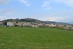
Budiná
Budiná (Hungarian: Budaszállás) is a village and municipality in the Lučenec District in the Banská Bystrica Region of Slovakia.
Budiná | |
|---|---|
Municipality | |
 | |
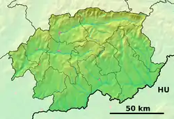 Budiná Location of Budiná in the Banská Bystrica Region 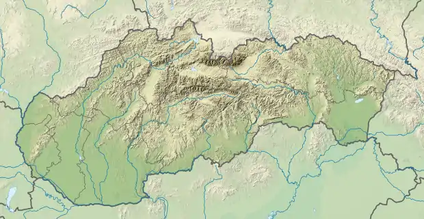 Budiná Location of Budiná in Slovakia | |
| Coordinates: 48°28′N 19°29′E | |
| Country | |
| Region | Banská Bystrica |
| District | Lučenec |
| First mentioned | 1393 |
| Area | |
| • Total | 17.30[1] km2 (6.68[1] sq mi) |
| Elevation | 629[2] m (2,064[2] ft) |
| Population (2021) | |
| • Total | 201[3] |
| Time zone | UTC+1 (CET) |
| • Summer (DST) | UTC+2 (CEST) |
| Postal code | 985 12[2] |
| Area code(s) | +421 47[2] |
| Car plate | LC |
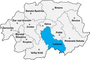
Location of Lučenec District in the Banská Bystrica Region
History
In historical records, the village was first mentioned in 1393 (1393 Brtolehutaya, 1467 Budalehotha). It belonged to Divín castle. From 1554 to 1595 it suffered Turkish occupation.
Rerefences
- "Hustota obyvateľstva - obce [om7014rr_ukaz: Rozloha (Štvorcový meter)]". www.statistics.sk (in Slovak). Statistical Office of the Slovak Republic. 2022-03-31. Retrieved 2022-03-31.
- "Základná charakteristika". www.statistics.sk (in Slovak). Statistical Office of the Slovak Republic. 2015-04-17. Retrieved 2022-03-31.
- "Počet obyvateľov podľa pohlavia - obce (ročne)". www.statistics.sk (in Slovak). Statistical Office of the Slovak Republic. 2022-03-31. Retrieved 2022-03-31.
External links
 Media related to Budiná at Wikimedia Commons
- https://web.archive.org/web/20071217080336/http://www.statistics.sk/mosmis/eng/run.html
- http://www.e-obce.sk/obec/budina/budina.html
This article is issued from Wikipedia. The text is licensed under Creative Commons - Attribution - Sharealike. Additional terms may apply for the media files.