Bouville, Seine-Maritime
Bouville (French pronunciation: [buvil] (![]() listen)) is a commune in the Seine-Maritime department in the Normandy region in northern France. This farming village, situated in the Pays de Caux some 19 miles (31 km) northwest of Rouen, is at the junction of the D104, D22 and the D6015 roads.
listen)) is a commune in the Seine-Maritime department in the Normandy region in northern France. This farming village, situated in the Pays de Caux some 19 miles (31 km) northwest of Rouen, is at the junction of the D104, D22 and the D6015 roads.
Bouville | |
|---|---|
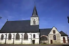 The church in Bouville | |
 Coat of arms | |
Location of Bouville 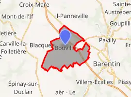 | |
 Bouville 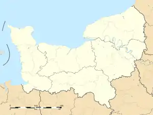 Bouville | |
| Coordinates: 49°33′48″N 0°53′41″E | |
| Country | France |
| Region | Normandy |
| Department | Seine-Maritime |
| Arrondissement | Rouen |
| Canton | Barentin |
| Government | |
| • Mayor (2020–2026) | François Huet[1] |
| Area 1 | 12.48 km2 (4.82 sq mi) |
| Population | 987 |
| • Density | 79/km2 (200/sq mi) |
| Time zone | UTC+01:00 (CET) |
| • Summer (DST) | UTC+02:00 (CEST) |
| INSEE/Postal code | 76135 /76360 |
| Elevation | 72–126 m (236–413 ft) (avg. 115 m or 377 ft) |
| 1 French Land Register data, which excludes lakes, ponds, glaciers > 1 km2 (0.386 sq mi or 247 acres) and river estuaries. | |
Heraldry
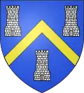
Arms of Bouville |
The arms of Bouville are blazoned : Azure background, a golden chevron between 3 argent towers molded from sand .
|
Population
| Year | 1962 | 1968 | 1975 | 1982 | 1990 | 1999 | 2006 |
|---|---|---|---|---|---|---|---|
| Population | 618 | 559 | 576 | 934 | 1020 | 994 | 935 |
| From the year 1962 on: No double counting—residents of multiple communes (e.g. students and military personnel) are counted only once. | |||||||
Places of interest
- The church of Notre-Dame, dating from the twelfth century.
- Remains of a sixteenth-century castle.
- A fifteenth century cross.
References
- "Répertoire national des élus: les maires". data.gouv.fr, Plateforme ouverte des données publiques françaises (in French). 2 December 2020.
- "Populations légales 2019". The National Institute of Statistics and Economic Studies. 29 December 2021.
External links
| Wikimedia Commons has media related to Bouville (Seine-Maritime). |
- Bouville on the Quid website (in French)
This article is issued from Wikipedia. The text is licensed under Creative Commons - Attribution - Sharealike. Additional terms may apply for the media files.