Béhagnies
Béhagnies (French pronunciation: [be.aɲi]) is a commune in the Pas-de-Calais department in the Hauts-de-France region in northern France.
Béhagnies | |
|---|---|
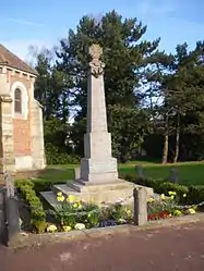 The monument to the dead | |
 Coat of arms | |
Location of Béhagnies 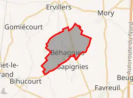 | |
 Béhagnies  Béhagnies | |
| Coordinates: 50°08′28″N 2°49′50″E | |
| Country | France |
| Region | Hauts-de-France |
| Department | Pas-de-Calais |
| Arrondissement | Arras |
| Canton | Bapaume |
| Intercommunality | Communauté de communes du Sud-Artois |
| Government | |
| • Mayor (2020–2026) | Régis Leleu[1] |
| Area 1 | 3.06 km2 (1.18 sq mi) |
| Population | 130 |
| • Density | 42/km2 (110/sq mi) |
| Time zone | UTC+01:00 (CET) |
| • Summer (DST) | UTC+02:00 (CEST) |
| INSEE/Postal code | 62103 /62121 |
| Elevation | 93–122 m (305–400 ft) (avg. 108 m or 354 ft) |
| 1 French Land Register data, which excludes lakes, ponds, glaciers > 1 km2 (0.386 sq mi or 247 acres) and river estuaries. | |
Geography
A small farming village located 13 miles (21 km) south of Arras on the N17 road, at the junction with the D31.
Population
| Year | Pop. | ±% |
|---|---|---|
| 1962 | 150 | — |
| 1968 | 151 | +0.7% |
| 1975 | 137 | −9.3% |
| 1982 | 133 | −2.9% |
| 1990 | 115 | −13.5% |
| 1999 | 127 | +10.4% |
| 2006 | 131 | +3.1% |
| 2007 | 131 | +0.0% |
| 2009 | 132 | +0.8% |
| 2012 | 115 | −12.9% |
| 2015 | 114 | −0.9% |
Sights
- The church of St. Martin, dating from the twentieth century
References
- "Répertoire national des élus: les maires". data.gouv.fr, Plateforme ouverte des données publiques françaises (in French). 2 December 2020.
- "Populations légales 2019". The National Institute of Statistics and Economic Studies. 29 December 2021.
| Wikimedia Commons has media related to Béhagnies. |
This article is issued from Wikipedia. The text is licensed under Creative Commons - Attribution - Sharealike. Additional terms may apply for the media files.