Beaufort Island (Hong Kong)
Beaufort Island is a member of the Po Toi group of islands in Hong Kong. Its size is about 120 hectares[1] while its highest point is 270m above sea level.
螺洲 | |
|---|---|
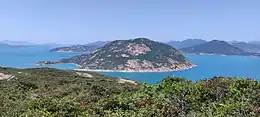 Beaufort Island & Lo Chau Mun channel | |
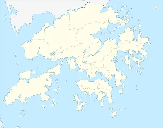 Location within Hong Kong | |
| Geography | |
| Location | South China Sea |
| Coordinates | 22°11′00″N 114°15′00″E |
| Administration | |
| District | Islands District |
| Demographics | |
| Population | 0 |
| Beaufort Island | |||||||||||||
|---|---|---|---|---|---|---|---|---|---|---|---|---|---|
| Traditional Chinese | 螺洲 | ||||||||||||
| |||||||||||||
The channel next to Beaufort Island called Lo Chau Mun, or Beaufort Channel, is the deepest part of Hong Kong at 66m below sea level.[2]
Ecology
According to the local government, several plant species of conservation concern are present on Beaufort Island such as Eulophia flava ( 黃花美冠蘭 ), Podocarpus macrophyllus (羅漢松), Polygala polifolia (小花遠志) and Rungia chinensis (中華孩兒草).[1]
Geology
The 140-million-year-old Po Toi Granite, which forms nearly all of Beaufort Island, is the last large magma intrusion in Hong Kong. Megacrysts are commonly found.[1]
See also
References
- (PDF) https://www.info.gov.hk/tpb/en/papers/TPB/1079_tpb_9845.pdf.
{{cite web}}: Missing or empty|title=(help) - "Hong Kong 2003 - The Environment". www.yearbook.gov.hk. Retrieved 21 April 2022.
| Wikimedia Commons has media related to Beaufort Island, Hong Kong. |
This article is issued from Wikipedia. The text is licensed under Creative Commons - Attribution - Sharealike. Additional terms may apply for the media files.