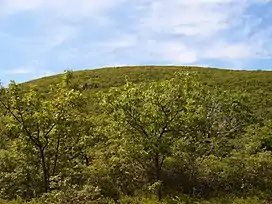
Bear Mountain (Connecticut)
Bear Mountain is a peak of the southern Taconic Mountains. It lies within the town of Salisbury, Connecticut, in the United States. At 2316 feet (note, per references 1 and 3, there is disagreement about the precise elevation), Bear Mountain is the highest mountain that lies wholly within the state of Connecticut. However, it is not the state highpoint: in the 1940s, the United States Geological Survey determined that the highest elevation in the state, at 2380 feet, was actually on the nearby Connecticut-Massachusetts border, on the southern slope of Massachusetts’ Mount Frissell.[3] There is a stone monument on the Bear Mountain summit. The Appalachian Trail crosses the mountain in a generally north-south direction.
| Bear Mountain | |
|---|---|
 Bear Mountain | |
| Highest point | |
| Elevation | 2323+ ft (708+ m) NGVD 29[1] |
| Prominence | 433 ft (132 m)[1] |
| Coordinates | 42°02′41″N 73°27′17″W[2] |
| Geography | |
| Location | Salisbury, Connecticut, U.S. |
| Parent range | Taconic Mountains |
| Topo map | USGS Ashley Falls |
| Geology | |
| Age of rock | Ordovician |
| Mountain type | Thrust fault; metamorphic rock |
| Climbing | |
| Easiest route | Appalachian Trail |
History
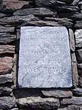
Erroneous inscription at summit
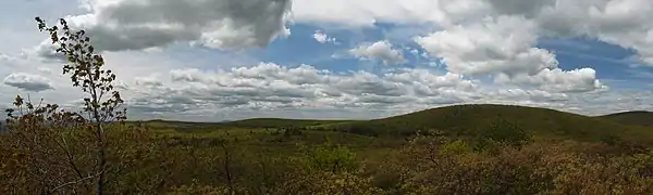
A panorama off a side of Bear Mountain.
References
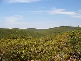
Mount Frissell, on which is located Connecticut's highest elevation, as seen from Bear Mountain
- "Bear Mountain, Connecticut". Peakbagger.com.
- "Bear Mountain". Geographic Names Information System. United States Geological Survey.
- Marteka, Peter (January 30, 2020). [It wasn’t until the United States Geological Survey using modern equipment in the 1940s determined that the highest spot was actually the southern slope of Massachusetts’ Mount Frissell at 2,380 feet above the sea. "Scaling Salisbury's Bear Mountain, one of the highest peaks in Connecticut"]. Hartforf Courant.
{{cite news}}: Check|url=value (help)
- Smith, Charles W G (2004). Massachusetts Trail Guide. Boston: Appalachian Mountain Club.
External links
- "Appalachian Trail Conservancy". Archived from the original on 2008-12-19. Retrieved 2008-03-12.
- "Highpoint Summit Log". Archived from the original on February 27, 2007.
- "Bear Mountain - Salisbury, CT". Berkshire Hiking.com.
This article is issued from Wikipedia. The text is licensed under Creative Commons - Attribution - Sharealike. Additional terms may apply for the media files.