Aztec, Arizona
Aztec is a census designated place situated in Yuma County, Arizona, United States. It had a population of 47 as of the 2010 U.S. Census. As of July 2015, Aztec had an estimated population of 52.[3] It has an estimated elevation of 509 feet (155 m) above sea level.[2] It is located along Interstate 8 to the west of Tenmile Wash.
Aztec, Arizona | |
|---|---|
Census designated place | |
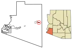 Location of Aztec in Yuma County, Arizona. | |
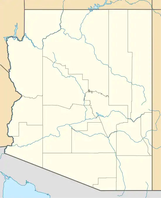 Aztec, Arizona Location of Aztec in Arizona | |
| Coordinates: 32°48′29″N 113°26′34″W | |
| Country | United States |
| State | Arizona |
| County | Yuma |
| Area | |
| • Total | 6.37 sq mi (16.50 km2) |
| • Land | 6.37 sq mi (16.50 km2) |
| • Water | 0.00 sq mi (0.00 km2) |
| Elevation | 509 ft (155 m) |
| Population (2020) | |
| • Total | 2 |
| • Density | 0.31/sq mi (0.12/km2) |
| Time zone | UTC-7 (Mountain (MST)) |
| • Summer (DST) | UTC-7 (MST) |
| Area code(s) | 520 |
| FIPS code | 04-04930 |
| GNIS feature ID | 2582734 |
Demographics
| Historical population | |||
|---|---|---|---|
| Census | Pop. | %± | |
| 1920 | 62 | — | |
| 1930 | 296 | 377.4% | |
| 2010 | 47 | — | |
| 2020 | 2 | −95.7% | |
| U.S. Decennial Census[4] | |||
Aztec first appeared on the 1920 U.S. Census as the Aztec Precinct of Yuma County.[5] It appeared again in 1930, and recorded having a Spanish/Hispanic majority[6] (the census would not separately feature that racial demographic again until 1980). With the combination of all county precincts into three districts in 1940, Aztec did not formally appear again until 2010, when it was made a census-designated place (CDP).
References
- "2020 U.S. Gazetteer Files". United States Census Bureau. Retrieved October 29, 2021.
- "Feature Detail Report for: Aztec". Geographic Names Information System. United States Geological Survey.
- "Aztec, AZ Profile: Facts, Map & Data". AZ Hometown Locator. Archived from the original on January 25, 2016. Retrieved January 24, 2016.
- "Census of Population and Housing". Census.gov. Retrieved June 4, 2016.
- http://www2.census.gov/prod2/decennial/documents/06229686v1-7ch02.pdf
- https://www2.census.gov/prod2/decennial/documents/10612963v3p1ch02.pdf
Municipalities and communities of Yuma County, Arizona, United States | ||
|---|---|---|
| Cities |  | |
| Town | ||
| CDPs | ||
| Populated places | ||
| Indian reservations | ||
| Ghost towns | ||
| Footnotes | ‡This populated place also has portions in an adjacent county or counties | |
| ||