Attenhofen
Attenhofen is a municipality located in the district of Kelheim in Bavaria in Germany.
Attenhofen | |
|---|---|
 Coat of arms | |
Location of Attenhofen within Kelheim district 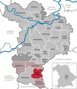 | |
 Attenhofen 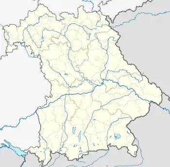 Attenhofen | |
| Coordinates: 48°39′N 11°51′E | |
| Country | Germany |
| State | Bavaria |
| Admin. region | Niederbayern |
| District | Kelheim |
| Municipal assoc. | Mainburg |
| Government | |
| • Mayor (2020–26) | Franz Stiglmaier[1] |
| Area | |
| • Total | 31.48 km2 (12.15 sq mi) |
| Elevation | 465 m (1,526 ft) |
| Population (2020-12-31)[2] | |
| • Total | 1,327 |
| • Density | 42/km2 (110/sq mi) |
| Time zone | UTC+01:00 (CET) |
| • Summer (DST) | UTC+02:00 (CEST) |
| Postal codes | 84091 |
| Dialling codes | 08751 |
| Vehicle registration | KEH |
| Website | www |
History
Attenhofen was established as a parish in 1413, according to old sources; the parish church was established sometime after the Battle of Lechfeld in 955.[3]
In 1886, 19 people from Attenhofen took part in the Austro-Prussian War and the Franco-Prussian War.[4]
In 1903, the population of Attenhofen was about 440 people; of those, 435 were Catholic.[5]
References
- Liste der ersten Bürgermeister/Oberbürgermeister in kreisangehörigen Gemeinden, Bayerisches Landesamt für Statistik, 15 July 2021.
- "Tabellenblatt "Daten 2", Statistischer Bericht A1200C 202041 Einwohnerzahlen der Gemeinden, Kreise und Regierungsbezirke". Bayerisches Landesamt für Statistik (in German). June 2021.
- Emerich, Karl (1903). Deutsche Gaue: Zeitschrift für Gesellschaftswissenschaft u. Landeskunde (in German). Vol. 5. pp. 7–8. Retrieved 12 November 2021.
- Deutsche Gaue: Zeitschrift für Gesellschaftswissenschaft u. Landeskunde. Vol. 5. 1903. p. 6.
- Deutsche Gaue: Zeitschrift für Gesellschaftswissenschaft u. Landeskunde. Vol. 5. 1903. p. 3.
Towns and municipalities in Kelheim (district) | ||
|---|---|---|
Coat of Arms of Kelheim district | ||
This article is issued from Wikipedia. The text is licensed under Creative Commons - Attribution - Sharealike. Additional terms may apply for the media files.